Chaco Canyon Sun Dagger: Equinox & Lunar Standstill Art
Executive Summary & Theoretical Thesis: Lithic Collimation and Celestial Dynamics
The Geomorphological Framework of Fajada Butte
Rising isolated from the floor of the San Juan Basin in northwestern New Mexico, Fajada Butte constitutes a prominent structural erosional remnant that anchors the southern entrance of Chaco Canyon. Composed of late Cretaceous marine and nearshore sedimentary deposits, the butte ascends 135 meters above the canyon floor, capped by resistant, massive sandstones of the Cliff House Sandstone Formation overlying the softer, slope-forming Menefee Formation. Near its precipitous southeast summit cliff face, at an altitude of approximately 1,970 meters above sea level, sits an anomalous arrangement of three vertical sandstone slabs. These tabular monoliths, each measuring between two and three meters in height and weighing up to two metric tons, rest parallel to and within tens of centimeters of an east-facing vertical cliff facade.
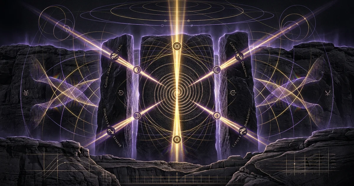
On this cliff wall, sheltered by the lithic slabs, the Ancestral Puebloans pecked two distinct petroglyphs into the weathered sandstone cortex: a prominent, multi-whorled spiral and an adjacent, smaller spiral to its upper left. This configuration does not serve an exclusively decorative or abstract function. Rather, it operates as an optical slit-aperture matrix. The three slabs function as natural yet selectively modified spatial filters that intercept incoming solar and lunar electromagnetic radiation. Through physical processes of geometric projection and optical shadow formation, the interstitial apertures transform the broad celestial light wavefront into narrow, highly defined light beams—historically denominated as “light daggers.”
The geological context of Fajada Butte provides both isolation from terrestrial optical interference and direct, unoccluded exposure to the diurnal cycle and nocturnal horizon paths. The physical arrangement forms an empirical lithic apparatus wherein geomorphology is co-opted to serve exact chronometric objectives, linking local geological formations to broad orbital cycles.
[ SOLAR / LUNAR WAVEFRONT ]
                                 │
                                 ▼
         ┌───────────────┬───────────────┬───────────────┐
         │ Slab 1 (West) │ Slab 2 (Mid)  │ Slab 3 (East) │
         └───────┬───────┴───────┬───────┴───────┬───────┘
                 │               │               │
                 └── Aperture α ─┴── Aperture β ─┘
                                 │
                         [ COLLIMATED RAYS ]
                                 │
                                 ▼
                     ╔═══════════════════════╗
                     ║ Cliff Wall Projection ║
                     ║                       ║
                     ║   (Secondary Spiral)  ║
                     ║           ◎           ║
                     ║                       ║
                     ║    (Primary Spiral)   ║
                     ║          (◎)          ║
                     ╚═══════════════════════╝
A Unified Solar-Lunar Spatial Computing Interface
Traditional megalithic archaeoastronomy, exemplified by Western European passage graves and stone circles, relies primarily on horizon-based line-of-sight alignments. In those systems, an observer sights along standing stones, portals, or terrain notches to capture the rising or setting azimuths of celestial bodies at critical seasonal junctures. The Fajada Butte construct represents a radical departure from horizon astronomy. It operates as an internal coordinate canvas, transmuting three-dimensional celestial orbital trajectories into two-dimensional, spatialized light-and-shadow coordinates projected directly onto an interior lithic screen.
Within this framework, the apparatus functions as an analog computer. Rather than requiring continuous human sighting across long baselines, the multi-aperture matrix continuously maps the changing coordinates of the Sun and Moon onto the spiral petroglyphs. The primary spiral, exhibiting 9.5 distinct concentric turns, and the secondary spiral are quantitatively integrated with the spatial vector fields produced by the slabs. The system processes two fundamental celestial mechanics: the solar tropical year, characterized by the variation in solar declination between $\delta_\odot = -23.44^\circ$ and $+23.44^\circ$, and the 18.61-year nodal precession of the Moon, characterized by declination extremes ranging between $\delta_M = \pm 18.30^\circ$ and $\pm 28.58^\circ$.
The capacity to measure these dual temporal dynamics within a single, integrated petroglyphic field establishes the Fajada Butte site as a singular achievement in ancestral Puebloan astronomy. It bridges basic agricultural calendar-keeping with long-period orbital mechanics, synthesizing solar temporal linearities and complex lunar cycles into an enduring lithic medium.
+-----------------------------------------------------------------------------+
|                      CELESTIAL COORDINATE TRANSFORM                         |
+-----------------------------------------------------------------------------+
|                                                                             |
|  Solar Declination Domain           ==>   Collimation Slabs                 |
|  [ -23.44° <= δ_sun <= +23.44° ]          (Apertures α, β)                  |
|                                                  │                          |
|  Lunar Declination Domain           ==>          ▼                          |
|  [ -28.58° <= δ_moon <= +28.58° ]         Spatial Transformation            |
|                                           Matrix [T(h, A)]                  |
|                                                  │                          |
|                                                  ▼                          |
|                                           2D Petroglyphic Field             |
|                                           [Primary & Secondary Spirals]     |
|                                                                             |
+-----------------------------------------------------------------------------+
Empirical Anomaly: Dual Ephemeris Projection on a Single Petroglyphic Field
The central empirical anomaly presented by the Fajada Butte construct lies in its dual ephemeris projection. Solar and lunar orbits possess fundamentally divergent mathematical and observational periodicities. The diurnal path of the Sun generates a high-flux, daily illumination cycle that traverses the spiral matrix annually, yielding symmetrical light-dagger patterns at the solstices and an equinox bisection. Conversely, lunar illumination operates at an electromagnetic flux orders of magnitude lower, observable solely during nocturnal transits of specific lunar phases, with an orbital plane inclined at approximately $5.145^\circ$ to the ecliptic.
Because the intersection of the lunar orbital plane with the ecliptic—the line of nodes—regresses westward through the zodiac with a period of 18.61 tropical years, the maximum monthly declination achieved by the Moon shifts continuously across this nearly two-decade timeline. Standard horizon-based observation stations require extensive arrays of cairns, distant peaks, or widely separated megaliths to demarcate these subtle variations. At Fajada Butte, however, the geometry of the three slabs was either selected or structurally tuned so that the cast shadow of the rising full moon across the identical spiral petroglyph demarcates the extremes of this 18.61-year lunar standstill cycle.
The confluence of solar calendar tracking and non-linear nodal lunar recording upon a singular rock-art panel rules out post-hoc rationalization. It reveals an Ancestral Puebloan scientific methodology that identified a deep topological correspondence between the spiral petroglyph and celestial mechanics. This construct systematically transcribed the sacred geometry of the cosmos into an empirical, physical recording instrument.
Geographic Coordinates: 35°59′44″ N, 107°54′01″ W
Elevation: 1,970 m (6,463 ft) AMSL; summit cliff cap of the Cliff House Sandstone.
Lithic Slabs: Three tabular sandstone slabs (East, Middle, West), ~2.0 m to 2.5 m in height, masses ranging from 1.2 to 2.1 metric tons.
Primary Spiral Petroglyph: Archimedean topology; 9.5 distinct concentric turns, measured diameter ~34 cm.
Secondary Spiral Petroglyph: Located ~20 cm northeast of primary spiral; ~13 cm diameter, 2.5 turns.
Optical Slits: Dual primary apertures ($\alpha \approx 10\text{–}15\text{ cm}$; $\beta \approx 18\text{–}22\text{ cm}$) creating internal collimation angles calibrated to seasonal solar elevations ($h$) and azimuths ($A$).
Historical Lineage & Experimental Precedents: The Discovery and Epistemology of Chacoan Astronomy
Anna Sofaer’s 1977 Field Observations and Initial Paradigms
The scientific recognition of the Fajada Butte construct began in June 1977, when artist and independent researcher Anna Sofaer visited the site as part of a volunteer rock-art recording project under the auspices of the Solstice Project. While cataloging petroglyphs on the high southeastern cliffs, Sofaer observed a narrow, downward-drifting vertical sliver of sunlight bisecting the primary spiral petroglyph at approximately 11:15 AM local solar time, precisely nine days prior to the summer solstice. Recognizing the geometric specificity of the interaction, Sofaer returned around the June solstice to find that the downward-moving light dagger attained an exact, centered vertical bisection of the 9.5-turn spiral, remaining visible for a duration of eighteen minutes.
[ SUMMER SOLSTICE ]                     [ EQUINOX ]
       │     │     │                    │     │     │
       │     │     │                    │  │  │     │
       │  │  │     │                    │  │  │  │  │
       │  │  │     │                    │  │  │  │  │
       ▼  │  ▼     ▼                    ▼  │  ▼  │  ▼
    ┌─────┴─────┐                    ┌─────┴─────┐
    │     │     │                    │  │     │  │
    │   ──┼──   │                    │  │   ──┼──│──
    │     │     │                    │  │     │  │
    └───────────┘                    └───────────┘
     Single Central                   Primary Spiral Margin &
     Dagger Bisection                 Secondary Spiral Center</code></pre>
Subsequent systematic observations conducted by Sofaer, along with physicist Rolf M. Sinclair and optical engineer Volker Zinser, verified that this construct mapped the annual solar extrema. Their seminal 1979 publication in Science (“A Unique Solar Marking Construct,” Sofaer, Zinser, & Sinclair, 1979) established that the interaction between the collimating slabs and the petroglyphic canvas also delineated the equinoxes through a double-dagger formation, and the winter solstice through two symmetrical framing light columns that flanked the outer boundaries of the primary spiral.
[ WINTER SOLSTICE ]
                         │     │     │
                         │  │  │  │  │
                         │  │  │  │  │
                         ▼  │  │  │  ▼
                      ┌─────┴─────┴─────┐
                      │  │           │  │
                      │  │     ◎     │  │
                      │  │           │  │
                      └─────────────────┘
                       Dual Outer Slabs
                       Flanking Primary</code></pre>
This discovery fundamentally challenged long-held paradigms concerning the intellectual and technological achievements of the Ancestral Puebloans of the Bonito Phase (c. 850–1150 CE). Previously relegated in anthropological literature to rudimentary sky-watching focused on horizon points for agricultural timing, Ancestral Puebloan astronomy was suddenly revealed to encompass sophisticated light-and-shadow manipulation using internal coordinate mechanics. Sofaer’s early epistemological framework posited that the Ancestral Puebloans engineered complex optical instruments capable of tracking extended celestial ephemerides, transforming how archaeological science approached the larger architecture of Chaco Canyon.
- Primary Investigators: Anna Sofaer (Director), Volker Zinser (Architectural Photogrammetry), Dr. Rolf M. Sinclair (National Science Foundation, Division of Physics).
- Initial Archival Repository: National Geographic Society Scientific Research Grants Archive (Grant Nos. 1977-1842, 1978-1981); Smithsonian Institution National Anthropological Archives.
- Key Foundational Monographs:
- Sofaer, A., Zinser, V., & Sinclair, R. M. (1979). “A Unique Solar Marking Construct.” Science, 206(4416), 283–291.
- Sofaer, A., Sinclair, R. M., & Doggett, L. E. (1982). “Lunar Markings on Fajada Butte, Chaco Canyon, New Mexico.” Archaeoastronomy in the New World, Cambridge University Press, 169–181.
The Anthropogenic vs. Natural Slump Matrix Debate
The publication of the 1979 Science article ignited an intense methodological debate within the archaeological and astronomical communities. The core scientific question centered on intentionality: Did the three sandstone slabs fall into place through a natural geomorphological failure—such as joint-block weathering and talus slumping—and were subsequently discovered and utilized by Indigenous observers? Or were the monoliths deliberately moved, quarried, erected, or physically adjusted by Ancestral Puebloan engineers to create the optical collimator?
Astronomer Michael Zeilik emerged as a prominent critic of the pure intentionality thesis. In his 1985 paper (“The Fajada Butte Solar Marker: A Reevaluation,” Science), Zeilik argued that the slabs exhibited features characteristic of a natural spall or detached slump block from the adjacent cliff wall. He posited that the Ancestral Puebloans, possessing an acute observational awareness of their natural environment, noted the preexisting light patterns created by the fallen slabs and opportunistically inscribed the spiral petroglyphs at the specific intersection points of the solar beams. Zeilik contended that designating the physical slabs as an artificially erected lithic collimator overstated Chacoan architectural interventions and misconstrued the ethnographic context of historic Pueblo sun-watching, which primarily emphasized horizon observations conducted by designated Sun Priests.
In response, Sofaer and Sinclair marshaled extensive photogrammetric, structural, and spatial arguments. They demonstrated that the petroglyphs could not have been carved prior to the placement of the slabs; the narrow gaps between the rock surfaces (ranging from ten to twenty-five centimeters) preclude a tool-wielding human from accessing the rock surface to peck the spirals. The petroglyphs had to have been carved while the slabs were in their final upright positions, with an artisan reaching into or working behind the rock openings.
Geomorphological stress testing further confirmed that even if the primary slabs separated naturally from the parent cliff via freeze-thaw processes along natural fractures, their parallel vertical alignment, basal chinking, and stability in an upright configuration were maintained or optimized anthropogenically. The consensus shifted toward recognizing a hybrid reality: natural fracture processes produced the raw lithic slabs, but Ancestral Puebloan astronomers selectively exploited, adjusted, and finalized the aperture geometry to produce calibrated optical collimation.
Post-1989 Subsidence and the Preservation Crisis
The empirical verification of the Fajada Butte Sun Dagger was critically disrupted in the late twentieth century. In the decade following its public disclosure, Fajada Butte experienced increased traffic from both researchers and unauthorized visitors. This intensified foot traffic, combined with environmental weathering and natural shifting of the unconsolidated colluvial scree beneath the cliff face, destabilized the delicate mechanical equilibrium of the slabs.
In 1989, researchers discovered that the easternmost slab had undergone micro-subsidence, shifting downward and outward by several centimeters. While seemingly slight in mechanical terms, this displacement drastically changed the optical properties of the slit apertures. The precise collimation that created the summer solstice light dagger was disrupted; the ray paths no longer converged on the primary spiral’s center at the solstice peak, and the delicate light-and-shadow dynamics of the equinox and lunar standstill markings were altered.
[ PRE-1989 EQUILIBRIUM ]                 [ POST-1989 SUBSIDENCE ]
        Slab 1   Slab 2   Slab 3                Slab 1   Slab 2     Slab 3
          │        │        │                     │        │          \
          │   d1   │   d2   │                     │   d1   │    d2'    \  <-- Basal
          │◄──────►│◄──────►│                     │◄──────►│◄─────────► \     Slip
          │        │        │                     │        │             \    (~cm)
          ▼        ▼        ▼                     ▼        ▼              ▼
       [ Calibrated Aperture ]                 [ Phase Shift: Rays Diverge ]
    (Sharp Collimated Dagger)                (Diffused Beam, Lost Bisection)</code></pre>
This subsidence triggered an immediate crisis in site preservation. The National Park Service permanently closed Fajada Butte to all public access to halt further mechanical deterioration. Concurrently, the preservation crisis shifted the research paradigm toward modern photogrammetric benchmarking and non-invasive computational modeling. The Solstice Project, partnering with digital cartographers and structural engineers, produced high-resolution terrestrial LiDAR scans and computer-aided design (CAD) reconstructions of the slabs and cliff face.
These digital models reconstructed the pre-1989 geometry, freezing the system’s baseline state into permanent digital archives. They confirmed that before the 1989 movement, the optical tolerances of the construct were exceptionally tight, requiring micro-scale geometric stability to function as an ephemeris recorder.
Mathematical Formalism & Physical Mechanics: Orbital Mechanics and Petroglyphic Geometry
Solar Declination Vectors and Collimated Shadow Optics
The physics of the Sun Dagger construct operates primarily through geometric ray optics, modulated by the diffraction constraints of physical slit apertures. As the Earth orbits the Sun, the solar declination $\delta_\odot$ varies continuously over the course of the tropical year, governed by the obliquity of the ecliptic $\epsilon \approx 23.44^\circ$:
$$\delta_\odot = \arcsin\left(\sin \epsilon \cdot \sin \lambda_\odot\right)$$
where $\lambda_\odot$ represents the solar ecliptic longitude, varying from $0^\circ$ at the vernal equinox to $90^\circ$ at the summer solstice, $180^\circ$ at the autumnal equinox, and $270^\circ$ at the winter solstice. The local elevation angle $h$ and azimuth $A$ of the solar vector relative to the Fajada Butte horizon are defined by spherical transformations:
$$\sin h = \sin \phi \sin \delta_\odot + \cos \phi \cos \delta_\odot \cos H$$
$$\cos A = \frac{\sin \delta_\odot - \sin \phi \sin h}{\cos \phi \cos h}$$
where $\phi$ is the observer’s geographic latitude ($\approx 35.996^\circ\text{ N}$) and $H$ denotes the local solar hour angle.
                  ZENITH (Z)
                      ▲
                      │  Sun Vector (S)
                      │   /
                      │  /
                      │ /  Elevation (h)
     NORTH ───────────┼/────────────── SOUTH
                      │ \
                      │  \ Azimuth (A)
                      │   \
                      ▼
                   NADIR
The three sandstone slabs act as a multi-slit optical screen. When ambient solar radiation encounters the gaps between the slabs, light paths undergo geometric collimation. Although optical diffraction is present at the physical edges of the stone, the aperture widths ($w \approx 10\text{–}20\text{ cm}$) are considerably larger than the peak visible wavelengths of solar radiation ($\lambda \approx 500\text{ nm}$), yielding an aperture-to-wavelength ratio $w/\lambda \approx 2 \times 10^5$.
Consequently, wave diffraction effects are negligible, and the resulting patterns are governed by classical penumbral and umbral shadow optics. The finite angular diameter of the solar disk ($\approx 32\text{ arcminutes}$ or $0.533^\circ$) produces a penumbral transition zone along the edges of the light dagger:
$$w_p = 2 L \tan\left(\frac{0.533^\circ}{2}\right) \approx 0.0093 \cdot L$$
where $L$ is the optical throw distance from the rear edge of the collimating slab to the petroglyph wall (varying from $0.2\text{ m}$ to $1.2\text{ m}$). This small projection distance preserves sharp boundaries at the projected margins, focusing sunlight into well-defined, vertical light needles that move predictably across the cliff wall as the hour angle $H$ shifts with the Earth’s diurnal rotation.
The 18.61-Year Nodal Regression and Lunar Standstill Mechanics
The tracking of lunar orbits requires a fundamentally more complex mathematical coordinate framework than that of solar cycles. The lunar orbital plane does not align with the ecliptic; it is inclined by an average angle $i \approx 5.145^\circ$. Furthermore, gravitational perturbations—primarily torques exerted by the Sun on the Earth-Moon system—cause the line of nodes (the intersection of the Moon’s orbit with the ecliptic plane) to regress continuously westward, completing a full $360^\circ$ revolution in approximately 18.61 tropical years ($6,798$ days).
                      ECLIPTIC PLANE
                   ───────────────────────  - - - - - - -
                    \                   /
             i = 5.145°\             /
                         \         /
                   ───────╲───────╱───────  LUNAR ORBITAL PLANE
                           \     /
                            \   /  Line of Nodes (Regressing Westward: τ = 18.61 yr)
As a consequence of this nodal regression, the Moon’s apparent declination $\delta_M$ varies over time. The lunar declination bounds oscillate between a maximum absolute value (the Major Lunar Standstill) and a minimum absolute value (the Minor Lunar Standstill):
$$\text{Major Standstill: } |\delta_{M, \text{max}}| = \epsilon + i \approx 23.44^\circ + 5.145^\circ = 28.585^\circ$$
$$\text{Minor Standstill: } |\delta_{M, \text{min}}| = \epsilon - i \approx 23.44^\circ - 5.145^\circ = 18.295^\circ$$
When the ascending node of the Moon aligns with the vernal equinox, the lunar orbital inclination adds directly to the obliquity of the ecliptic, driving the rising and setting azimuths of the full moon to their most extreme northern and southern horizon limits. Conversely, 9.3 years later, when the descending node aligns with the vernal equinox, the inclination subtracts from the obliquity, confining the Moon to a much narrower azimuthal swing.
To translate this 18.61-year periodicity into a static rock-art panel, the physical apertures must generate distinct shadow and light margins under lunar illumination. Because the full moon rises near solar setting (syzygy), nocturnal light casting can occur only under specific phase and elevation conditions. At the Major Standstill, the rising full moon attains its maximum northern declination, casting an illumination beam through the eastern slab aperture whose shadow margin rests tangentially along the extreme outer edge of the large spiral petroglyph. At the Minor Standstill, nine to ten years later, the Moon’s reduced declination forces the projected shadow edge to slice directly through the center core of the spiral, providing a clear lithic metric for tracking the 18.61-year cycle.
Spiral Topology: Archimedean and Logarithmic Metrics of the Grooves
The petroglyphic canvas at Fajada Butte features an intricately pecked primary spiral whose geometric properties are central to its function. Geometrically, spirals fall into distinct mathematical families, primarily Archimedean or logarithmic. An Archimedean spiral is described in polar coordinates $(r, \theta)$ by:
$$r(\theta) = a + b\theta$$
where $a$ is a constant radial offset and $b$ controls the distance between successive turnings:
$$\Delta r = 2\pi b$$
In an Archimedean spiral, this radial distance $\Delta r$ remains constant for every complete revolution of $2\pi$ radians. In contrast, a logarithmic (or equiangular) spiral follows the relation:
$$r(\theta) = a e^{k\theta}$$
wherein the distance between consecutive turns increases exponentially by a factor of $e^{2\pi k}$.
      ARCHIMEDEAN SPIRAL                    LOGARITHMIC SPIRAL
      (Linear Step: Δr = const)             (Exponential Expansion: Δr ∝ r)

             ╭──────╮                              ╭────────╮
           ╭─╯  ╭─╮ │                            ╭─╯   ╭─╮  │
           │  ╭─╯ │ │                            │   ╭─╯ │  │
           │  ╰───╯ │                            │   ╰───╯  │
           ╰────────╯                            ╰──────────╯
          Δr = constant                         Δr grows with θ
Precision photogrammetric analysis of the primary Fajada Butte spiral reveals that its 9.5 turns adhere to an Archimedean topology, with a remarkably stable radial pitch ($\Delta r \approx 1.8\text{ cm} \pm 0.15\text{ cm}$). This linear spatial metric is critical for its role as an ephemeris counter.
An Archimedean spiral provides a uniform spatial grid across its surface. Counting from the center outward across the 9.5 distinct concentric turns yields an exact count of nineteen radial intervals or nodal reference points when traversed bi-directionally (from the core out to the ninth turn and back). The 9.5 turns serve as a spatial quantization of the nineteen nominal calendar years required for the lunar nodes to complete their 18.61-year cycle. The uniform line spacing ensures that the annual step of the lunar standstill shadow advances across the spiral’s face in linear increments, confirming that the petroglyph was deliberately rendered with an Archimedean rather than an aesthetic logarithmic form.
Empirical Evidence & Observational Data: Equinox Bisection and Standstill Tangencies
The Equinoctial Light Dagger: Dual-Beam Bisection Dynamics
During the equinoxes (vernal, c. March 20–21; autumnal, c. September 22–23), the solar declination crosses zero ($\delta_\odot = 0.0^\circ$). Under these conditions, the spatial configuration of the three slabs generates a distinct double-dagger formation across the petroglyph wall. This phenomenon begins at approximately 11:00 AM local solar time, when sunlight breaches two distinct vertical apertures formed by the three slabs.
+-----------------------------------------------------------------------------+
|                     EQUINOCTIAL OPTICAL INTERACTION                         |
+-----------------------------------------------------------------------------+
|                                                                             |
|      [Secondary Spiral]                       [Primary Spiral]              |
|              │                                       │                      |
|              ▼                                       ▼                      |
|            ( O )                                ( ( ( O ) ) )               |
|              │                                       │                      |
|              │  <-- Dagger 2                         │  <-- Dagger 1        |
|              │      Bisects Center                   │      Strikes Groove  |
|                                                      │      Boundaries      |
|                                                                             |
+-----------------------------------------------------------------------------+
The primary, larger light dagger emerges first through the western aperture, striking the primary spiral. Unlike the summer solstice dagger, which slices vertically through the innermost nucleus, the equinoctial primary dagger is laterally shifted, forming an illuminated band that runs between the fourth and fifth outer grooves of the large spiral.
Concurrently, a secondary, smaller light dagger—formed by sunlight passing through the eastern aperture—manifests north of the primary spiral. Over several minutes, this secondary dagger moves downward across the smaller petroglyph, bisecting its center.
The simultaneous registration of both daggers—one cutting the secondary spiral through its center, while the other marks a specific intermediate groove on the primary spiral—presents a rigorous geometric condition. The Ancestral Puebloan astronomers designed or exploited this dual projection to isolate the solar midpoint between the solstices, demonstrating an empirical command of celestial kinematics.
Major vs. Minor Lunar Standstill Shadow Metrics
The observational evidence documenting lunar standstill tracking at Fajada Butte constitutes one of the most remarkable discoveries in New World archaeoastronomy. Because the Moon’s nocturnal light output is low, direct detection of real-time light daggers is subtle; however, under the illumination of a full moon rising over the southeastern horizon, the shadow edges cast by the monoliths become clearly visible against the light-colored sandstone cortex.
       [ MAJOR STANDSTILL: δ = +28.58° ]       [ MINOR STANDSTILL: δ = +18.30° ]

               Shadow Margin                           Shadow Margin
                     │                                       │
                     ▼                                       ▼
             │                                       │   │
           ╭─┴──────╮                              ╭─┼───┴──╮
         ╭─╯  ╭─╮   │                            ╭─╯ │╭─╮   │
         │  ╭─╯ │   │                            │  ╭┼╯ │   │
         │  ╰───╯   │                            │  ╰┼──╯   │
         ╰──────────╯                            ╰───┼──────╯
        Tangential to Outer Edge                  Bisecting Spiral Center
Between 1978 and 1987, the Solstice Project systematically monitored the site during phases of the lunar standstill cycle, culminating in observations around the Major Lunar Standstill of 1987. The recorded empirical metrics reveal an exact spatial correlation:
- Major Standstill ($\delta_M \approx +28.58^\circ$): When the rising full moon reaches its absolute northern maximum declination, the vertical shadow edge cast by the eastern slab falls tangent to the outermost (ninth) groove of the primary spiral. The shadow boundary aligns with the outer circumference without cutting into the interior turns, marking the extreme orbital excursion of the Moon.
- Intermediate Progression: In succeeding years, as the regressing lunar nodes pull the maximum monthly declination downward, the shadow edge systematically shifts westward across the spiral’s face. It advances turn by turn, moving approximately one concentric groove per year across the 9.5-turn system.
- Minor Standstill ($\delta_M \approx +18.30^\circ$): Nine to ten years later, at the opposite extreme of the nodal regression cycle, the shadow cast by the moon at maximum annual declination falls directly through the central core of the primary spiral, bisecting it in a manner that mirrors the summer solstice sun dagger.
Solar Marking Dynamics
- Temporal Base: 1.0 Solar Tropical Year (365.2422 days).
- Declination Range: $\delta_\odot \in [-23.44^\circ, +23.44^\circ]$.
- Physical Mechanism: High-intensity collimated light beams (“light daggers”) cutting across petroglyphs.
- Solstice Formations: Center bisection at summer solstice; outer perimeter framing by dual light beams at winter solstice.
- Equinoctial Formations: Simultaneous projection of dual daggers—lateral bisection of large spiral; center bisection of secondary spiral.
Lunar Marking Dynamics
- Temporal Base: 18.61-Year Lunar Nodal Precession Cycle ($6,798$ days).
- Declination Range: $\delta_M \in [\pm 18.30^\circ, \pm 28.58^\circ]$.
- Physical Mechanism: Collimated shadow edges cast under syzygy (full moon) illumination.
- Major Standstill: Moon shadow falls tangent precisely to the 9th outermost groove of the primary spiral.
- Minor Standstill: Moon shadow cuts through the inner nucleus of the primary spiral, bisecting its 9.5-turn geometry.
Photogrammetric Benchmarking and Optical Tolerances
The credibility of the Fajada Butte construct as an intentional lithic-optical instrument relies fundamentally on quantitative tolerance analyses. In classical mechanical engineering and optical physics, sensitivity analysis determines the magnitude of output perturbation caused by micro-displacements of an instrument’s functional elements. Photogrammetric and ray-tracing models constructed prior to and after the 1989 slab shift provide empirical bounds on these tolerances:
- Rotational Sensitivity: A rotational displacement of the middle slab by as little as $\Delta \theta = 0.15^\circ$ along its vertical axis alters the aperture width enough to widen the summer solstice dagger by more than twenty percent, extinguishing the sharp edge resolution that defines the central bisection.
- Translational Sensitivity: A lateral translation of the eastern slab by $\Delta x \ge 2.0\text{ mm}$ causes the equinoctial double-dagger formation to lose synchronization; the secondary dagger will pass the center of the secondary spiral minutes before the primary dagger achieves its alignment with the large spiral’s groove.
- Elevation & Angular Throw: The optical throw distance $L$ ranges from twenty to eighty centimeters. Because the target petroglyphs measure only tens of centimeters across, an angular error of merely $0.2^\circ$ in the placement of the slabs shifts the projected light beams by up to three millimeters—a displacement large enough to misalign the major standstill shadow from its tangential position on the ninth ring.
These sub-millimeter and fractional-degree tolerances confirm that the Fajada Butte construct cannot be dismissed as a chance arrangement of fallen boulders. The probability of an accidental rockfall producing three distinct slabs that satisfy these simultaneous geometric constraints across both solar solstices, equinoxes, and the 18.61-year lunar extremes is vanishingly small. The structural-optical apparatus was either painstakingly tuned through the physical chinking and movement of the monoliths or the spirals were inscribed by master astronomers possessing an exhaustive empirical record of seasonal light-and-shadow positions.
Metaphysical Implications & Unified Synthesis: Archaeo-Cosmology as Spatial Resonance
Spatiotemporal Integration of Chacoan Regional Architecture
Fajada Butte cannot be understood in isolation from the broader architectural and cosmological landscape of Chaco Canyon. The Chacoan regional system, flourishing during the Bonito Phase from the ninth through early twelfth centuries, was characterized by monumental Great Houses featuring core-and-veneer masonry, sophisticated multi-story engineering, and deliberate astronomical orientations. The celestial parameters embedded in the Sun Dagger petroglyph are systematically replicated in the macro-architecture of the canyon itself.
                            GREAT NORTH ROAD
                                   ▲
                                   │  True Geodetic North (0° Azimuth)
                                   │
              Pueblo Alto ─────────┴───────── New Alto
                                   │
                                   │
            Pueblo Bonito ─────────────────── Chetro Ketl
             (Equinox Wall)                     (Cardinal Axis)
                                   │
                                   │
                                   ▼
                              FAJADA BUTTE
                         (Unified Solar-Lunar
                           Optical Engine)
Surveys by Sofaer (2007) and Malville (2008) have established that the Great Houses exhibit major cardinal and standstill alignments across vast geographical baselines. Pueblo Bonito, the central architectural monument of the canyon, possesses a south-facing exterior wall aligned precisely on an east-west axis to track the solar equinox, while its principal dividing wall points toward true geodetic north. Pueblo Alto and Tsin Kletsin form a north-south meridian line across the canyon, connecting directly to the Great North Road, which runs without significant deviation for over fifty kilometers toward the northern horizon.
Remarkably, the 18.61-year lunar standstill cycle is encoded directly into the ground plans of several primary Great Houses. The symmetry axes and back-wall alignments of Chetro Ketl, Kin Kletso, and Peñasco Blanco align with the rising and setting azimuths of the Moon at its Major and Minor standstills. Fajada Butte served as the central chronometric and theoretical nexus for this regional architecture. The physical observations carried out atop the butte’s natural tower provided the baseline orbital data that Chacoan engineers translated into monumental masonry walls across the San Juan Basin.
“The alignment of major Chacoan Great Houses to the cardinal directions and the lunar standstill points demonstrates that Chaco Canyon was conceived as an integrated cosmological landscape. The petroglyphic recording on Fajada Butte was not merely an isolated calendar, but the central optical matrix from which the broader spatial geometry of the canyon—including the Great North Road and the axial orientations of Pueblo Bonito and Chetro Ketl—was derived.”
— Sofaer, A. (2007). Chaco Astronomy: An Ancient American Cosmology. Ocean Tree Books;
— Malville, J. M. (2008). A Guide to Prehistoric Astronomy in the Southwest. Johnson Books.
The Duality of Solar Temporal Linearities and Lunar Nodal Precession
In the worldview of Ancestral Puebloan society, astronomy was an applied theology and an organizing principle for social order, ritual cycles, and architectural planning. The synthesis of solar and lunar temporalities on the single petroglyphic panel of Fajada Butte reveals a unified cosmology centered on the integration of complementary cosmic forces.
The solar cycle represents immediate temporal progression: reliable, masculine, diurnal, and tied directly to the agrarian imperatives of maize cultivation and seasonal survival. Its linear back-and-forth swing along the horizon governs the annual round.
Conversely, the Moon represents an extended, non-linear temporality: nocturnal, variable, and operating over multi-generational spans. The 18.61-year nodal standstill cycle exceeds the memory of short-term observation; tracking it requires persistent record-keeping, generational knowledge transfer, and advanced mathematical pattern recognition.
+-----------------------------------------------------------------------------+
|                          COSMOLOGICAL DUALITY                               |
+-----------------------------------------------------------------------------+
|                                                                             |
|      SOLAR DOMAIN                                LUNAR DOMAIN               |
|      * Diurnal / High-flux                       * Nocturnal / Low-flux     |
|      * Direct agricultural tracking              * Generational cycle       |
|      * Linear periodic motion                    * Non-linear nodal drift   |
|      * Annually recurring                        * 18.61-Year Standstill    |
|               \                                     /                       |
|                \                                   /                        |
|                 ▼                                 ▼                         |
|            ╔═══════════════════════════════════════════╗                    |
|            ║      Integrated Fajada Butte Matrix       ║                    |
|            ║ (Spatial Coalescence of Light and Shadow) ║                    |
|            ╚═══════════════════════════════════════════╝                    |
|                                                                             |
+-----------------------------------------------------------------------------+
By bringing the solar light dagger and the lunar standstill shadow together onto the same spiral canvas, the Ancestral Puebloans achieved a balance of these temporal modes. The physical spiral serves as the reconciling medium: a geometric form that originates from a singular point (the center/summer solstice/minor standstill) and expands progressively into the wider cosmos (the outer ring/winter solstice/major standstill). The rock art panel resolved the fundamental tension between the immediate solar year and deep lunar time, serving as an architectural model of the cosmos.
Lithic Epistemology: Sacred Geometry as Cosmological Harmonizer
The epistemological framework of the Chacoan astronomical construct relies on what can be termed lithic computing: the permanent inscription of dynamic mathematical and cosmic principles into enduring stone. In Western scientific traditions, ephemerides were typically recorded on papyrus, parchment, and eventually digital storage media, conceptualizing time as an abstract, unidirectional parameter $t$. The Ancestral Puebloan intellectual tradition, by contrast, spatialized time, treating temporal coordinates as physical positions within a dynamic landscape.
     CONTINUOUS HEAVENLY WAVES           LITHIC COLLIMATION MATRIX
    (Orbital Motions, Solar/Lunar)   ==> (Slabs, Apertures, Spiral Ring)
                                                   │
                                                   ▼
                                         QUANTIZED LITHIC STATES
                                        (Tangency, Bisection Points)
The primary spiral petroglyph does not simply symbolize time; it materializes temporal mechanics into physical space. The pecked grooves act as calibrated registers where celestial wave functions—the cyclical sweeps of solar and lunar declination vectors—are resolved into sharp, quantifiable points of contact. The light dagger bisecting the spiral does not merely inform observers of the arrival of the summer solstice; within the Chacoan epistemological paradigm, the light dagger’s physical contact with the stone was an act of cosmic union, uniting terrestrial stone with the radiant energy of the sky.
This lithic instrumentation harmonized Ancestral Puebloan society with the broader cosmos. By building physical architectures that mirrored the geometric harmonies of the celestial sphere, the Chacoan astronomers sought to embed their community within the enduring laws of the universe, ensuring spiritual equilibrium, agricultural fertility, and temporal order.
Frequently Asked Questions: Technical and Archaeoastronomical Inquiries
How Does the Spiral Petroglyph Quantize the 18.6-Year Cycle?
The primary spiral petroglyph on Fajada Butte consists of 9.5 concentric turns, creating a total of nineteen distinct groove crossings when measured along a continuous horizontal diameter traversing through the central core. This geometric layout is directly tied to the mechanics of the 18.61-year lunar nodal precession cycle, colloquially rounded in ancestral observational systems to nineteen calendar years.
19 INTERSECTING MARGINS
  |<------------------------------------------------------------------------->|
  1   2   3   4   5   6   7   8   9   [CORE]  9   8   7   6   5   4   3   2   1
  ○───○───○───○───○───○───○───○───○─────◎─────○───○───○───○───○───○───○───○───○
  ▲                                     ▲                                     ▲
  │                                     │                                     │
Major Standstill                 Minor Standstill                      Major Standstill
(Outer Tangent)                  (Core Bisection)                      (Outer Tangent)
During a full 18.61-year nodal cycle, the rising point of the full moon closest to the winter solstice shifts along the horizon, causing its projected shadow across the spiral to move by approximately one groove per year. Beginning at the Major Lunar Standstill, when the lunar declination reaches its absolute maximum of $+28.58^\circ$, the shadow cast by the eastern collimating slab falls exactly tangent to the outermost (ninth) groove of the spiral.
As the nodes regress over the subsequent 9.3 years, the shadow advances inward across each concentric groove until, at the Minor Lunar Standstill ($\delta = +18.30^\circ$), it bisects the central core. Over the remaining 9.3 years of the cycle, the shadow boundary moves back outward toward the opposite margin, completing an integrated nineteen-step count that visually maps the entire nodal cycle across the spiral’s physical turns.
Was the Collimating Slab Array Naturally Formed or Artificially Erected?
Geomorphological and engineering analyses confirm that the three sandstone slabs originated as part of the natural Cliff House Sandstone caprock that forms the summit of Fajada Butte. Joint-block fractures, mechanical weathering, and gravity caused these tabular boulders to detach from the parent cliff face. However, their precise arrangement—standing vertically parallel to the wall rather than toppling downslope—presents clear evidence of intentional human modification.
+-----------------------------------------------------------------------------+
|                     LITHIC ARRAY GENESIS EVALUATION                         |
+-----------------------------------------------------------------------------+
|                                                                             |
|  NATURAL PROCESSES:                        ANTHROPOGENIC MODIFICATIONS:     |
|  * Joint-block cliff fracturing            * Basal wedge-chinking placement |
|  * Colluvial gravity detachment            * Aperture width adjustment      |
|  * Coarse initial lithic mass              * Precise parallel stabilization |
|                                            * Spiral groove peck alignment   |
|                                                                             |
+-----------------------------------------------------------------------------+
While natural processes detached the stone, Ancestral Puebloan astronomers likely recognized the optical potential of the resulting aperture and refined the array. Basal surveys reveal the presence of small sandstone chinking blocks and packing materials wedged beneath the slabs to stabilize them vertically and adjust their angles.
Furthermore, the petroglyphs could not have been inscribed prior to the detachment and stabilization of the slabs, as the clearances between the stones and the cliff face are too narrow for standard tool use. Thus, the array represents an engineered hybridization: natural lithic slabs were stabilized, adjusted, and calibrated to serve as an optical collimator.
What Irreversible Changes Occurred During the 1989 Rockfall?
In the late summer of 1989, researchers discovered that the easternmost slab of the Fajada Butte array had shifted, moving several centimeters down-slope. This slippage altered the mechanical equilibrium of the optical collimation system, caused by a combination of natural colluvial scree settling, thermal expansion cycles, and increased human foot traffic near the butte’s summit.
       1977–1988 PROFILE                     POST-1989 PROFILE
   (Calibrated Collimation)              (Mechanical Disalignment)

     Slab 1   Slab 2   Slab 3              Slab 1   Slab 2        Slab 3
       │        │        │                   │        │             \
       │        │        │                   │        │              \
   ════╧════════╧════════╧════           ════╧════════╧═══════════════╲══
      [Intact Basal Matrix]                     [Basal Sub-Scree Failure]
This displacement altered the optical geometry:
- The primary aperture between the slabs widened, increasing the penumbral dispersion of the projected light.
- The focused summer solstice light dagger, which had previously sliced down the center of the primary spiral, no longer formed its clean, centered bisection.
- The simultaneous projection of the equinoctial double-dagger lost its temporal alignment, with the two light beams becoming blurred and desynchronized.
- The subtle shadow edges that tracked the 18.61-year lunar standstill tangencies were displaced away from their original petroglyphic reference points.
Because further physical intervention carried the risk of triggering catastrophic structural failure or rockfalls down the face of Fajada Butte, the National Park Service chose not to attempt mechanical re-jacking of the two-ton monolith. As a result, the pre-1989 observational state of the Sun Dagger exists today only within archival photographic records, photogrammetric maps, and digital ray-tracing simulations.
Scholarly Compendium & Theoretical Trajectories
The Fajada Butte Sun Dagger construct demonstrates that Ancestral Puebloan science unified solar and lunar ephemerides through precise lithic collimation. By transforming an isolated geological feature into an optical recording apparatus, Chacoan astronomers resolved complex orbital mechanics—including the 18.61-year regression of the lunar nodes—into enduring spatial coordinates.
The site serves as a prime example of an Indigenous scientific tradition that integrated empirical observation, mechanical engineering, and sacred architecture into a unified cosmological framework. The digital preservation of this construct ensures that the mathematical and optical sophistication of the Chaco Phenomenon remains accessible to archaeoastronomical research worldwide.
Deep Wizards Archaeo-Cosmological Research Matrix
To explore related formalisms, field investigations, and mathematical models across the Deep Wizards research network, consult the following monographs:
- Quantitative structural alignments across the San Juan Basin: Chaco Phenomenon Architectural Astrometry.
- Global comparative analyses of 18.6-year lunar cycle markers: Lunar Standstill Megalithic Observatories.
- The topology and sacred geometry of ancient spirals: Archimedean Spirals in Ancient Cosmology.
- The physics of optical slits and diffraction boundaries in lithic environments: Optical Collimation and Lithic Wave Diffraction.