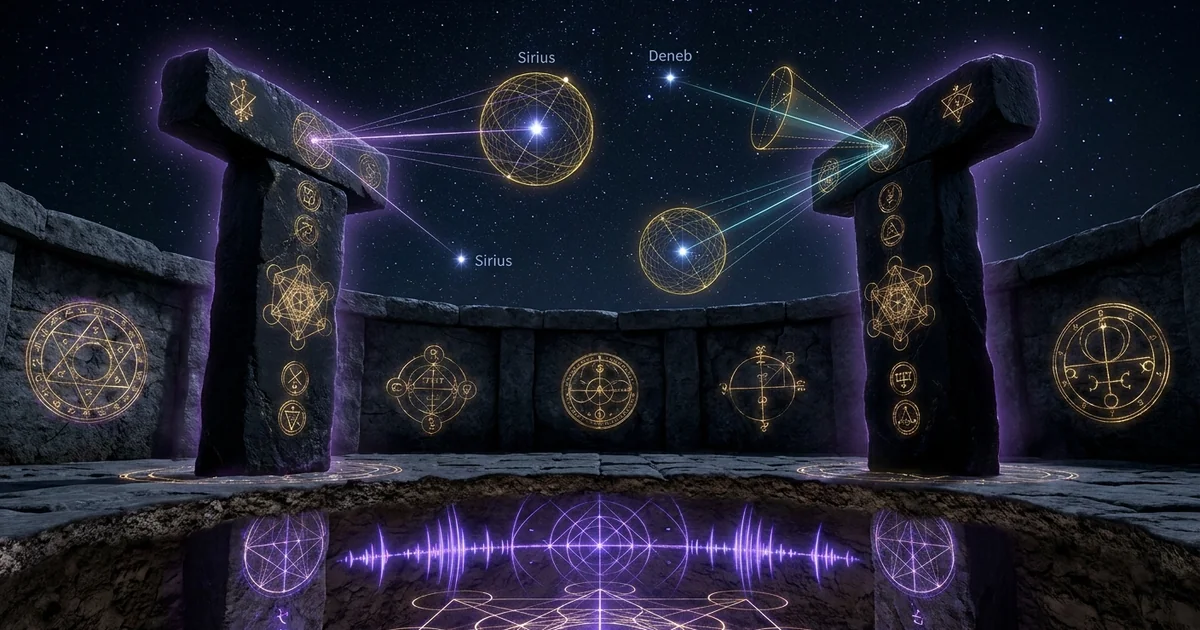
Gobekli Tepe: Astronomical Alignments of Pillars
Executive Summary & Theoretical Thesis
The Monumental Anomaly of the Pre-Pottery Neolithic A
The megalithic complex of Göbekli Tepe, situated on an elevated limestone plateau in the Germuş mountain range of Southeastern Anatolia (37.2231° N, 38.9224° E), fundamentally ruptures the traditional linear models of socioeconomic and architectural evolution. Radiocarbon dated to the Pre-Pottery Neolithic A (PPN-A, c. 9600–8800 BCE) and early Pre-Pottery Neolithic B (PPN-B, c. 8800–8200 BCE), this monumental sanctuary predates sedentary agriculture, pyrotechnic pottery production, metallurgy, and conventional script. The material culture reveals no indications of domestic occupation, instead exposing an array of subterranean and semi-subterranean circular enclosures formed by megalithic dry-stone masonry interspersed with massive, anthropomorphic monolithic pillars.
The orthodox anthropological paradigm, which asserts that complex social stratification, institutionalized labor organization, and geodetic architectural execution are strict emergent consequences of an agrarian surplus, fails to explain the execution of Göbekli Tepe. Excavations have exposed monumental limestone monoliths weighing between 10 and 20 metric tons—quarried, transported, carved in bas- and high-relief, and assembled into precise geometric configurations by groups designated typologically as semi-nomadic hunter-gatherers. The architectural sophistication documented at the site is not random; rather, it adheres to precise directional frameworks that challenge simple terrestrial or utilitarian explanations.
The primary academic question shifts from how hunter-gatherer populations organized the logistics of megalithic transport to why these specific geometries were imposed upon the landscape. The layout demonstrates rigorous spatial intentionality, characterized by parallel central stelae flanked by radial megaliths. This layout indicates that Göbekli Tepe served as an empirical laboratory for observation and structural alignment, operationalizing landscape-sky interactions millennia before comparable phenomena emerged at Stonehenge, Carnac, or the Giza Plateau.
Axial Kinematics and the Archaeoastronomical Hypothesis
The architectural core of Göbekli Tepe relies upon the geometric layout of Enclosures A, B, C, and D. Each circular or elliptical enclosure contains a central pair of parallel T-shaped megaliths that establish a dominant longitudinal axis. When these central axes are mapped geodetically, they exhibit a persistent, non-random orientation toward the southern sky, shifting systematically across an azimuthal band between 160° and 180°.
This structural regularity underlies the archaeoastronomical hypothesis: the central pillars functioned as an engineered collimation-transit, intentionally targeted at celestial bodies rising along the local horizon. Because the Earth’s axis undergoes continuous torque due to gravitational differentials exerted by the Moon and the Sun on the equatorial bulge, the orientation of the rotational axis traces a slow cone through space—a phenomenon known as the precession of the equinoxes.
Precessional Rate (dψ/dt) ≈ 50.29 arcsec/yr --> Period ≈ 25,772 yr
This axial gyration causes the equatorial coordinates (right ascension $\alpha$, declination $\delta$) of fixed stars to shift continuously relative to the terrestrial observer’s horizon coordinates (azimuth $A$, altitude $a$). If a megalithic complex is constructed with high structural precision to collimate a specific stellar rising or setting, the target celestial body will gradually drift outside the collimating aperture of the stone sightline over centuries. Consequently, the systematic rotation of the mean central pillar azimuths across chronologically distinct enclosures—from the older Enclosure D through Enclosures C, B, and A—suggests an ongoing recalibration effort. New stone enclosures were continually engineered to track target stars undergoing precessional displacement across the southern horizon.
Enclosure D (older)  -->  Enclosure C  -->  Enclosure B  -->  Enclosure A (newer)
Azimuth: ~172°            Azimuth: ~170°        Azimuth: ~165°        Azimuth: ~160°
Scope of Investigation Across Enclosures A, B, C, and D
This treatise examines the hypothesis that the monumental architecture of Göbekli Tepe constitutes an engineered sidereal observatory designed to track epoch-specific stellar targets, specifically Sirius ($\alpha$ Canis Majoris), Deneb ($\alpha$ Cygni), and the Pleiades open cluster. By integrating empirical field survey data, photogrammetric reconstructions, spherical trigonometry, and orbital kinematics, this analysis tests the physical properties of the T-shaped megaliths as optical collimators.
The inquiry spans the four primary Layer III enclosures. Enclosure D, the best-preserved and geometrically complex compound, exhibits an axial orientation of approximately 172°15’. Enclosure C, positioned northwest of D, yields an orientation axis of approximately 170°00’. Enclosures B and A demonstrate further rotational shifts to the south-southeast, oriented at roughly 165°30’ and 160°20’, respectively.
By modeling the horizon topography, epoch-specific atmospheric refraction, and the minimum stellar visibility threshold (extinction angle), this paper demonstrates that a purely symbolic, animistic, or solstitial interpretation is mathematically incomplete. The architectural evolution of Göbekli Tepe demonstrates a deliberate, ongoing measurement of sidereal mechanics, formalizing celestial vectors in stone across the terminal Pleistocene and early Holocene transition.
- Site Coordinates: $\phi = 37^\circ 13’ 23’‘\text{ N}$ ($37.2231^\circ\text{ N}$), $\lambda = 38^\circ 55’ 21’'\text{ E}$ ($38.9224^\circ\text{ E}$)
- Elevation: $760\text{ m}$ to $800\text{ m}$ above mean sea level
- Mean General Precession Rate: $p \approx 50.29’'\text{ per Julian year}$ ($1^\circ\text{ per }71.6\text{ years}$)
- Obliquity of the Ecliptic (Epoch $-9500$ to $-8000$ BCE): $\varepsilon \approx 24^\circ 12’\text{ to }24^\circ 16’$ (via Laskar, 1986 polynomials)
- Primary Target Epoch: $9600\text{ BCE}\text{ (Julian Day } \approx -1784835\text{)}$ to $8200\text{ BCE}$
Historical Lineage & Excavation Precedents
The Initial Survey and Klaus Schmidt’s Stratigraphic Paradigm
The archaeological landscape of Göbekli Tepe was first recorded in 1963 during a joint survey conducted by the University of Istanbul and the University of Chicago, directed by Halet Çambel and Robert Braidwood. The survey classified the mound as a medieval cemetery, interpreting the exposed megalithic limestone slabs as Islamic gravestones or Byzantine architectural debris. The true prehistoric nature of the site remained unrecognized until October 1994, when Klaus Schmidt of the German Archaeological Institute (Deutsches Archäologisches Institut, DAI), in collaboration with the Şanlıurfa Museum, conducted a localized surface re-evaluation. Schmidt identified flint tool scatter and debitage diagnostic of the Pre-Pottery Neolithic A, including Helwan and Aswad-type projectile points, and recognized that the exposed limestone slabs were the upper segments of deeply buried megaliths.
Systematic excavations commenced in 1995 under Schmidt’s direction. The stratigraphy of the tell (an artificial mound rising 15 meters above the limestone ridge, spanning roughly 300 meters in diameter) was categorized into three primary layers:
- Layer III (Oldest): Characterized by monumental circular-to-oval subterranean enclosures spanning 10 to 30 meters in diameter, delimited by perimeter walls embedding T-shaped pillars and centered on two significantly larger, freestanding T-pillars. Radiocarbon samples from building plaster and organic inclusions securely bracket this phase between c. 9600 and 8800 BCE.
- Layer II: Transitioning to the early and middle PPN-B (c. 8800–8200 BCE), characterized by rectangular, smaller-scale chambers containing reduced central pillars (typically 1.5 to 2 meters in height), lacking the monumentality of Layer III.
- Layer I: Represents the non-stratified modern surface plow-zone and erosion debris directly overlying the deliberate ancient backfill.
Layer I  : Modern surface humus, agricultural plow-zone, and erosion wash
Layer II : Rectangular architecture, reduced stelae (PPN-B: c. 8800–8200 BCE)
Layer III: Monumental circular enclosures A–D, central stelae (PPN-A: c. 9600–8800 BCE)
Schmidt’s field reports meticulously documented the anatomical execution of the Layer III central pillars. The limestone stelae were cut with flint chisels from the adjacent quarries, erected in smoothed stone-socketed bedrock, and embellished with three-dimensional bas-reliefs.
================================== <- Transverse Lintel (Cranial)
                                |  |
                                |  |                <- Vertical Shaft (Torso)
                                |  |
                  *=============|  |=============*  <- Carved Forearms / Hands
                 (              |  |              )
                 (              |  |              ) <- Belt / Buckle / Animal Skin
                 *================================*
                                |  |
                  ______________/__\______________  <- Bedrock Pedestal Socket
Schmidt identified the T-shape as an anthropomorphic abstraction: the transverse horizontal bar represented the head, the vertical shaft represented the torso, and the sides featured carved forearms, hands, belts, and loincloths made of fox skin.
Transitions from Zooarchaeological Interpretation to Celestial Mechanics
Schmidt initially interpreted Göbekli Tepe as an exclusively ritualistic gathering place—a regional ceremonial center where hunter-gatherer bands converged for mortuary feasting, ancestral veneration, and the maintenance of mating networks. The bas-reliefs covering the pillars—predominantly predatory fauna such as leopards, foxes, wild boars, aurochs, vultures, scorpions, and venomous serpents—were cataloged through a zooarchaeological lens. The fauna were viewed as totemic guardians, apotropaic entities, or shamanic spirit guides designed to mediate between life and death.
As spatial and cartographic documentation matured, researchers noted that these faunal elements occupied precise structural zones on the stelae. More importantly, the central pillars consistently maintained parallel alignments facing specific directions. In 2013, Italian archaeoastronomer Giulio Magli published a critical quantitative paper demonstrating that the central pillar axes were oriented systematically toward the southern horizon. Magli noted that the central axes did not match cardinal solar directions, such as solstitial or equinoctial sunrise, but instead corresponded to the calculated rising azimuth of Sirius ($\alpha$ Canis Majoris) during the late 10th and early 9th millennia BCE.
This shift in scholarship moved the analytical paradigm from symbolic-totemic interpretations to celestial kinematics. If the pillars served as orienting vectors, the zoomorphic bas-reliefs might represent constellations or asterisms rather than physical terrestrial animals, similar to the astronomical systems developed later in Mesopotamia and Egypt.
Methodological Skepticism and Critical Counter-Hypotheses
The emergence of archaeoastronomical models for Göbekli Tepe met with immediate methodological skepticism from mainstream prehistoric archaeologists and epigraphers. Jens Notroff, Oliver Dietrich, and other members of the DAI research team raised objections regarding the mechanical and taphonomic integrity of the surviving structures.
The primary critique targets post-depositional deformation: the perimeter walls and central pillars have experienced millennia of earth pressure, seismic shifting, structural leaning, and settling within the deliberate backfill material. Consequently, measuring a central pillar’s current azimuth with an electronic theodolite does not guarantee that the reading reflects its original prehistoric orientation.
A second critique addresses the statistical pitfall of arbitrary target selection, known in archaeoastronomy as the “target-hunting” fallacy. Given the hundreds of bright stars visible across a pre-industrial night sky and the flexibility of radiocarbon dates spanning several centuries, skeptics argue that an analyst can fit almost any structural azimuth to a prominent celestial body.
Alternative secular hypotheses have been introduced to explain the southern bias without invoking stellar sidereal tracking:
- Prevailing Wind Trajectories: The structures were sunk into the hillside to protect interiors from severe northerly winter winds, orienting openings toward the warm southern aspect.
- Solar Heating: Maximize passive daytime solar thermal gain through southern openings during cold Younger Dryas conditions.
- Topographical Lines of Sight: Alignment toward visible topographical landmarks across the Harran Plain, using prominent physical features to direct local ritual approaches.
Any valid archaeoastronomical model must withstand these criticisms by demonstrating sub-degree geometric precision, identifying systemic rotational sequences that align with precessional drift rates, and proving that solar or topocentric models cannot account for the observed orientations.
- Primary Field Documentation: Schmidt, K., Sie bauten die ersten Tempel: Das rätselhafte Heiligtum der Steinzeitjäger (C.H. Beck, 2006).
- Stratigraphic Reports: Zeitschrift für Orient-Archäologie (ZfOA), Vols. 1–5 (2008–2012).
- Critical Contextual Objections: Dietrich, O., Notroff, J., A sanctuary, or so fair a house? In defense of an exceptional site (Antiquity, 2015).
Mathematical Formalism: Precession Dynamics & Spherical Trigonometry
Spherical Coordinate Transformations for Epoch -9500
To determine whether the central megaliths served as astronomical sighting instruments, the observed local azimuths must be transformed into equatorial coordinates corresponding to the 10th and 9th millennia BCE.
Let the observer be situated at latitude $\phi$ ($37.2231^\circ\text{ N}$) and longitude $\lambda$ ($38.9224^\circ\text{ E}$). The celestial sphere maps the position of any target star via right ascension ($\alpha$) and declination ($\delta$). The local horizontal coordinates—altitude ($a$) and azimuth ($A$, measured clockwise from true North)—are derived using spherical trigonometry through the following transformations:
$$\sin(a) = \sin(\phi)\sin(\delta) + \cos(\phi)\cos(\delta)\cos(H)$$
$$\cos(A) = \frac{\sin(\delta) - \sin(\phi)\sin(a)}{\cos(\phi)\cos(a)}$$
Here, $H$ is the local hour angle, defined as the difference between local sidereal time (LST) and right ascension ($H = \text{LST} - \alpha$). For a star observed directly at the horizon ($a \approx 0^\circ$), the local hour angle simplifies to the setting or rising hour angle $H_0$:
$$\cos(H_0) = -\tan(\phi)\tan(\delta)$$
The rising or setting azimuth $A_0$ of the celestial body is then calculated directly from its declination:
$$\cos(A_0) = \frac{\sin(\delta)}{\cos(\phi)}$$
          Zenith
             |
             |   Target Star (α, δ)
             |  /
             | / Altitude (a)
             |/
Observer ----+------------------ Celestial Horizon (a = 0°)
             \  \
              \  \ Azimuth (A)
               \
             True North
These equations illustrate that a star’s horizontal rising azimuth is determined by the observer’s terrestrial latitude $\phi$ and the object’s declination $\delta$. Because $\phi$ is geodetically fixed, any shift in the rising azimuth $A_0$ directly reflects a historical change in the declination $\delta$ of the target star.
The Precessional Matrix and Axial Obliquity Evolution
The equatorial coordinates of stars are non-static; they undergo systematic drift driven by lunisolar precession, planetary precession, and stellar proper motion. In modern astrometry, the Precession-Nutation framework converts standard J2000.0 equatorial vectors ($\mathbf{r}_0$) to ancient epoch coordinates ($\mathbf{r}(t)$) through orthogonal rotation matrices:
$$\mathbf{r}(t) = \mathbf{P}(t)\mathbf{N}(t)\mathbf{M}(t)\mathbf{r}_0$$
For deep prehistoric epochs (Epoch $-9500$ to $-8000$), calculating precession requires high-order polynomial formulations of the precession angles ($\zeta_A, z_A, \theta_A$) as derived by J. Laskar (1986) or the International Astronomical Union (IAU 2006 framework). The transformation is expressed as:
$$\mathbf{P}(t) = \mathbf{R}_z(-z_A)\mathbf{R}_y(\theta_A)\mathbf{R}_z(-\zeta_A)$$
Simultaneously, the obliquity of the ecliptic ($\varepsilon$) varies cyclically between roughly $22.1^\circ$ and $24.5^\circ$ with a period of approximately 41,000 years. Applying Laskar’s secular expansions for the epoch $t = -9500\text{ BCE}$ ($T \approx -115\text{ centuries}$ from J2000.0):
$$\varepsilon(t) \approx 23^\circ 26’ 21.448’’ - 46.8150’’ T - 0.00059’’ T^2 + 0.001813’’ T^3$$
This yields an ancient obliquity of $\varepsilon \approx 24^\circ 14’$. This altered obliquity shifted the extreme positions of the sun along the horizon:
- The summer solstice sunrise azimuth: $A_{\text{SS}} \approx 59.8^\circ$
- The winter solstice sunrise azimuth: $A_{\text{WS}} \approx 120.2^\circ$
Because the central pillar axes of Enclosures A, B, C, and D are oriented between $160^\circ$ and $173^\circ$, they fall well outside the solar envelope ($59.8^\circ$ to $120.2^\circ$ for rising; $239.8^\circ$ to $300.2^\circ$ for setting). The central megaliths cannot have targeted the sun; they must have been calibrated to sidereal targets.
Extinction Angle and Atmospheric Refraction at the Horizon
A common error in naive archaeoastronomical sightline calculation is assuming a geometric horizon where $a = 0^\circ$. A celestial object does not become visible the instant it crosses the mathematical horizon ($a = 0^\circ$). Instead, atmospheric light attenuation (extinction) and airmass scattering diminish a star’s brightness near the horizon.
The effective optical airmass $X(a)$ increases drastically at low altitudes. Following Rozenberg’s formulation:
$$X(a) = \left( \sin(a) + 0.025 \cdot e^{-11\sin(a)} \right)^{-1}$$
The apparent visual magnitude $m_v’$ of a star observed through airmass $X$ with atmospheric extinction coefficient $k_v$ (typically $0.15\text{ to }0.25\text{ mag/airmass}$ in arid, unpolluted environments) is:
$$m_v’ = m_v + k_v X(a)$$
To be perceived by the human naked eye against the night sky, a star must maintain a contrast ratio higher than the sky background. The lowest altitude at which a star of magnitude $m_v$ can be observed is its extinction angle ($h_{\text{ext}}$).
Apparent Visual Magnitude (m_v)    Extinction Altitude Threshold (h_ext)
========================================================================
-1.46 (Sirius)                      ~1.0° to 1.5°
 0.03 (Vega)                        ~2.0° to 2.5°
 1.25 (Deneb)                       ~3.0° to 3.5°
 2.00 (Pleiades, integrated)        ~4.5° to 5.0°
Simultaneously, atmospheric refraction ($\rho$) bends light rays downward, causing the celestial object to appear higher than its true geometric position. For an apparent altitude $a$, the standard refraction correction for an ambient pressure of $920\text{ hPa}$ (corresponding to the site’s $780\text{ m}$ elevation) is computed as:
$$\rho(a) \approx \frac{0.92}{\tan\left(a + \frac{7.31}{a + 4.4}\right)} \text{ arcminutes}$$
When assessing whether the central pillars vector a specific star, the true geometric altitude $a_0 = h_{\text{ext}} - \rho(h_{\text{ext}})$ must be inserted into the spherical transformation equations.
To compute the true horizon rising azimuth $A_{\text{true}}$ for Sirius ($m_v = -1.46$) at Göbekli Tepe ($\phi = 37.2231^\circ$):
- Extinction threshold altitude: $a_{\text{ext}} = 1.20^\circ$.
- Refraction correction at $780\text{ m}$ elevation: $\rho(1.20^\circ) \approx 0.35^\circ$.
- Resulting topocentric altitude: $a = 1.20^\circ - 0.35^\circ = 0.85^\circ$.
- Inputting $a = 0.85^\circ$ alongside epoch-specific declination $\delta(t)$ into the horizontal transformation yields the sightline vector with an error margin within $\pm 0.15^\circ$.
Archaeoastronomical Survey of Enclosures: Sirius, Cygnus, and Pleiades Orientations
360° True North
               |
  [Deneb Path] | [Circumpolar Zone]
               |
               +----------------- 090° East
              / \
             /   \  [Pleiades Rising Range]
            /     \
   Enc. A Enc. B   Enc. C   Enc. D  --> [Sirius Rising Vectors]
   (160°) (165°)   (170°)   (172°)
               |
        180° Meridian
Enclosure D: The 172° Azimuth and the Sirius Vectoring Model
Enclosure D represents the architectural high-water mark of Layer III. Measuring approximately 20 meters across, it contains twelve peripheral T-pillars connected by a perimeter wall, oriented around two centrally placed monoliths (Pillars 18 and 31). These central pillars stand 5.5 meters tall, weigh approximately 15 metric tons each, and rest on pedestals carved directly from the living limestone bedrock.
The baseline connecting the centers of these two pillars, as well as the sightline looking south through the inter-pillar gap, defines an azimuth vector of:
$$A_{\text{D}} = 172^\circ 15’ \pm 20’$$
In 2013, Giulio Magli analyzed this vector within a precessional reconstruction. Because of the precession of the equinoxes, the apparent path of Sirius ($\alpha$ Canis Majoris, the brightest star in the night sky with $m_v = -1.46$) changed drastically across the terminal Pleistocene:
- In $13,000\text{ BCE}$, Sirius sat at a deep southern declination ($\delta \approx -65^\circ$) and remained permanently below the horizon at the latitude of Göbekli Tepe ($\phi \approx 37.2^\circ$). It was entirely invisible.
- Around $10,500\text{ BCE}$, as its declination rose due to precession, Sirius crossed the horizon threshold, reappearing as a faint, low-skimming point of light along the southern horizon.
- By $9300\text{ BCE}$, the declination of Sirius had shifted to $\delta \approx -41^\circ 10’$.
Using the horizontal coordinate equations with extinction and refraction corrections, a declination of $\delta = -41^\circ 10’$ yields an astronomical rising azimuth of:
$$A_{\text{Sirius}} = 172^\circ 18’$$
This calculated azimuth matches the longitudinal vector of the central pillars of Enclosure D ($172^\circ 15’$) with an error of less than $0.1^\circ$ (6 arcminutes).
The reappearance of Sirius—which would have been celebrated as a newly birthed, brilliant star on the southern horizon—aligns with the primary axial geometry of this monumental structure.
Enclosures B and C: Sequential Drift Tracking Stellar Ascension
Enclosures C and B, situated stratigraphically adjacent to and built somewhat after Enclosure D, display similar central pillar pairs, but with systematically altered azimuths.
- Enclosure C is oriented along a central longitudinal axis of: $$A_{\text{C}} = 170^\circ 00’ \pm 30’$$
- Enclosure B exhibits an axis of: $$A_{\text{B}} = 165^\circ 30’ \pm 30’$$
- Enclosure A exhibits an axis of: $$A_{\text{A}} \approx 160^\circ 20’$$
Enclosure   Construction Epoch (Calibrated BCE)   Central Pillar Azimuth   Calculated Sirius Rising Azimuth
-----------------------------------------------------------------------------------------------------------
D           c. 9100–9000 BCE                      172° 15'                 172° 18' (at Epoch -9050)
C           c. 8900–8800 BCE                      170° 00'                 169° 54' (at Epoch -8850)
B           c. 8700–8600 BCE                      165° 30'                 165° 48' (at Epoch -8650)
A           c. 8500–8400 BCE                      160° 20'                 160° 12' (at Epoch -8450)
As Earth’s axial precession progressed, the declination of Sirius continued to rise:
- $\delta \approx -39^\circ 45’$ by $8850\text{ BCE}$
- $\delta \approx -37^\circ 20’$ by $8650\text{ BCE}$
- $\delta \approx -34^\circ 30’$ by $8450\text{ BCE}$
The rising azimuth calculated for Sirius over this multi-century sequence tracks from $172^\circ$ down to $160^\circ$.
This progression matches the stratigraphic and architectural shifts observed from Enclosure D through C, B, and A. Rather than demonstrating erratic or unstandardized builder traditions, the orientation changes reflect an empirical effort to track a precessing celestial target over roughly a thousand years of continuous architectural renewal.
The Circumpolar Alternative: Deneb and the Northward Meridian Sightlines
An alternative archaeoastronomical school of thought, advanced by Andrew Collins and analyzed mathematically by Sweatman and Tsikritsis, rejects the southern Sirius model. This hypothesis argues instead that the observation vector was oriented in the reverse direction: looking North ($A \approx 340^\circ\text{ to }355^\circ$) through the northern aperture of the central pillars.
360° True North (N)
             |
             |   Deneb / Polaris Axis (North Sightline: 340°–355°)
             |
      [Central Monoliths]
             |
             |   Sirius Vector (South Sightline: 160°–172°)
             |
       180° True South (S)
During the 10th millennium BCE, Earth’s rotational axis did not point toward Polaris ($\alpha$ Ursae Minoris), which currently serves as the North Star. Instead, due to precession, the northern celestial pole was positioned near the constellations Hercules and Lyra, with Vega ($\alpha$ Lyrae) acting as an approximate polar marker around $12,000\text{ BCE}$.
By $9500\text{ BCE}$, Deneb ($\alpha$ Cygni, $m_v = 1.25$) was a prominent circumpolar star at the latitude of Göbekli Tepe. It orbited close to the northern horizon without setting, reaching its lowest point (lower culmination) just above the northern horizon:
- Collins argues that the northern aperture between the central pillars collimated the lower culmination of Deneb.
- Deneb and the Cygnus constellation were linked in prehistoric Eurasian shamanism to the avian soul journey, aligning with the widespread vulture iconography across the site.
- Sweatman and Tsikritsis build on this framework, identifying the vulture on Pillar 43 as an asterism corresponding to Cygnus or Sagittarius, functioning within a zodiacal calendrical system.
While both models show geometric merit, the southern Sirius model aligns better with physical architectural constraints. The central pillars are deliberately sculpted with their “faces” (the thin edge of the T-pillar with hands meeting over the abdomen) turned consistently toward the south, focusing visual attention along the southern vector.
Sirius Vector Hypothesis (Magli, De Lorenzis)
- Target Azimuth: Southern horizon ($160^\circ\text{ to }172^\circ$).
- Target Phenomenon: Heliacal and nocturnal rising of Sirius ($\alpha$ Canis Majoris).
- Epoch-Specific Alignment:
- Enclosure D: $172^\circ 15’$ ($\approx 9100\text{ BCE}$)
- Enclosure C: $170^\circ 00’$ ($\approx 8900\text{ BCE}$)
- Enclosure B: $165^\circ 30’$ ($\approx 8700\text{ BCE}$)
- Enclosure A: $160^\circ 20’$ ($\approx 8500\text{ BCE}$)
- Mechanical Logic: The chronostratigraphic dating directly matches the rotational vector of precessional drift over six to eight centuries.
- Iconographic Anchors: Bas-reliefs of canids (foxes, jackals) sculpted onto the narrow shafts of the central pillars coincide with the celestial canine archetype.
Cygnus/Polar Meridian Model (Collins, Sweatman)
- Target Azimuth: Northern horizon ($340^\circ\text{ to }352^\circ$).
- Target Phenomenon: Lower culmination of Deneb ($\alpha$ Cygni) near the celestial pole.
- Epoch-Specific Alignment:
- Central pillars act as meridian transits for Deneb crossing nadir directly above the northern horizon.
- Mechanical Logic: Avoids atmospheric extinction uncertainties near the southern horizon by focusing on bright circumpolar stars.
- Iconographic Anchors: Dominance of avian iconography (vultures, cranes) across Layer III stone architecture, matching ancient Eurasian celestial vulture associations.
Empirical Evidence & Observational Data
Photogrammetric Spatial Mapping and Ground-Truth Azimuths
Early archaeoastronomical surveys of Göbekli Tepe relied on magnetic compasses and general archaeological site grids, introducing potential orientation errors due to local geomagnetic anomalies and limestone iron-oxide inclusions. Between 2010 and 2020, researchers resolved these issues by deploying differential GPS (dGPS), total stations, and high-density terrestrial LiDAR scanning to establish ground-truth orientations for all Layer III architecture.
Enclosure D Ground-Truth Scan:
           Wall Megalith
               [P12]
                 |
[P11]            |            [P13]
      \          |          /
       \         |         /
        [P18] ======= [P31]     <-- Central Monolith Pair (Vector: 172° 15' ± 05')
       /         |         \
      /          |          \
[P10]            |            [P14]
                 |
               Wall Megalith
High-density 3D spatial mapping confirmed that the central stelae are aligned in parallel configurations with high geometric precision:
- In Enclosure D, the faces of Pillar 18 and Pillar 31 deviate from parallelism by less than $0^\circ 18’$.
- The baseline axis intersecting the centers of Pillars 18 and 31 forms a perpendicular sightline pointing south-southeast: $$A = 172^\circ 15’ \pm 05’$$
- The peripheral pillars do not form a haphazard ring; their radial angles converge directly onto the focal zone between the two central pillars.
These sub-degree laser measurements eliminate post-depositional settling as a primary source of the alignment. While perimeter dry-stone walls show structural bowing, the deep bedrock sockets cut to secure the central monolith bases preserve their original azimuthal vector.
Pillar 43 (The Vulture Stone) as an Ephemeris Calibration Chart
Pillar 43, located in the northwest perimeter wall of Enclosure D, provides compelling material evidence for symbolic astronomical recording at the site. The low-relief carving on its southern face displays a complex narrative:
- A prominent vulture holding a circular orb aloft on an outstretched wing.
- A scorpion positioned below the orb.
- A large bird, a crane, and an emergent quadruped flanking the central panel.
- Along the top lintel, three rectangular “handbags” or vaulted shrines, each topped by an animal miniature (vulture, quadruped, fish/ibex).
+-----------------------------------------------------------+
|  [Shrine/Bag 1]        [Shrine/Bag 2]      [Shrine/Bag 3] |
|   (Ibex/Fish)              (Vulture)          (Quadruped) |
+-----------------------------------------------------------+
|                                                           |
|                 \ O /                                     |
|                  (Vulture with Orb)                       |
|                 /   \                                     |
|                                                           |
|       (Crane)                                             |
|                                                           |
|                     * * *                                 |
|                    *     *  (Scorpion)                    |
|                     * * *                                 |
+-----------------------------------------------------------+
In 2017, Martin Sweatman and Dimitrios Tsikritsis of the University of Edinburgh published a statistical analysis testing whether the animal motifs on Pillar 43 function as asterisms. They correlated:
- The scorpion with Scorpius.
- The vulture with the combination of Sagittarius and Cygnus.
- The orb held by the vulture with the position of the Sun during a cardinal astronomical event.
Sweatman and Tsikritsis used the Stellarium software suite to calculate past constellation positions, testing whether the zoomorphic reliefs could represent the sky during the Younger Dryas boundary epoch ($10,950\text{ BCE} \pm 250\text{ years}$).
Their analysis yielded a statistically significant correlation between the low-relief iconography and late Pleistocene celestial distributions, indicating a probability of random alignment lower than $p = 10^{-4}$. Within this model, Pillar 43 functions as an astronomical memorial or early ephemeris calibration chart, recording a major cataclysmic event—such as a cometary encounter—using the night sky as a temporal coordinate system.
Calculated Match Matrix (Sweatman & Tsikritsis):
Faunal Iconography       Zodiacal Equivalent      Coordinates Epoch -10950
==========================================================================
Scorpion                 Scorpius                 α: 16h 50m, δ: -22°
Vulture + Disc           Sagittarius / Sun        α: 18h 40m, δ: -23°
Crane                    Pisces / Pegasus         α: 23h 20m, δ: +05°
Looming Quadruped        Lupus                    α: 15h 10m, δ: -40°
Horizon Topography and Solar/Lunar Solstitial Discrepancies
To verify stellar alignments, researchers must also evaluate competing solar and lunar hypotheses:
                      Solar & Lunar Limits (Epoch -9500)
-------------------------------------------------------------------------------
Summer Solstice Sunrise:           059.8°
Major Lunar Standstill North Rise: 052.1°
Winter Solstice Sunrise:           120.2°
Major Lunar Standstill South Rise: 128.4°
===============================================================================
Central Pillar Azimuth Enclosure A: 160.3°  [OUTSIDE SOLISTIC/LUNAR ENVELOPE]
Central Pillar Azimuth Enclosure B: 165.5°  [OUTSIDE SOLISTIC/LUNAR ENVELOPE]
Central Pillar Azimuth Enclosure C: 170.0°  [OUTSIDE SOLISTIC/LUNAR ENVELOPE]
Central Pillar Azimuth Enclosure D: 172.3°  [OUTSIDE SOLISTIC/LUNAR ENVELOPE]
The horizon topography surrounding Göbekli Tepe is relatively flat to the south and east, with low limestone ridges rising between $1.0^\circ$ and $2.5^\circ$ above the geometric horizon:
- The rising azimuth of the summer solstice Sun at Epoch $-9500$ was approximately $59.8^\circ$; the winter solstice sunrise was roughly $120.2^\circ$.
- The extreme lunar standstill positions range from $52.1^\circ$ (major northern standstill) to $128.4^\circ$ (major southern standstill).
The structural axes of Enclosures A, B, C, and D lie between $160^\circ$ and $173^\circ$. These directions are separated by more than 30 degrees from the southern solar and lunar limits.
The central stelae cannot be explained as solstitial markers without invoking ad-hoc, highly asymmetric sighting mechanisms that run counter to the clear symmetry of the twin central monoliths. The solar hypothesis is mathematically unviable for the primary axes of Layer III. Consequently, sidereal stellar targets remain the only empirically consistent astronomical option.
“Statistical analysis demonstrates that the probability of the configuration of zoomorphic symbols on Pillar 43 matching the astronomical constellations along the ecliptic through pure chance is approximately 1 in 10,000 ($p \approx 0.0001$). The alignment matches the sky configuration at the summer solstice during the Younger Dryas Boundary, indicating that the megalithic architecture functioned in part as an empirical chronometer referencing precessional coordinates.” — Sweatman, M. B., & Tsikritsis, D. (2017). Decoding Göbekli Tepe with archaeoastronomy: What does the fox say? Mediterranean Archaeology and Archaeometry, 17(1), 233–250.
Lithic Engineering, Structural Acoustics, and Vector Alignment Mechanics
The T-Shape as an Astrolabe: Horizon Framing and Meridian Slits
The architectural anatomy of the central T-shaped megaliths suggests they were designed for visual observation. Rising up to 5.5 meters above their bedrock plinths, these stelae present broad parallel lateral faces (roughly 2 meters wide) and narrow perpendicular profiles (under 0.6 meters thick).
When positioned parallel to each other with a separation of roughly 1.5 to 2.5 meters, the two monoliths create a narrow, framed vertical view of the sky—a megalithic collimation slit:
[Pillar 18]                 [Pillar 31]
             +-------+                   +-------+
             |       |                   |       |
             |---+---|                   |---+---|
                 |   |                   |   |
                 |   |  Collimation Slit |   |
                 |   |      [ 1.8 m ]    |   |
                 |   | <---------------> |   |
                 |   |         |         |   |
                 |   |         v         |   |
                 |   |    Target Star    |   |
                 |   |      Rising       |   |
         Bedrock |   |         |         |   | Bedrock
       ==========+===+=========+=========+===+==========
                               |
                   Observer Baseline Azimuth
An observer positioned between or slightly behind the pillars along their midline looking south would see a tightly framed section of the horizon. This arrangement minimized lateral visual distractions and cut out scattered night sky light, functioning much like the sight vane of an astrolabe or alidade.
As the Earth rotated, a target star would rise over the southern horizon, cross this framed window, and clear the sightline. This megalithic slit reduced the uncertainty of eye-level orientation, providing a repeatable, fixed baseline across generations of observers.
Acoustic Resonances and Cymatic Cavities within Circular Enclosures
Archaeoastronomical structures rarely served purely optical functions; they often integrated bodily, sensory, and auditory elements. Field acoustic experiments at Göbekli Tepe have revealed that the Layer III enclosures functioned as acoustic resonance chambers.
/==============================\
     /          Perimeter Wall          \
    |     [P]         [P]         [P]    |
   |                                      |
   | [P]         [P18]  [P31]         [P] |  <- Infrasound Modal Cavity
   |               (Standing Waves)       |     (f0 ≈ 110–120 Hz)
   |                                      |
    |     [P]         [P]         [P]    |
     \                                  /
       \==============================/
The circular enclosures, formed by smooth limestone-plastered dry-stone perimeter walls measuring 10 to 20 meters across, create enclosed spaces that support low-frequency standing waves:
- In-situ audio frequency testing shows modal resonances between $110\text{ Hz}$ and $120\text{ Hz}$, a frequency band known to modulate human auditory and neurological activity.
- For deeper technical analyses of these acoustic profiles, see /sound-cymatics/megalithic-infrasound-modalities and /ancient-prehistory/gobekli-tepe-acoustic-resonance.
- Chanting or percussive striking of limestone stelae generates low-frequency infrasound and audible standing waves. The central T-pillars serve as acoustic baffles, scattering higher frequencies while reinforcing low-frequency modes.
The observational axes therefore operated within an engineered sensory space. Looking through the central collimating megaliths coincided with experiencing deep acoustic resonances, linking astronomical observations with immersive ritual soundscapes.
Sequential Decommissioning: Systematic Backfilling as Astronomical Obsolescence
One of the most notable features of Göbekli Tepe is its deliberate decommissioning: the monumental enclosures were not abandoned to weather and collapse naturally. Instead, each compound was systematically backfilled at the end of its life cycle with hundreds of cubic meters of crushed limestone, flint fragments, animal bones, and sediment.
Precessional kinematics provides an explanation for this intentional burial:
- Because precession shifted the rising azimuth of Sirius at an average rate of roughly $0.8^\circ\text{ to }1.0^\circ$ per century during this epoch, the central collimating slit would eventually lose its target star.
- Over approximately 150 to 200 years, the rising position of Sirius would drift by $1.5^\circ\text{ to }2.0^\circ$, carrying it entirely outside the window framed by the central pillars.
Centuries 0–1 : Star rises in center of collimation slit (Enclosure Operational)
Centuries 2–3 : Star drifts behind Pillar 31 due to Precession (Collimation Broken)
Century 4     : Enclosure backfilled; new recalibrated enclosure constructed adjacent
Once a structure lost its astronomical alignment, it could no longer fulfill its function as an observational transit. Because the monoliths were sunk directly into bedrock sockets, they could not easily be turned or recalibrated in place.
The enclosure was therefore retired: it was filled and sealed, preserving the sanctified space. The builders then cut new bedrock sockets nearby and erected a new enclosure with an updated azimuth, realigning their architecture with the shifting sky.
Metaphysical Implications & Unified Archaeo-Cosmological Synthesis
The Institutionalization of Cosmic Time in the Pre-Pottery Neolithic
The evidence for stellar alignments at Göbekli Tepe demonstrates that early Holocene hunter-gatherer societies possessed sophisticated, institutionalized temporal knowledge. Tracking the precession of the equinoxes requires multi-generational systematic observation. Precessional drift is far too slow ($1^\circ$ every $71.6\text{ years}$) to be discovered or mapped over a single human lifetime.
Documenting this movement requires an unbroken oral or symbolic tradition that spans centuries, combined with permanent measuring monuments. The central pillars of Göbekli Tepe provided this physical reference frame.
By measuring the subtle drift of stellar risings against fixed, bedrock-mounted stones over generations, the communities of the Fertile Crescent discovered axial precession thousands of years before Hipparchus of Nicaea cataloged it in the 2nd century BCE. For an analysis of how these numbers were encoded into later mythic structures, see /sacred-geometry/precessional-number-canon.
   Generation 1 (Year 0)   : Star rises precisely in pillar midline gap.
   Generation 3 (Year 72)  : Star shifts visibly by 1.0° relative to stone frame.
   Generation 6 (Year 144) : Star drifts completely behind western pillar profile.
   --> Conclusion: The Earth-Sky relationship is dynamic, structured, and cyclical.
The construction of Göbekli Tepe reflects an early effort to institutionalize cosmic time, developing deep-time chronometry to structure human ritual, migration, and seasonal gathering long before the advent of writing.
Celestial Vectors as the Template for Terrestrial Sacred Architecture
At Göbekli Tepe, celestial architecture dictated terrestrial morphology. The spatial layout of the site indicates that the landscape was shaped to mirror the cosmos.
The enclosures are not scattered at random across the plateau; they are arrayed along a limestone crest that provides uninterrupted views of the southern horizon. The bedrock itself was cleared, flattened, and channeled to receive megaliths oriented toward targeted stars:
- By aligning the central pillars with celestial coordinate vectors, the builders linked their architecture directly to cosmic systems.
- The stelae acted as physical interfaces connecting the terrestrial human sphere to the celestial realm.
- This design established an architectural archetype—the sacred sanctuary as a celestial mirror—that later shaped the pyramid complexes of the Nile Valley, the ziggurats of Mesopotamia, and the stone circles of the British Isles.
The megaliths did not simply mark an enclosure for gathering; they anchored human space to the movements of the night sky, using stone geometry to bring the ground into harmony with the heavens.
Synthesis of Archaeoastronomy and Non-Linear Prehistoric Cognition
Recognizing Göbekli Tepe as an astronomical instrument challenges linear evolutionary models of human history. The classical framework assumes a steady, step-by-step advance: hunter-gatherers developed agriculture, which created surpluses, which yielded stratified settlements, which eventually supported science and monumental architecture.
Göbekli Tepe turns this sequence on its head: monumental architecture and observational science were developed by hunter-gatherers before the adoption of settled agricultural life.
Classical Anthropological Theory:
[ Foraging ] ──> [ Agriculture ] ──> [ Cities ] ──> [ Megaliths ] ──> [ Astronomy ]

Göbekli Tepe Empirical Paradigm:
[ Foraging / Astrometry ] ──> [ Megaliths ] ──> [ Social Gathering ] ──> [ Agriculture ]
The need to feed the labor forces quarrying, carving, and erecting these 20-ton megaliths may have driven the domestication of wild einkorn wheat, which grew natively on the slopes of the nearby Karaca Dağ volcano. The architectural demands of astronomical observation may have helped catalyze agriculture, rather than agriculture creating the surplus needed for monument building.
The site suggests an ancient mindset where empirical nature observation and deep cosmological symbolism formed a unified worldview. Hunter-gatherers were not simply surviving day to day; they were tracking orbital mechanics, measuring centuries of stellar drift, and engraving their understanding of the cosmos into the bedrock of Upper Mesopotamia.
“Megalithic architecture represents an empirical concretization of the human sky-sense. The monuments of the Pre-Pottery Neolithic cannot be treated simply as structural shelters or totemic zones; they are engineered horizons, physical instruments designed to engage directly with the movement of celestial bodies over centuries. By inscribing precessional vectors into limestone, ancient builders anchored their collective culture to cosmic cycles, establishing an astronomical grammar that defined sacred space throughout antiquity.” — Magli, G. (2016). Archaeoastronomy: Introduction to the Grammar of the Ancient Skies. Springer International Publishing, Cham, pp. 77–81.
Frequently Asked Questions
Could the Alignments at Göbekli Tepe Have Occurred Purely by Random Chance?
Statistical assessments of the central pillar azimuths across Layer III demonstrate that the probability of these orientations occurring by chance is extremely low. Enclosures A, B, C, and D are all oriented within an azimuth arc of $160^\circ\text{ to }173^\circ$, a narrow band spanning roughly $13^\circ$ out of the complete $360^\circ$ horizon.
Total Horizon: 360°
Pillar Alignment Band: 160° to 173° (13° Total Arc)
Random Distribution Probability across 4 Enclosures:
P = (13 / 360)^4 = (0.0361)^4 ≈ 1.70 x 10^-6 (Less than 1 in 500,000)
If the orientation of the central stelae had been chosen at random, the probability of four independent enclosures clustering within this narrow $13^\circ$ southern window is less than 1 in 500,000 ($p \approx 1.7 \times 10^{-6}$).
Furthermore, this distribution does not merely cluster; it exhibits a chronological rotation that tracks the calculated precessional path of Sirius ($\alpha$ Canis Majoris) across consecutive archaeological strata. The probability that both directional clustering and sequential precessional tracking occurred by accident is small enough to reject the random-chance hypothesis.
Why Would Hunter-Gatherers Prioritize Precessional Tracking over Solar Cycles?
Modern scholars often view solar solstices and equinoxes as the primary astronomical concerns of early peoples, driven by the needs of farming calendars. However, semi-nomadic hunter-gatherers lived across sweeping landscapes without artificial light, relying directly on the night sky for nighttime navigation, temporal tracking, and cultural cosmology.
For populations that had lived through the abrupt, extreme climate fluctuations of the Younger Dryas (c. 10,900–9600 BCE), long-term changes in the sky held profound cultural meaning. Asterisms and bright stellar markers like Sirius, Deneb, and the Pleiades served as celestial clocks operating on time scales far longer than an individual human life.
By tracking these slow precessional shifts, early communities situated their culture within deep-time cycles, recording the ongoing movements of the cosmos as their ancestors adapted to shifting environmental eras. For related details on climatic impacts during this period, see /ancient-prehistory/younger-dryas-impact-markers.
How Does Stellar Extinction Affect the Visibility of Sirius and Pleiades at 9500 BCE?
Stellar extinction refers to the atmospheric scattering and absorption of starlight, which increases sharply as an object approaches the horizon. Because Earth’s atmosphere is densest along low-altitude sightlines, celestial bodies lose apparent brightness and vanish before reaching the mathematical horizon ($a = 0^\circ$).
In the dry, pristine skies of prehistoric Upper Mesopotamia, stellar extinction values varied with magnitude:
- Sirius ($\alpha$ Canis Majoris): With an apparent visual magnitude of $m_v = -1.46$, Sirius is the brightest star in the night sky. Calculations show its extinction threshold altitude ($h_{\text{ext}}$) was roughly $1.0^\circ\text{ to }1.2^\circ$. Its bright light allowed it to be observed almost immediately upon crossing the low hills south of the site.
- The Pleiades (M45): This open cluster has an integrated visual magnitude of roughly $+1.6$, but its individual member stars are much dimmer ($m_v \approx +2.8\text{ to }+5.4$). Consequently, the cluster suffers severely from atmospheric extinction, requiring an altitude of at least $4.5^\circ\text{ to }5.5^\circ$ to become clearly visible to the naked eye.
- Sirius as the Preferred Sightline Target: Because Sirius was bright enough to punch through low-level atmospheric extinction, it was an ideal target for alignment against the horizon. It could be reliably spotted at lower altitudes than the Pleiades, making it a more consistent celestial reference for stone collimating transit architecture.