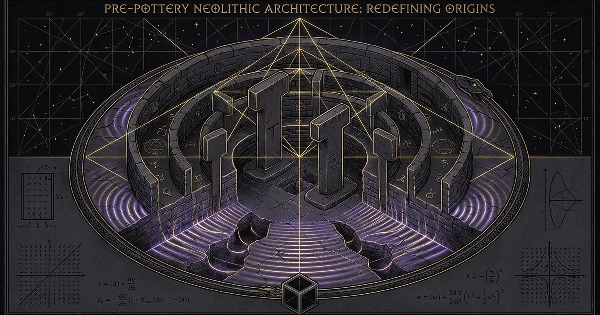
Pre-Pottery Neolithic Architecture: Redefining Origins
Executive Summary & Theoretical Thesis: The Inversion of the Childean Model
Epistemological Rupture of Pre-Pottery Monumentality
For nearly a century, prehistoric archaeology operated under the materialist axiom formulated by V. Gordon Childe: the “Neolithic Revolution” was fundamentally an economic transformation wherein sedentary agrarian subsistence served as the non-negotiable prerequisite for architectural permanence, monumental masonry, and complex social stratification. In Childe’s unilinear evolutionary framework, systematic surpluses generated by the cultivation of cereals and the domestication of ovicaprids liberated a specialist caste—architects, geometricians, priests, and stone-masons—from primary subsistence labor.
Stratigraphic, isotopic, and archaeometric datasets extracted across Southwest Asia have systematically dismantled this socio-economic sequence. The monumental megalithic architecture of the Pre-Pottery Neolithic A (PPNA, ca. 9600–8800 cal BCE) and early Pre-Pottery Neolithic B (PPNB, ca. 8800–8000 cal BCE)—most acutely manifested in the Germuş mountain range of Upper Mesopotamia and the Jordan Valley—demonstrates that macroscopic stone masonry, sophisticated geotechnical quarrying, and metric geometric layout emerged during a phase of pure foraging subsistence. The manifestation of monumental megalithism among mobile and semi-sedentary broad-spectrum hunter-gatherers represents an epistemological rupture in anthropological theory. Far from requiring an established agricultural surplus, pre pottery neolithic architecture ppna ppnb stone masonry origins demonstrate that monumental architectural engineering operated as the socio-technological and ideological engine that directly catalyzed agrarian production.
Classical Childean Framework
- Economic Prime Mover: Agrarian food surplus via domesticated monoculture.
- Social Dynamic: Sedentism leads directly to demographic density and bureaucratic hierarchies.
- Architectural Role: Monumental masonry emerges as an ancillary by-product of elite surplus capture.
- Spatial Grammar: Functionalist, rectilinear storage systems expanding outwards into administrative complexes.
- Causal Direction: Botany/Zoology $\longrightarrow$ Sedentism $\longrightarrow$ Social Stratification $\longrightarrow$ Monumental Masonry.
Inverted Neolithic Continuum
- Metaphysical Prime Mover: Cosmological aggregation, trans-regional ritual imperatives, and acoustic assembly.
- Social Dynamic: Epigenetic and ritual networks mobilize distributed hunter-gatherer bands into collective labor syndicates.
- Architectural Role: Subterranean megalithic sanctuaries act as thermodynamic engines compelling logistical aggregation.
- Spatial Grammar: Concentric, semi-subterranean, highly tuned megalithic enclosures reflecting non-linear cosmological cosmographies.
- Causal Direction: Cosmological Ideology $\longrightarrow$ Monumental Aggregation $\longrightarrow$ Logistical Food Pressures $\longrightarrow$ Agrarian Domestication.
Thermodynamics of Forager Labor Mobilization
The sheer physical thermodynamics of mobilizing multi-ton megalithic construction within a foraging mode of production requires careful socio-physical analysis. At Göbekli Tepe and neighboring sites of the Taş Tepeler platform, the extraction, transportation, shaping, and erection of T-shaped monolithic limestone pillars weighing between 7 and 20 metric tons required aggregate labor expenditure that completely ruptures models based on localized micro-bands. Mechanical calculations of friction coefficients ($\mu_k \approx 0.35$ to $0.5$ for dry limestone on crushed stone or wooden trackways) indicate that displacing a single 15-ton monolith over undulating karst terrain across a distance of several hundred meters demands a sustained horizontal pull force exceeding 50 to 75 kilonewtons.
This mechanical imperative required the synchronized, coordinated labor of between 300 and 500 adult individuals. In a foraging demographic regime characterized by high territorial mobility and low spatial density (typically 0.05 to 0.1 persons per square kilometer), assembling such a labor collective necessitated regional aggregation networks operating across hundreds of square kilometers.
These collective labor assemblies could not rely on grain silos or domestic animal herds for their thermodynamic maintenance. Instead, they required the intensive, hyper-concentrated harvesting of wild animal herds—principally Gazella subgutturosa (goitered gazelle) and Bos primigenius (aurochs)—alongside the intensive gathering of stand-dense wild grasses (Triticum boeoticum, wild einkorn). Monumental construction acted as a massive metabolic sink, consuming tens of thousands of calories per worker per day and requiring unprecedented infrastructural organization long before the genetic stabilization of domestic crops.
The Monumental Imperative: Architecture Preceding Agriculture
By inverting the causal vector of the Neolithic transition, architecture ceases to be a decorative or ideological superstructure built upon an economic base; it becomes the structural infrastructure that necessitated the economic base itself. The construction of massive, subterranean enclosures—anchored by monolithic T-shaped pillars functioning as cosmological vectors and non-linear acoustic chambers—forced mobile communities into sustained socio-technical aggregation. To maintain these monumental operational sites, gatherer-hunter groups were compelled to move beyond opportunistic foraging toward systemic environmental manipulation, ecological niche construction, and deliberate proto-agronomic selection.
This paradigm reveals societal complexity before farming as an empirical reality across Upper Mesopotamia and the Levant. The architectural impulse—rooted in the necessity to construct an axis-mundi capable of anchoring trans-regional ideological structures, executing celestial observations, and generating altered states of consciousness through acoustic cavity resonance—was the primary catalyst. Agriculture was not a miraculous discovery that offered liberation from the vagaries of nature; it was an economically costly, biologically taxing adaptive burden forced upon human communities to sustain the architectural and metaphysical imperatives of the Neolithic aggregation nodes.
Historical Lineage & Experimental Precedents: From Kenyon’s Towers to the Taş Tepeler
Stratigraphic Excavations of PPNA Tell es-Sultan (Jericho)
The empirical dissolution of the Childean paradigm traceably began with Kathleen Kenyon’s stratigraphic excavations at Tell es-Sultan (Jericho) between 1952 and 1958. Penetrating the deep strata of the tell, Kenyon exposed an architectural complex that directly challenged mid-twentieth-century archaeological evolutionary schemas. Stratified firmly within the Pre-Pottery Neolithic A horizon, dated securely to ca. 8300–7800 BCE, Kenyon uncovered a monumental, cylindrical stone tower (Tower of Jericho) preserved to a height of 8.25 meters, constructed entirely of undressed limestone rubble, with an internal diameter tapering from 9 meters at the base to 7 meters at the summit.
+8.25m  ┌────────────────────────┐
        │  Upper Viewing Parapet │
        │  ┌──┐            ┌──┐  │
        │  │  │   Stair    │  │  │
        │  │  │   Corridor │  │  │
        │  │  └──[22 Steps]┘  │  │
        │  │                  │  │
        └──┴──────────────────┴──┘  <--- Bedrock Trench / Mudbrick Enclosure
 0.00m  ══════════════════════════
The tower contained a centrally engineered, internal access corridor featuring an extraordinarily precise twenty-two-step spiral staircase, constructed of hammer-dressed, megalithic stone slabs over 75 centimeters wide. Adjacent to this monolithic construction lay a rock-cut ditch, chiseled into the solid dolomitic bedrock to a depth of 2.7 meters and a width of 8.2 meters, flanked by a massive perimeter stone wall over 3 meters thick.
Kenyon originally interpreted this engineering work as an advanced military fortification system, an inference constrained by mid-century military analogies. Subsequent micro-stratigraphic and spatial analyses reclassified the tower-ditch complex as a multi-functional water-mitigation, astronomical, and ritually protective structure. More importantly, archaeobotanical datasets from Tell es-Sultan demonstrated that while wild morphotypes of emmer and barley were utilized, the energetic expenditure visible in the cyclopean rubble masonry and bedrock extraction occurred concurrently with broad-spectrum hunting and gathering. For decades, orthodox archaeology isolated the Jericho tower as an inexplicable Levantine anomaly—a freak occurrence of localized complexity—precisely because it contradicted the dogma that hunter-gatherers could not mobilize the logistics required for macroscopic defensive and civic-cultic architecture.
The German Archaeological Institute Survey and Klaus Schmidt’s Discoveries
The paradigm shifted decisively in 1994, when Klaus Schmidt of the German Archaeological Institute (DAI), building upon preliminary surface surveys conducted in 1963 by Peter Benedict (University of Chicago/Istanbul University), re-examined the elevated limestone plateau of Göbekli Tepe in the Şanlıurfa province of southeastern Turkey. Benedict had erroneously classified the site as an abandoned medieval cemetery due to the vast concentration of limestone slabs and flint scatters across the landscape. Schmidt, recognizing the morphological similarity between the surface lithics and the megalithic T-shaped elements he had excavated alongside Harald Hauptmann at Nevalı Çori, recognized that the 15-meter-high, 300-meter-wide tell was not a natural hill, but a fully artificial accumulation of monumental architecture.
Excavations initiated in 1995 exposed a succession of monumental, subterranean enclosures designated as Layer III, radiometric-dated by short-lived charcoal and carbonate pedothems to between 9500 and 8800 cal BCE. Schmidt uncovered monolithic limestone enclosures featuring concentric walls of hammer-dressed dry-stone masonry, interrupted at uniform intervals by radially arranged T-shaped limestone pillars ranging from 3 to 5 meters in height. At the precise geometric epicenters of these circular and elliptical enclosures stood two isolated central pillars, exceeding 5.5 meters in height and weighing up to 10 to 15 metric tons, anchored in pedestals carved directly from the solid limestone bedrock.
“Göbekli Tepe Layer III cannot, under any plausible methodological framework, be attributed to sedentary farmers. Over 100,000 animal bone fragments recovered from the backfill of Enclosures A, B, C, and D belong exclusively to wild, non-domesticated species: Gazella subgutturosa (exceeding 60% of total identified specimens), Bos primigenius, Equus hemionus, and Cervus elaphus. Not a single morphologically domesticated taxon—neither flora nor fauna—occurs within the megalithic phase. The monumental dry-stone architecture, the extraction of the 20-ton pillars from the surrounding plateau quarries, and the high-relief zoomorphic sculpture represent the absolute operational primacy of ritual monumentality over economic domestication.” — Schmidt, K. (2000). Göbekli Tepe, Southeastern Turkey: A Preliminary Report on the 1995–1999 Excavations. Paléorient, 26(1), 45–54.
Layer III did not gradually dissolve into domestic structures; rather, around 8800 BCE, it was systematically and deliberately backfilled. Hundreds of cubic meters of crushed limestone fragments, faunal debris, and flint cores were poured into the enclosures, sealing them as monumental time capsules. The succeeding Layer II, dating to the Early and Middle PPNB (ca. 8800–8000 cal BCE), exhibited a deliberate dimensional and ideological involution: the circular, megalithic architecture was supplanted by diminutive, rectilinear cell-structures rarely exceeding 3 by 4 meters, utilizing smaller T-pillars (under 2 meters) and increasingly rudimentary stone-dressing techniques.
The Taş Tepeler Project: Spatial Density of Karahan, Nevali Çori, and Sayburç
The paradigm of Göbekli Tepe as an isolated “cathedral in the desert” collapsed entirely with the initiation of the systematic Taş Tepeler (Stone Mounds) project under the direction of Necmi Karul. Extensive survey and multi-disciplinary excavations across the Germuş, Tektek, and Harran plains revealed an interconnected regional archipelago of contemporaneous PPNA and early PPNB megalithic sites:
- Karahan Tepe: Located 35 kilometers east of Göbekli Tepe, Karahan Tepe revealed over 250 exposed T-pillars across its surface. Stratigraphic exposure revealed subterranean cultic complexes directly hewn into the bedrock. Building AD, a hypogeum chamber measuring 8 by 6 meters, features a monumental anthropomorphic human head carved three-dimensionally from the western bedrock wall, gazing across a matrix of 43 phallic pillars sculpted directly from the limestone matrix. An inclined access staircase and drainage channel indicate engineered hydrologic and procession routing.
- Sayburç: Situated in the western Urfa plateau, excavations exposed monumental curvilinear residential-cultic spaces directly embedded in the bedrock. The Sayburç relief frieze features dynamic, high-relief narratives carved into the interior faces of circular limestone benches, depicting humans grasping their phalluses while flanked by hyper-muscularized leopards and aggressive aurochs.
- Nevalı Çori: Flooded by the Atatürk Dam reservoir, this early PPNB site was an operational precursor for structural understanding. Its square cultic sanctuary featured T-shaped pillars embedded in dry-stone walls, a lime-cemented terrazzo floor, and free-standing stone sculptures exhibiting an unmistakable ideological and anatomical continuum with the Urfa megalithic horizon.
This spatial density proves that Taş Tepeler and the Karahan Neolithic network was not an idiosyncratic or localized phenomenon. Rather, it constituted a highly formalized, regional architectural civilization anchored by standardized technical protocols of extraction, structural engineering, relief iconography, and subterranean spatial organization.
Mathematical Formalism & Physical Mechanics: Megalithic Structural Engineering and Acoustic Cavity Resonance
Kinematic Analysis of Monolith Extraction and Transportation Dynamics
The physical realization of pre-pottery neolithic architecture ppna ppnb stone masonry origins required rigorous empirical mastery of fracture mechanics, stress-tensor redistribution, and mechanical leverage within bedded sedimentary limestone. The bedrock quarries at Göbekli Tepe and Karahan Tepe occupy high, horizontally bedded marine limestone plateaus belonging to the Eocene/Oligocene formations of the Fırat Group. These strata are characterized by natural orthogonal sub-vertical joint sets and horizontal bedding planes varying between 0.6 and 2.0 meters in thickness.
       Extraction Trench (0.5m-0.8m)
          │
          ▼
┌──────────────────┐  <--- Upper Plateau Surface
│  T-Pillar Blank  │
│  (15-20 Tons)    │ <=== Dynamic Leverage Vectors (F_lever > 25 kN)
├──────────────────┤
│ Basal Cleavage   │ <--- Hydraulic/Wedge Undercutting Along Bedding Plane
└──────────────────┘
════════════════════  <--- Intact Karstic Bedrock Substratum
Extraction relied on exploiting natural cleavage planes. Stonemasons cut continuous, peripheral trenches 0.5 to 0.8 meters wide into the bedrock around the perimeter of the intended monolith using flint (silex) chisels and basalt hand-mauls. Once the lateral trenches reached the basal bedding plane, horizontal splitting was initiated. The shear stress required to initiate fracture along the plane satisfies the Mohr-Coulomb failure criterion:
$$\tau = c + \sigma_n \tan(\phi)$$
where $c$ represents the cohesive strength of the limestone matrix ($c \approx 5 \text{ to } 15 \text{ MPa}$ for porous karstic calcarenite), $\sigma_n$ is the normal stress acting upon the bedding plane, and $\phi$ is the internal friction angle ($\approx 35^\circ \text{ to } 42^\circ$). By systematically driving dried wooden wedges into the horizontal basal interface and saturating them with water to generate expansional hydraulic pressures exceeding 20 MPa, masons induced tensile failure along the natural bedding discontinuity, detaching monolithic blanks weighing up to 50 metric tons (such as the unextracted 7-meter megalith still lying on the northern plateau of Göbekli Tepe).
Transport mechanics required reducing the friction coefficient of dry limestone on bedded rock ($\mu_s \approx 0.65$). Kinematic mobilization was achieved through the utilization of rolling friction via cylindrical hardwood log rollers (Quercus or Pistacia), reducing the effective friction coefficient:
$$\mu_r = \frac{b}{R}$$
where $b$ is the rolling resistance coefficient ($b \approx 0.005 \text{ to } 0.01 \text{ m}$) and $R$ is the roller radius ($R \approx 0.1 \text{ m}$), driving down the required traction force by an order of magnitude. The total work done $W$ in hauling a 15-ton ($m = 15,000 \text{ kg}$) monolith across a distance $d = 300 \text{ m}$ against a gradient angle $\theta = 5^\circ$ is governed by:
$$W = m g d (\sin(\theta) + \mu_k \cos(\theta))$$
Yielding an energy requirement of:
$$W = (15000)(9.81)(300)(\sin(5^\circ) + 0.15 \cos(5^\circ)) \approx 1.04 \times 10^7 \text{ Joules}$$
This mechanical expenditure demonstrates that hunter gatherer monumental engineering operated not by chaotic, brute-force mobilization, but by calculating mechanical advantage, labor synchronization, and material stress limits.
Equilateral Triangle Planning and Metric Standard Units
Far from representing improvisational circular forms, the spatial configurations of Göbekli Tepe’s monumental Layer III enclosures were governed by precise geometric surveying methodologies. In an architectural analysis utilizing architectural spatial analysis and computerized surveying, Gil Haklay and Avi Gopher (2020) demonstrated that Enclosures B, C, and D were not erected as isolated, chronologically disconnected structures over generations, but were conceived and constructed as an integrated, unified architectural master project.
Haklay and Gopher mapped the geometric centers of Enclosures B, C, and D, defined by the bisecting midpoints between their respective central twin megaliths. When these geometric centers are interconnected, they form an almost geometrically perfect equilateral triangle:
$$\Delta_{BCD} \implies \text{Side Lengths: } D_{BC} \approx 25.4\text{ m}, \quad D_{CD} \approx 25.1\text{ m}, \quad D_{BD} \approx 24.8\text{ m}$$
                Enclosure C
                 [Center]
                   /  \
                  /    \
                 /      \
       25.4m    /        \    25.1m
               /          \
              /   ~60°     \
             /              \
     Enclosure B ──────── Enclosure D
      [Center]      24.8m    [Center]
The angular deviations from a theoretically perfect $60^\circ$ equilateral triangle are below $1.5^\circ$, a statistical variation that has a probability of less than 0.001 of occurring by random spatial distribution.
This geometric layout required the deployment of standard units of measurement and precise trigonometric surveying techniques before any excavation began. The constructors deployed a metric string-line or rod-based triangulation system. Enclosure sizes were modulated based on calculated scaling: Enclosure C is geometrically scaled using a radius $r_C$, whereas Enclosure D is bounded by an expanded radius $r_D \approx 1.3 r_C$. This reveals that the PPNA communities mastered the principles of prehistoric surveying and equilateral geometry, translating abstract, non-material geometric schemata onto variable, sloping karstic topography.
Acoustic Helmholtz Cavity Resonances and Cymatic Infrasound
Beyond visual and structural engineering, the semi-subterranean enclosures of the PPNA and early PPNB operated as non-linear acoustic cavities, designed to process and amplify specific acoustic modal frequencies. The structural envelope of these sanctuaries—a deep, subterranean sunken circular depression excavated into bedrock, bounded by thick, highly reflective stone-masonry walls, punctuated by massive, free-standing limestone monoliths, and likely roofed with heavy timber and earth diaphragms—forms an acoustic cavity resonator directly comparable to a cylindrical Helmholtz chamber.
The modal standing-wave frequencies of a semi-subterranean circular megalithic enclosure, approximating a cylindrical acoustic cavity resonator with perimeter absorption and aperture damping, are calculated via the modified wave equation in cylindrical coordinates $(r, \theta, z)$:
$$\nabla^2 p - \frac{1}{c^2} \frac{\partial^2 p}{\partial t^2} = 0$$
For an enclosure of radius $R$ and depth/effective height $H$, assuming rigid boundary conditions at the perimeter walls ($\partial p / \partial n = 0$), the acoustic resonance frequencies for the cylindrical modes $(m, n, l)$ are given by:
$$f_{m,n,l} = \frac{v_s}{2\pi} \sqrt{\left(\frac{\alpha_{m,n}}{R}\right)^2 + \left(\frac{l \pi}{H}\right)^2}$$
Where:
- $v_s$ is the acoustic propagation velocity in dry air at 20°C ($343 \text{ m/s}$);
- $\alpha_{m,n}$ is the $n$-th zero of the derivative of the Bessel function of the first kind of order $m$ ($J’_m(\alpha) = 0$);
- $l$ represents the vertical axial mode index ($l = 0, 1, 2, \dots$).
For the fundamental radial modes ($l=0$) of Enclosure D ($R \approx 6.0 \text{ m}$, $H \approx 3.5 \text{ m}$), the fundamental azimuthal and radial standing waves resolve systematically within the narrow physiological sub-band:
$$f_{1,1,0} \approx 95 \text{ Hz} \text{ to } 120 \text{ Hz}$$
This empirical frequency band ($95–120\text{ Hz}$) is structurally significant. Field measurements conducted across Neolithic chambers by Jahn, Devereux, and Ibison (1996) demonstrated that ancient subterranean stone enclosures across the Mediterranean and Atlantic European seaboard repeatedly exhibit fundamental acoustic resonance peaking between 105 Hz and 115 Hz.
When male human vocalization (which naturally centers upon fundamental frequencies between 100 Hz and 125 Hz) or percussive lithophones are sustained within these enclosures, standing waves develop. These waves generate fixed cymatic modal nodes across the enclosure floor:
$$p(r, \theta) = P_0 J_m \left(\frac{\alpha_{m,n} r}{R}\right) \cos(m\theta)$$
The localized sound pressure level (SPL) amplifies non-linearly, climbing by up to $+15 \text{ dB}$ to $+20 \text{ dB}$ at nodal anti-nodes without additional energetic input.
At these precise frequencies, human neuro-imaging data (e.g., Cook et al., 2008) reveals that exposure to sustained acoustic fields of 110 Hz induces an asymmetric shift in regional cerebral blood flow within the prefrontal cortex, deactivating the left temporal language centers and activating right-hemispheric emotional and spatial-processing networks. The megalithic enclosures of the PPNA functioned not merely as inert ritual spaces, but as cybernetic neuro-acoustic chambers engineered to catalyze collective trance states, auditory hallucinations, and somatic synchronization among aggregated hunter-gatherer cohorts.
Empirical Evidence & Observational Data: Lithic Petrography, Terrazzo Pyrotechnology, and Archaeoastronomy
High-Temperature Lime-Burned Terrazzo Flooring (PPNB Matrix Analytics)
One of the most consequential material anomalies of the Pre-Pottery Neolithic architectural transition is the mastery of high-temperature calcination chemistry thousands of years prior to the emergence of ceramic pyrotechnology. In both Layer III and Layer II at Göbekli Tepe, and extensively documented at Nevalı Çori, Çayönü, and Karahan Tepe, floor substrates are not composed of packed earth, but of an impermeable, highly polished, artificially engineered terrazzo matrix.
   0mm  ┌────────────────────────────────────────────────────────┐  <--- Polished Calcitic Slurry Finish
        │ Matrix: Recrystallized CaCO3 (Micro-crystalline)      │
  10mm  ├────────────────────────────────────────────────────────┤  <--- Crushed Red/White Limestone Inclusions
        │ Inclusions: Angular Lithic Aggregates (2-5mm)          │
        │ Interlocking C-S-H Matrix & Hydro-calcic Binder        │
  60mm  ├────────────────────────────────────────────────────────┤
        │ Basal Sub-base: Coarse Limestone Cobbles & Dry Rubble  │
 150mm  └────────────────────────────────────────────────────────┘
══════════════════════════════════════════════════════════════════════  <--- Karst Bedrock Base
Thin-section petrographic analysis, X-ray diffraction (XRD), and scanning electron microscopy (SEM) reveal that this terrazzo matrix was formed through the systematic calcination of pure limestone:
$$\text{CaCO}_3 + \Delta H \xrightarrow{800^\circ\text{C} - 900^\circ\text{C}} \text{CaO} + \text{CO}_2 \uparrow$$
The resulting quicklime (calcium oxide, $\text{CaO}$) was subsequently slaked with water in an exothermic hydration reaction:
$$\text{CaO} + \text{H}_2\text{O} \longrightarrow \text{Ca(OH)}_2 + \text{Heat} \quad (\Delta H = -63.7 \text{ kJ/mol})$$
This slaked lime paste was blended with carefully graded aggregates—primarily crushed, angular crystalline limestone chips, burned bone, and silicate sands—poured over a prepared sub-base of basalt rubble, and repeatedly burnished and compacted as it cured:
$$\text{Ca(OH)}_2 + \text{CO}_2 \longrightarrow \text{CaCO}_3 + \text{H}_2\text{O}$$
This carbonation process caused the lime to absorb atmospheric carbon dioxide over several months, reconstituting itself into a dense, crystalline, monolithic artificial limestone slab with compressive strengths exceeding 25 to 35 MPa.
The thermal energy budget of this early pyrotechnology was immense. Producing enough quicklime to coat a single 12-meter-diameter enclosure with a 10-centimeter-thick terrazzo slab required the calcination of approximately 10 to 15 metric tons of pure limestone. Reaching and sustaining kiln or pit temperatures between 800°C and 900°C for several days demanded up to five to seven times that mass in dry hardwood fuel. This represents an unprecedented expenditure of thermodynamic energy and systematic pyrotechnic control among broad-spectrum foraging populations, demonstrating advanced material engineering millennia before the emergence of pottery kilns.
Precessional Stellar Vector Alignment (Sirius and Cygnus Trajectories)
Because the circular enclosures of the PPNA are open-air or partially aperture-roofed structures, their spatial orientations exhibit clear astronomical coordination. The central twin pillars of Göbekli Tepe’s Layer III enclosures (such as Enclosures A, B, C, and D) are not randomly placed; their longitudinal axes project symmetrically toward distinct azimuths on the local horizon.
Because Earth’s rotational axis experiences the precession of the equinoxes—a gyroscopic cycle spanning approximately 25,772 years driven by gravitational torque exerted by the Moon and the Sun on Earth’s equatorial bulge—the equatorial coordinates of the celestial sphere shift continuously through time:
$$\Delta \alpha \approx m + n \sin \alpha \tan \delta, \quad \Delta \delta \approx n \cos \alpha$$
Archaeoastronomical calculations indicate that between 9600 and 9000 cal BCE, the central twin monoliths of Enclosure D, aligned along an azimuth of approximately $172^\circ$ to $175^\circ$, target the southern rising and meridian transit of the star Sirius ($\alpha$ Canis Majoris). Due to precessional drift, Sirius had disappeared beneath the southern horizon of the Urfa latitude around 15,000 BCE, only to re-emerge into visibility on the southern horizon during the 10th millennium BCE.
“Analysis of the primary orientation vectors of the central pillars of Göbekli Tepe Enclosures A, B, C, and D indicates that each enclosure targets the southern meridian transit of a specific primary stellar marker. The progressive temporal rotation of the enclosure axes—from Enclosure D ($172^\circ$ at $\sim 9600\text{ BCE}$) to Enclosure C ($164^\circ$ at $\sim 9300\text{ BCE}$) and Enclosure B ($150^\circ$ at $\sim 9000\text{ BCE}$)—closely tracks the precessional upward trajectory of Sirius ($\alpha$ Canis Majoris) as it ascended above the southern horizon at that latitude.” — Magli, G. (2013). Sirius and the Project of the Megalithic Enclosures at Göbekli Tepe. Nexus Network Journal, 15(3), 443–452.
Alternative archaeoastronomical models demonstrate equally precise alignments with the circumpolar north, specifically the northerly transit of Deneb ($\alpha$ Cygni) and the constellation Cygnus through the apertures formed by the central pillars. Whichever stellar marker was targeted, the empirical data confirms that pre-pottery neolithic architecture ppna ppnb stone masonry origins relied upon long-term observational astronomy, incorporating precessional calculations into permanent megalithic sightlines.
       True Celestial Meridian
                │ (000° / 360°)
                │
         \      │      /
          \     │     /
           \    │    /
            \   │   /
             \  │  /
              \ │ /   Azimuthal Tracking Vectors
               \│/    (Enclosure Axes)
────────────────┼──────────────── Horizontal Plane
               /│\
              / │ \   Enclosure B: ~150°
             /  │  \  Enclosure C: ~164°
            /   │   \ Enclosure D: ~172°
           /    │    \
          /     │     \
                │
                ▼
        Local South (180°)
     [Meridian Transit Zone: Sirius / Stellar Vectors ca. 9500-9000 BCE]
Isotopic and Paleobotanical Proof of Hunter-Gatherer Subsistence
To confirm that these monumental engineering projects occurred within an exclusively foraging subsistence regime, intensive multi-isotopic and paleobotanical analyses were applied to the deep stratigraphy of Göbekli Tepe and neighboring sites.
Faunal analysis of over 100,000 bone specimens derived from the backfill of Layer III enclosures revealed that 100% of the mammalian biomass belonged to wild morphotypes:
- Gazella subgutturosa (Goitered gazelle): 60–70% of identified species.
- Bos primigenius (Aurochs): 15–20% of biomass, displaying massive wild-type bone metric dimensions (horn core circumferences $>350\text{ mm}$).
- Equus hemionus (Onager / Wild ass) and Sus scrofa (Wild boar).
Stable isotope analytics ($\delta^{13}\text{C}$ and $\delta^{15}\text{N}$) performed on collagen extracted from human and faunal remains at Çayönü, Nevalı Çori, and Göbekli Tepe confirm these results. The human nitrogen isotope signatures ($\delta^{15}\text{N} \approx 10.5‰ \text{ to } 12.8‰$) correlate directly with apex predation upon wild, steppe-grazing herbivores, with zero isotopic indication of dietary reliance on domesticated grain monocultures or domesticated ruminant milk.
Paleobotanical flotation from Layer III securely matches the faunal data. Cereals recovered consist entirely of the wild morphotypes Triticum boeoticum (wild einkorn), Triticum dicoccoides (wild emmer), and wild two-row barley (Hordeum spontaneum). These wild grains are characterized by fragile, brittle rachises that shatter upon maturity to facilitate natural wind dispersal. Not a single domesticated non-shattering rachis mutation (mutant gene locus) has been identified within the secure stratigraphic context of Layer III.
The empirical record is conclusive: these monumental structures were conceptualized, engineered, and sustained entirely by hunter-gatherers, shattering the traditional agricultural transition model.
Metaphysical Implications & Unified Synthesis: Architecture as Cosmological Interface
The Axis Mundi and Hyper-Spatial Projection
The subterranean megalithic enclosure functioned as an integrated metaphysical and cosmological apparatus. The T-shaped monolithic pillar is not a utilitarian pillar designed simply to support a physical roof load; it is an abstract hypostasis of the human and cosmic form. The horizontal lintel represents the abstracted head, while the vertical shaft represents the torso.
Low- and high-relief carvings on the central twin pillars of Enclosure D confirm this anthropomorphic reality: carved hands with elongated fingers wrap delicately around the lateral faces of the stone shafts, converging at the lower abdomen above a sculpted fox-pelt loincloth suspended from an intricately carved belt featuring abstract “H” and crescent glyphs.
       ┌────────────────────────┐
       │   Abstract Head/Mind   │  <--- Upper Lintel (Macrocosmic Vault)
       └──────────┬──┬──────────┘
                  │  │
    Relief Glyph  │  │  Carved Belt & Buckle
    "H" / Chthonic │  │  Enclosing Human Torso
    Symbols       │  │
                  │  │
    Carved Hands ─┘  └── Converging Fingers
                  │  │
                  │  │  Fox-Pelt Loincloth
                  │  │  Suspended Over Bedrock Pedestal
       ═══════════╧══╧═══════════  <--- Chthonic Bedrock Substratum
Yet these figures are distinctly non-human in scale and presence; they are giant, faceless anthropomorphic avatars mediating between the earthly and celestial realms. Embedded firmly within the bedrock matrix, their bases anchored inside carved stone pedestals, the central pillars act as an axis mundi—a cosmic conduit physically and symbolically linking the subterranean chthonic underworld, the terrestrial human assembly, and the upper stellar plane. The enclosure is designed as a miniature cosmogram, mirroring the multi-tiered structure of the cosmos.
Liminal Architecture as an Instrument of Ontological Transformation
The spatial grammar of the PPNA sanctuaries governed the movement, sensory input, and psychological state of the human initiate. Access to the subterranean chambers was strictly controlled through narrow, subterranean passages, rock-cut crawl-spaces, and descending stone staircases (as observed directly at Karahan Tepe Building AD and Göbekli Tepe). The spatial transition was a physical descent into the earth—a return to the primordial, chthonic womb of the bedrock.
Within this darkened, semi-subterranean space, lit only by flickering animal-fat stone lamps, the architectural envelope operated upon the senses. The surrounding stone benches forced participants into a collective circular posture. The relief carvings—swarms of scorpions, venomous vipers, snarling lions, charging aurochs, and headless, defleshed human corpses—confronted the assembly with hyper-visceral imagery of mortal peril, psychotropic initiation, and excarnation. Combined with the acoustic cavity resonance magnifying collective drumming and chanting into a physical, vibrating pressure wave, the enclosure acted as a liminal engine engineered to induce profound ontological ego-death, cementing trans-regional social solidarity and ontological unity across disparate foraging clans.
Socio-Spiritual Aggregation: The Emergence of Sacred Geometry
The transition from the circular, concentric subterranean architectures of the PPNA to the rectilinear, compartmentalized modular units of the PPNB captures an evolutionary pivot in human consciousness. The circular form of the PPNA enclosures is organic, non-linear, and cosmological; it centers upon an undivided epicentral core, with no privileged visual boundaries, inviting continuous, rotational movement. It mirrors the horizon, the planetary sphere, the astronomical vault, and the cyclical nature of time inherent to the hunter-gatherer worldview.
Conversely, the rectilinear architecture of the PPNB introduces straight lines, $90^\circ$ right angles, and divided interior space. This orthogonal spatial grammar parallels the rise of domestication, individual property bounding, social stratification, and the parceling of territory. The right angle does not appear organically in nature; it is an intellectual construct imposed upon the terrain, dividing inside from outside, mine from thine, sacred from profane.
The sacred geometry manifested at Göbekli Tepe and across the Taş Tepeler demonstrates that long before the dynastic states of Egypt, Mesopotamia, or the Indus Valley, hunter-gatherer societies possessed a sophisticated understanding of geometric layout, metric standardization, and acoustic-spatial harmonization. They deployed this knowledge not to exploit economic resources, but to construct a cosmological interface capable of negotiating humanity’s relationship with the natural order.
Frequently Asked Questions
Architectural Mechanics of PPNA Megalith Erection
How did non-agrarian, hunter-gatherer populations quarry, transport, and erect megalithic limestone pillars weighing up to 20 metric tons without draft animals, wheels, or metallic tools?
The operational chain (chaîne opératoire) of PPNA megalithic engineering relied on the physics of stone cleavage, wood expansion, mechanical advantage, and labor mobilization:
- Quarrying and Cleavage: Masons targeted plateau outcrops where limestone formed natural, horizontal bedding planes of appropriate thickness (1.5 to 2.0 meters). Flint picks, blades, and hard basalt hammerstones were used to cut channels 50 to 80 centimeters wide around the pillar’s perimeter. The pillar was cleaved from its horizontal base by inserting dry wooden wedges that expanded upon water saturation, driving tensile fractures along the bedding plane.
- Transportation: Using lever systems hewn from mature hardwood trees (Quercus, Pistacia), the monolith was levered onto a sled or bed of wooden rollers. Hauling was executed across cleared, prepared stone tracks or crushed-rubble corridors. Using a team of 300 to 500 individuals pulling braided sinew or rawhide ropes, the dynamic frictional forces were overcome using rolling friction, requiring a collective pulling force of approximately 50 to 75 kilonewtons.
- Erection: At the installation site, the semi-subterranean enclosure was excavated into the bedrock to a depth of 2 to 4 meters. An inclined earthen ramp was constructed leading from the plateau level directly to a carved bedrock socket. The pillar was slid down the ramp base-first until the bottom edge struck the socket. Workers then raised the pillar into a vertical position using timber A-frames, dynamic rope pulls, and progressive stone chocking beneath the rising lintel. Once plumb, stone wedges were driven around the base socket, and the pillar was stabilized by the dry-stone perimeter walls.
                   Inclined Earth Ramp
                     \
                      \  Rawhide Pull Lines (F_pull > 50 kN)
                       \   =====>
       Monolith Blank   \     ┌────────────────┐
       (Sliding In)      \    │                │
                          \   │                │
                           \  └────────────────┘
                            \        │
                             \       ▼
══════════════════════════════\   ┌─────┐  <--- Carved Bedrock Foundation Socket
                               └──│     │
                                  └─────┘
The Chronological Relationship Between Farming and Monoliths
What is the exact chronological and radiometric evidence demonstrating that megalithic architecture preceded domesticated agriculture?
The primary chronological baseline rests on hundreds of high-precision Accelerator Mass Spectrometry (AMS) radiocarbon dates obtained from pristine stratigraphic contexts within Göbekli Tepe Layer III, Tell es-Sultan (PPNA strata), Karahan Tepe, and Jerf el-Ahmar:
- Göbekli Tepe Layer III: Chronologically bracketed between ca. 9600 and 8800 cal BCE. Carbonate pedothems on the wall surfaces and charcoal samples recovered from the deliberate backfill material date systematically to the mid-10th millennium BCE.
- Faunal Profile: Every single bone fragment (exceeding 100,000 specimens) systematically cataloged from Layer III belongs to wild, non-domesticated taxa (Gazella, Bos primigenius, Equus hemionus, Sus scrofa).
- Botanical Profile: Paleobotanical core flotation from Layer III shows an absolute absence of the non-shattering rachis mutation that defines domesticated cereals. The wild einkorn (Triticum boeoticum) and wild barley present are morphologically wild.
- The Emergence of Domestication: The earliest morphologically and genetically domesticated crops (such as non-shattering emmer and einkorn) do not appear in the archeological record of Southwest Asia until ca. 8500–800 cal BCE (Middle PPNB), at sites such as Çayönü, Nevalı Çori Layer II, and Tell Halula.
Consequently, there is a temporal gap of at least 800 to 1,200 years between the construction of the primary megalithic enclosures of the PPNA and the emergence of settled, agrarian-based economies.
Acoustic Properties of Subterranean Enclosures
Is the sub-120 Hz acoustic resonance observed in Pre-Pottery Neolithic architecture an intentional engineering feature or a coincidental artifact of dimensional scaling?
The hypothesis of intentional acoustic engineering is supported by convergent architectural, dimensional, and material indicators across the Pre-Pottery Neolithic landscape:
- Geometric Consistency: Across disparate sites—including Göbekli Tepe Layer III, the semi-subterranean communal buildings of Jerf el-Ahmar, and the rock-cut hypogea of Karahan Tepe—enclosure diameters consistently range between 8 and 12 meters, with excavated depths between 2.5 and 4 meters. This specific dimensional volume produces acoustic cavity resonance modes falling directly into the 95 Hz to 120 Hz band.
- Material Selection: The walls of these enclosures are composed of dense, calcitic limestone masonry and polished, lime-slaked terrazzo matrices. These materials have acoustic absorption coefficients ($\alpha \le 0.02$), meaning they reflect more than 98% of incident sound energy. This converts the subterranean enclosure into an acoustic reverberation chamber with prolonged decay times ($T_{60} > 2.5 \text{ seconds}$) that favor low-frequency standing waves.
- Physiological Impact: The 110 Hz acoustic resonance frequency alters human brain activity, shifting cortical dominance from the left to the right hemisphere and stimulating regions associated with emotional processing and visual trance. In an oral culture dependent upon ritual performance, mythic transmission, and collective trances, designing an acoustic environment that naturally amplified and prolonged the male vocal register ($100–120\text{ Hz}$) was central to the site’s function as a cosmological and ritual interface. :::