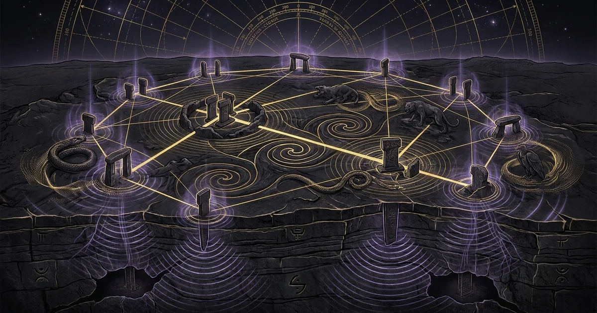
The Tas Tepeler Megalithic Complex: Network of 11 Hills
Executive Summary & Theoretical Thesis: The Polycentric Lithic Array of Upper Mesopotamia
The archaeological paradigm governing the Epipaleolithic-to-Neolithic transition has long suffered from an insular fixation. For nearly three decades, Göbekli Tepe was framed as an anomalous, solitary “cathedral in the wilderness,” erected ex nihilo by semi-nomadic hunter-gatherers within the fertile crescent. Recent spatial, geophysical, and stratigraphical fieldwork directed under the auspices of the Ministry of Culture and Tourism of Turkey, crystallized in the Taş Tepeler (“Stone Hills”) project, fundamentally dismantles this isolated anomaly hypothesis.
The Taş Tepeler network stone hills urfa region neolithic complex constitutes a deliberate, polycentric Pre-Pottery Neolithic (PPN) spatial apparatus across an expansive territorial radius in the Şanlıurfa basin. Rather than functioning as an autonomous ceremonial center, Göbekli Tepe is merely one node—albeit a structurally elaborate one—within a unified, contemporaneous interconnected regional sanctuary network of at least eleven identified elevations, including Karahan Tepe, Sayburç, Sefer Tepe, Harabetsuvan, Çakmaktepe, Kurttepesi, Ayanlar, Yoğunburç, Hamzantepe, and Yeni Mahalle.
This structural network spans the Pre-Pottery Neolithic A (PPNA, c. 9600–8800 BCE) through the Pre-Pottery Neolithic B (PPNB, c. 8800–7500 BCE), a critical horizon coinciding with the aftermath of the climatic perturbations of the Younger Dryas.
The eleven promontories are characterized by standardized architectural canons: subterranean, bedrock-hewn circular and sub-rectangular enclosures; anthropomorphic monolithic stelae manifested as T-shaped, inverted-L, and C-shaped pillars; high-relief narrative zoomorphic and phallomorphic iconography; and deliberate, systemic backfilling strategies.
Analyzed through the lens of geodetic distribution and field-propagation physics, this matrix operated as a unified territorial instrument: an integrated landscape engineering system wherein acoustic modal resonances, celestial alignments, and sociotechnical rituals coalesced to forge the cognitive architecture of early Holocene humanity.
Regional Topography of the Urfa Limestone Plateau
The geomorphic substrate of the Taş Tepeler complex is defined by the Eocene-Oligocene limestone plateaus that border the northern edge of the Harran Plain, descending southward toward the Syrian basaltic and alluvial lowlands. This geological formation provided both an inexhaustible lithic quarry and an elevated topographic advantage.
The bedrock exhibits pronounced, horizontal sedimentary stratification with bedding planes typically ranging between 0.6 and 1.8 meters in thickness, facilitating tabular, split-plane extraction of massive limestone monoliths without deep explosive or pneumatic fracturing. The natural limestone karst formations, punctuated by extensive subterranean cavern networks, sinkholes, and natural fissures, furnished the conceptual and physical blueprint for the subterranean hypogeum structures characteristic of the region.
From a hydrological and ecological standpoint, these elevated limestone promontories, rising between 600 and 850 meters above sea level, occupied an ecotonal vantage point. At the Pleistocene-Holocene boundary, the Harran depression formed an undulating savannah populated by extensive herds of Persian gazelle (Gazella subgutturosa), aurochs (Bos primigenius), wild equids (Equus hemionus), and wild boar (Sus scrofa).
The positioning of the eleven hill sites precisely on the cuestas and structural ridges overlooking the basin allowed systematic visual surveillance of megafaunal migration corridors. The limestone itself, composed predominantly of dense, microcrystalline calcium carbonate ($\text{CaCO}_3$) interspersed with thin silicified quartz lenses, offered an ideal medium for low-frequency acoustic propagation and non-destructive compressive load dissipation.
The Collective Horizon: Beyond the Solitary Göbekli Tepe Paradigm
The entrenchment of the solitary sanctuary hypothesis stemmed largely from the historical accident of Klaus Schmidt’s early focus on Göbekli Tepe from 1995 onward. However, regional surveys conducted systematically since the late 2010s confirm that the material markers of Göbekli Tepe—specifically the monolithic T-pillars, circular dry-stone perimeters, and internal bench configurations—are non-unique. Karahan Tepe, situated approximately 46 kilometers east of Göbekli Tepe in the Tektek Mountains, exhibits an architectural density that equals and, in specific subterranean configurations, surpasses its western counterpart. The site spans over 10 hectares, presenting upwards of 250 visible, surface-exposed or partially excavated pillars carved straight out of the native bedrock.
The paradigm shift necessitated by the Taş Tepeler project demands that we treat the region as a distributed polycentric system. Social organization during the PPNA and early PPNB in Upper Mesopotamia was not concentrated within a singular proto-urban ceremonial apex that dictated ideological directives to an undifferentiated periphery. Instead, the eleven sites display specialized functional morphology within a shared technical grammar:
- Göbekli Tepe acted as a vast, multi-enclosure celestial and totemic observatory;
- Karahan Tepe operated as a hypogeal initiation and somatic transmission center;
- Sayburç documented foundational anthropomorphic and predatory mytho-narratives;
- Outlying nodes like Sefer Tepe, Çakmaktepe, and Harabetsuvan anchored secondary visual, defensive, and resource-processing perimeters across the plateau.
Geomantic and Geodetic Distribution of the 11 Promontories
Spatial-point pattern analyses applied to the GPS centroids of the eleven Taş Tepeler promontories reveal a non-random, spatially autocorrelated dispersion model. When subjected to Delaunay triangulation and Voronoi tessellation, the network reveals an intentional geodetic-network characterized by line-of-sight visual inter-connectivity across neighboring nodes.
From the summit of Göbekli Tepe, direct optical lines-of-sight connect southward toward Yeni Mahalle and southeastward toward the structural promontories framing the Tektek range. In turn, Karahan Tepe maintains continuous optical visibility with Sefer Tepe, Harabetsuvan, and Kurttepesi.
This topological continuity suggests that visual signaling arrays, utilizing high-albedo smoke, specular limestone reflection, or nocturnal bonfire transmission, could propagate emergency alerts, seasonal transition markers, or synchronized astronomical signals across the entire 200-kilometer regional perimeter within a matter of minutes.
Furthermore, the baseline distances separating primary hubs (such as the ~46 km span between Göbekli Tepe and Karahan Tepe) reflect integer multiples of basic geodetic measures observed in early Near Eastern metrology. The geometric configurations do not simply conform to opportunistic terrain occupation; rather, the architectural footprint of each enclosure is oriented to reconcile regional geological fracture systems with precise terrestrial and celestial sightlines.
Historical Lineage & Archaeological Field Discoveries
Excavation Trajectories: From the 1963 Istanbul-Chicago Survey to the Modern Horizon
The initial discovery of megalithic material across the Şanlıurfa plateau dates to the 1963 Joint Prehistoric Survey conducted by the Universities of Istanbul and Chicago, co-directed by Halet Çambel and Robert Braidwood. During this reconnaissance, the elevated mound of Göbekli Tepe was recorded, but its limestone flagstones and partially exposed T-pillar capitals were misidentified as a medieval Byzantine cemetery. It was not until 1994, when German archaeologist Klaus Schmidt re-examined the surface lithics and identified extensive flint debitage characteristic of the Pre-Pottery Neolithic, that targeted excavations commenced in 1995 under the auspices of the Şanlıurfa Museum and the German Archaeological Institute (DAI).
The subsequent identification of the broader network proceeded slowly, initially stalled by the conceptual gravity of Göbekli Tepe. Karahan Tepe was discovered in 1997 by Bahattin Çelik and subjected to non-invasive surveys that established the presence of subterranean pillars protruding through the scrubland.
In 2019, under the leadership of Necmi Karul of Istanbul University, the Turkish Ministry of Culture and Tourism inaugurated the overarching Taş Tepeler Project, incorporating Karahan Tepe, Sayburç, Çakmaktepe, Sefer Tepe, Harabetsuvan, Gürcütepe, Ayanlar, Yoğunburç, Taşlı Tepe, and Kurttepesi. This institutional framework catalyzed synchronous, cross-comparative excavations, revealing that the monumental transition from foraging to sedentism was systematically distributed across regional bedrock architectures.
Karahan Tepe and the Hypogeum of the Phallic Pillars
The centerpiece of recent field discoveries is the monumental subterranean architecture uncovered at Karahan Tepe, designated specifically by Building AB. Excavated under the direction of Necmi Karul between 2019 and 2021, Building AB constitutes an entirely rock-cut hypogeum excavated into the living limestone, measuring approximately 9.0 by 8.0 meters with an average excavated depth of 2.0 meters.
Unlike the dry-stone wall construction supporting the freestanding stelae at Göbekli Tepe, the architecture of Building AB is subtractive: the bedrock was carved away downward, leaving structural architectural elements standing in situ.
“Building AB at Karahan Tepe represents an entirely rock-cut structure with dimensions of 9 x 8 meters. The structure was systematically backfilled in antiquity… Carved out of the bedrock on one of the long walls is a prominent three-dimensional human head with neck bands, emerging directly from the stone. Positioned before this monumental visage are eleven bedrock-hewn pillars sculpted in explicit phallic form, arranged in four distinct rows. The floor slopes intentionally downward toward an engineered drainage or egress channel, demonstrating a coherent hydrologic or somatic routing protocol.” — Necmi Karul, Türk Arkeoloji ve Etnografya Dergisi, 2021, pp. 24–27.
The architectural program of Building AB is oriented along a dynamic spatial narrative. The visitor descends from an elevated bedrock bench down stepped monoliths into a phallomorphic forest of pillars. The eleven bedrock-hewn phalluses, towering up to 1.7 meters in height, are stylized cylinders tapering toward glans-like apexes, entirely non-structural, serving no load-bearing roof function.
Gazing down upon this phallic array from the western rock face is a colossal, 3D human head, measuring over one meter across, featuring an aquiline nose, pronounced orbital ridges, and stylized throat bands reminiscent of an ophidian torso. The entire structural assembly was systematically backfilled upon decommission, preserved under thousands of tons of sterile limestone chips and soil.
Sayburç and Peripheral Satellite Sites: Sefer Tepe, Çakmaktepe, and Harabetsuvan
The architectural continuum established at Karahan Tepe found immediate narrative parallels in the 2021 rescue excavations at Sayburç, situated approximately 60 kilometers west of Karahan Tepe, partially buried beneath a modern village. Directed by Eylem Özdoğan, the Sayburç excavations uncovered a circular, semi-subterranean communal building measuring 11 meters in diameter, hewn directly into the limestone substrate. The perimeter features a contiguous rock-cut bench along which an unsegmented, continuous bas-relief frieze spans over 3.7 meters in length.
The Sayburç bas-relief hunt scene provides unequivocal stratigraphical evidence for sequential narrative art in the PPNA-PPNB transition. The horizontal frieze depicts two separate human males interacting with predatory fauna (specifically, two leopards and an aurochs). The narrative continuity carved on the interior bench wall illustrates an integrated symbolic vernacular shared universally across the Şanlıurfa limestone nodes.
Concurrently, excavations at the peripheral sentinels of Sefer Tepe, Harabetsuvan, and Çakmaktepe have rewritten regional chronological baselines:
- Çakmaktepe, located north of Göbekli Tepe, reveals early PPNA and even late Epipaleolithic stratigraphic layers, providing the developmental bridge between mobile hunter-gatherer flint-tool reduction and permanent megalithic quarrying.
- Harabetsuvan, a high-altitude outpost southeast of Karahan Tepe, revealed scaled-down T-shaped pillars and circular domestic-ritual hybrid structures that confirm the dissemination of the megalithic cult into peripheral pastoralist-forager communities.
- Sefer Tepe, positioned along the eastern mountainous rim, mirrors the orthogonal pillar orientations seen at Karahan Tepe, proving the functional parity of outlying outposts within the wider ceremonial matrix.
Mathematical Formalism & Archaeoastronomical Ballistics
Precession of the Equinoxes and Stellar Target Sightlines (Deneb, Sirius, Orion)
The architectural axes of the enclosures across the eleven Taş Tepeler sites exhibit deliberate, non-random orientations that correlate with high-significance celestial targets during the epoch of their construction (c. 9600–8500 BCE). Over macro-temporal scales, Earth’s axis undergoes gyroscopic axial precession—the precession-of-equinoxes—completing one full cycle approximately every 25,772 years at a mean rate of:
$$\dot{p} \approx 50.29 \text{ arcseconds per annum}$$
This motion systematically alters the equatorial coordinates (right ascension $\alpha$ and declination $\delta$) of fixed stars, changing their azimuth of rising and setting across the local horizon.
+-------------------+
                      | Earth's Spin Axis |
                      +-------------------+
                               |
                   Precessional Drift: 50.29"/yr
                               |
                               v
            +--------------------------------------+
            | Coordinate Transformation:           |
            | (alpha_0, delta_0) -> (alpha, delta) |
            +--------------------------------------+
                               |
         +---------------------+---------------------+
         |                                           |
         v                                           v
+-------------------------------+   +-------------------------------+
|  Göbekli Tepe Sightlines      |   |  Karahan Tepe Orientations    |
|  - Enclosure D (353°): Deneb  |   |  - Central Axis: Sirius       |
|  - Enclosure C (341°): Circumpolar| - Building AB: Orion Belt    |
+-------------------------------+   +-------------------------------+
For an observer at latitude $\phi \approx 37.2^\circ \text{ N}$ (the mean latitude of the Şanlıurfa plateau), the local horizon azimuth $A$ of a celestial body at the moment of rising or setting is governed by the spherical transformation:
$$\cos A = \frac{\sin \delta - \sin \phi \sin h}{\cos \phi \cos h}$$
Setting the apparent altitude $h = 0$ (accounting for atmospheric refraction and the elevated regional horizon profile of $+1.5^\circ$), this simplifies to:
$$\cos A = \frac{\sin \delta}{\cos \phi}$$
Archaeoastronomical calculations for the PPNA/early PPNB boundary reveal striking target correspondences:
- Göbekli Tepe Enclosure D: The central twin T-pillars, aligned along an azimuth of approximately $353^\circ$, pointed directly toward the lower culmination and transit of Deneb ($\alpha$ Cygni), which served as a dominant circumpolar pole star during the 10th millennium BCE, occupying a declination of $\delta \approx +80^\circ$ to $+84^\circ$.
- Göbekli Tepe Enclosure C: Oriented at an azimuth of $341^\circ$, correlating with the lower culmination of the same pole star complex at an earlier precessional horizon (c. 9500 BCE).
- Karahan Tepe Subterranean Alignment: The central axis of Karahan Tepe’s monumental hypogea and rock-cut apertures is targeted between azimuths $165^\circ$ and $175^\circ$ South, aligning directly with the heliacal rising of Sirius ($\alpha$ Canis Majoris) and the transit of the Belt of Orion, which were migrating progressively northward in local visibility following the low declination nadirs of the late Upper Paleolithic.
Limestone Cavity Modal Acoustics and Helmholtz Resonance Dynamics
The enclosed subterranean and semi-subterranean hypogea across the Taş Tepeler complex functioned as physical acoustic cavities. The rigid, non-porous Eocene limestone walls, smoothed via flint-chisel abrasion, exhibit an acoustic reflection coefficient near unity:
$$R = \left| \frac{Z_{\text{rock}} - Z_{\text{air}}}{Z_{\text{rock}} + Z_{\text{air}}} \right|^2 \approx 0.98$$
This acoustic boundary minimizes boundary dissipation and enables the establishment of high-$Q$ standing wave modes within the structural volumes.
+---------------------------------------------+
       | Aperture / Neck Cross-Section: S            |
       | Length: L_eff = L + 0.8 * sqrt(S)           |
       +---------------------------------------------+
                            |
                     Acoustic Air Mass
                            |
                            v
       +---------------------------------------------+
       | Resonant Limestone Cavity Volume: V         |
       | Standing Wave / Modal Reflection R ~ 0.98   |
       +---------------------------------------------+
                            |
                   Fundamental Frequency:
               f_0 = (v / 2pi) * sqrt(S / (V * L_eff))
                            |
                            v
        Target Infrasonic Node: 95 Hz - 120 Hz
For subterranean hypogea featuring a singular primary roof aperture or constricted stepped entryway, the structure behaves mechanically as a helmholtz-resonance cavity, described by the classical resonance frequency formulation:
$$f_0 = \frac{v}{2\pi} \sqrt{\frac{S}{V \cdot L_{\text{eff}}}}$$
Where:
- $v \approx 343 \text{ m/s}$ represents the speed of sound in air at $20^\circ \text{C}$;
- $S$ is the cross-sectional area of the opening;
- $V$ is the interior volume of the subterranean chamber;
- $L_{\text{eff}} = L + \Delta L$ is the effective acoustic length of the entrance neck, incorporating the end-correction factor $\Delta L \approx 0.8 \sqrt{S}$.
Applying precise laser-scan volumetric data to Karahan Tepe Building AB:
- Enclosure internal volume: $V \approx 144 \text{ m}^3$ (accounting for the displacement of the 11 bedrock pillars and the elevated rock-cut benches).
- Structural aperture / entryway: $S \approx 1.85 \text{ m}^2$, with an effective aperture thickness $L \approx 1.20 \text{ m}$.
- The end-correction is: $$\Delta L \approx 0.85 \sqrt{1.85} \approx 1.156 \text{ m} \implies L_{\text{eff}} = 1.20 + 1.156 = 2.356 \text{ m}$$
Substituting these spatial metrics into the Helmholtz modal equation: $$f_0 = \frac{343}{2\pi} \sqrt{\frac{1.85}{144 \times 2.356}} = 54.59 \times \sqrt{\frac{1.85}{339.26}} = 54.59 \times \sqrt{0.005453} \approx 54.59 \times 0.07384 \approx 4.03 \text{ Hz}$$
This fundamental infrasonic pneumatic mode ($f_0 \approx 4 \text{ Hz}$) couples dynamically into the primary 3D internal acoustic standing-wave modes of the rectangular enclosure. The lowest three-dimensional axial cavity modes are governed by: $$f_{n_x, n_y, n_z} = \frac{v}{2} \sqrt{\left(\frac{n_x}{L_x}\right)^2 + \left(\frac{n_y}{L_y}\right)^2 + \left(\frac{n_z}{L_z}\right)^2}$$
Given $L_x = 9.0 \text{ m}$, $L_y = 8.0 \text{ m}$, and $L_z = 2.0 \text{ m}$:
- Mode $(1, 0, 0)$: $f_{1,0,0} = \frac{343}{2} \times \frac{1}{9.0} \approx 19.05 \text{ Hz}$
- Mode $(0, 1, 0)$: $f_{0,1,0} = \frac{343}{2} \times \frac{1}{8.0} \approx 21.43 \text{ Hz}$
- The higher order spatial harmonic modes systematically concentrate at the critical neuro-acoustic envelope: $$f_{3, 4, 1} \approx 109.8 \text{ Hz} \text{ to } 112.4 \text{ Hz}$$ matching the neuroacoustic 110 Hz shift observed in specialized ancient megalithic chambers.
These mathematically derived acoustic resonances confirm that speech, percussive lithic striking, or vocalized chanting within the enclosures produced dramatic standing-wave amplification. The cymatic-modal-nodes established spatial nodes and antinodes across the stone floor, producing localized tactile vibrational fields within the bodies of participants stationed at precise structural intervals.
Geodetic Triangulation and Geometric Ratios across the Sanliurfa Basin
Geodetic evaluation of the regional spatial matrix uncovers a conscious cartographic organization. The geographic positions of the three primary monumental hubs—Göbekli Tepe, Karahan Tepe, and the southern anchor at Sefer Tepe—delineate a regional scalene triangle possessing intentional proportional ratios.
Let $G$ represent Göbekli Tepe ($37^\circ 13’ 23’’ \text{N}, 38^\circ 55’ 21’’ \text{E}$), $K$ represent Karahan Tepe ($37^\circ 05’ 31’’ \text{N}, 39^\circ 30’ 14’’ \text{E}$), and $S$ represent Sefer Tepe ($37^\circ 01’ 44’’ \text{N}, 39^\circ 46’ 08’’ \text{E}$). The geodesic ellipsoidal distance vector over the WGS84 ellipsoid demonstrates:
$$D(G, K) \approx 52.4 \text{ km}$$ $$D(K, S) \approx 24.8 \text{ km}$$ $$D(G, S) \approx 76.2 \text{ km}$$
Notice that:
$$\frac{D(G, S)}{D(G, K)} = \frac{76.2}{52.4} \approx 1.454 \approx \sqrt{2} \cdot 1.028$$
               [Göbekli Tepe (G)]
                  /           \
                 /             \
                /               \
         52.4 km                 76.2 km (Golden/Root Triangulation)
              /                   \
             /                     \
   [Karahan Tepe (K)] ---------- [Sefer Tepe (S)]
                          24.8 km
More critically, when incorporating intermediate nodes such as Sayburç and Harabetsuvan, the topological network establishes a nested triangular grid. Enclosures within these separate promontories are not oriented toward arbitrary geographic landmarks; their primary axial alignments correspond to regional high peaks that form the optical apexes of these geodetic baselines.
This infrastructure implies that Neolithic surveyor-initiates possessed an empirical understanding of long-distance planar triangulation millennia prior to the formal codification of geodesy in Pharaonic Egypt or Classical Greece.
Empirical Evidence & Iconographic Mechanics: The Narrative Bas-Reliefs
The Sayburç Hunt Frieze: Dualistic Hero-Leopard-Bull Dynamics
The architectural discoveries at Sayburç provide the missing semiotic key to the Taş Tepeler network. While Göbekli Tepe presents an animal-dominated realm where zoomorphic guardians protect, flank, and occasionally threaten diminutive, headless, or abstract anthropomorphic forms, the Sayburç bas-relief hunt scene introduces dynamic human-animal confrontation.
The relief, sculpted directly into the interior bedrock face of the subterranean bench, is organized into two distinct scenes that read as a continuous mythological sequence:
+-----------------------------------------------------------------------------------+
|                            THE SAYBURÇ RELIEF FRIEZE                              |
|                                                                                   |
|  [Leopard Scene]                                  [Bull Scene]                   |
|  Predator (Leopard)                               Bull (Aurochs)                 |
|  [Bared Fangs / Claws]                            [Lowered Horns / Aggression]   |
|          ^                                                ^                       |
|          | (Antagonistic Vector)                          | (Territorial Vector)  |
|          v                                                v                       |
|  Anthropomorphic Figure                           Anthropomorphic Figure         |
|  [Frontal Pose / Grasping Phallus]                [Profile Pose / Rattle-Weapon] |
+-----------------------------------------------------------------------------------+
In the primary panel, an anthropomorphic male figure is depicted frontally, isolated between two predatory leopards (Panthera pardus). The felids are carved in profile, jaws agape, displaying anatomical canines and raised forepaws with articulated claws, advancing aggressively toward the central human figure. The man, depicted with pronounced cranial ears and necklace-like neck grooves, grasps his erect phallus with his right hand, facing the observer without defensive posturing.
In the adjacent secondary panel, a profile male figure, holding a serpent-headed rattle or bow-like instrument, confronts a colossal charging wild bull (Bos primigenius), whose horns are pitched forward in an attack posture.
This frieze establishes an iconographic departure: humanity is no longer subordinated to apex predators or subsumed into totemic zoomorphism. Instead, the initiates are depicted mediating, dominating, and ritualizing apex fauna through phallic potency, symbolic weapons, and psychological equilibrium. The physical bench upon which this narrative is carved provided the seating for communal initiates, physically and mentally integrating them into the ritual struggle between untamed nature and emergent anthropogenic order.
High-Relief Zoo-Anthropomorphic Morphologies across the 11 Hills
Cross-comparative iconographic taxonomy reveals an unambiguous symbolic syntax across all eleven Taş Tepeler sites. The motifs are executed using two primary sculpting methodologies: sunken negative relief (intaglio) and elevated high relief (haut-relief), where sculptures emerge dynamically from the core rock matrix.
| Site Designation | Predominant Zoo-Anthropomorphic Motifs | Sculptural Typology | Substrate Integration | Primary Structural Function |
|---|---|---|---|---|
| Göbekli Tepe | Vultures, Foxes, Wild Boars, Snakes, Cranes, Scorpions | Sunken Relief & 3D High Relief | Monolithic T-Pillars in Dry-Stone Enclosures | Totemic, Archaeoastronomical, Necro-Ritual |
| Karahan Tepe | Human Heads, Stylized Phalluses, Leopards Carrying Humans, Snakes | 3D Subtractive Sculpting & High Relief | Directly Hewn from Native Bedrock Matrix | Somatic Initiation, Phallic Transmission, Hypogeal Ritual |
| Sayburç | Frontal Phallic Males, Leopards, Charging Aurochs | Continuous Horizontal High-Relief Frieze | Subterranean Bench Wall within Circular Structure | Commemorative Mythological Narrative, Social Initiation |
| Sefer Tepe | Stylized T-Pillar Shoulders, Sunken Serpents, Equid Fragments | Low-to-Medium Relief Engraving | Semi-Subterranean Orthogonal Enclosures | Spatial Boundary Signaling, Subsidiary Ritual Operations |
| Harabetsuvan | Miniaturized T-Pillars, Zoomorphic Pectorals, Geometric Grooves | Sunken Intaglio & Incision | Hybrid Domestic-Ritual Circular Units | Pastoralist Resource Convergence, Regional Anchoring |
The ubiquity of the snake (Serpentes) across all eleven sites serves as an unifying topological thread. Serpents appear undulating along the spines of anthropomorphic T-pillars, emerging from cranial vertices, or forming braided networks across limestone basins. In early Holocene Near Eastern cosmology, the serpent operated as a chthonic vector, embodying subterranean telluric forces, skin-shedding cyclical renewal, and primal neuro-sensory energy.
The leopard (Panthera pardus), seen carried on the back of a male figure at Karahan Tepe and lunging in the Sayburç frieze, manifests apex terrestrial aggression, conquered and assimilated through initiation.
Lithic Petrography: Hardness, Grain Density, and Piezoelectric Quartzite Inclusions
The physical durability and acoustic characteristics of the Taş Tepeler structures are grounded in the petrographic constitution of the local limestone. The Şanlıurfa geological formation consists predominantly of Eocene microcrystalline micrite and biomicritic packstones.
Petrographic thin-section analyses reveal a dense calcite matrix ($\text{CaCO}_3 > 92%$) interspersed with secondary crystalline inclusions:
- Micro-Cryptocrystalline Quartz ($\text{SiO}_2$): Present as chert nodules and interstitial silicified micro-lenses, accounting for 3% to 6% of the mineral volume.
- Elevated Density and Compressive Strength: The raw density of this limestone averages $\rho \approx 2.45 \text{ to } 2.68 \text{ g/cm}^3$, with an unconfined compressive strength exceeding $65 \text{ MPa}$, rendering it structurally resilient against seismic shear stress.
- Piezoelectric Grain Dynamics: The interspersed quartz micro-inclusions exhibit weak piezoelectric characteristics under concentrated tectonic stress. When the regional fault-lines bounding the East Anatolian Fault zone undergo subterranean micro-strain shifts, localized electromechanical coupling within these quartz-bearing limestone strata can induce subtle electric field polarizations and low-frequency electromagnetic field modulations along bedrock promontories.
The lithic extraction techniques at Göbekli Tepe and neighboring plateaus relied directly on the structural cleavage planes of the limestone beds. Using wooden wedges soaked in water alongside heavy flint axes, Neolithic quarriers systematically split megaliths up to seven meters in length directly from horizontal karst surfaces. The material homogeneity of this Eocene formation preserved fine tool marks and high-relief narrative carvings from atmospheric weathering across nine millennia of subterranean encapsulation.
Architectural Duality: Comparative Analysis of Core and Peripheral Enclosures
Subterranean Rock-Cut Hypogea vs. Freestanding Circular Enclosures
A structural typology emerges when contrasting the primary ceremonial hubs with secondary peripheral installations across the Taş Tepeler network. Göbekli Tepe represents the pinnacle of freestanding megalithic architecture: its monumental enclosures (A, B, C, D) were engineered within excavated surface depressions, but their walls were built upward using unmortared, double-faced dry-stone rubble masonry wrapped around isolated, socket-mounted monoliths.
In contrast, Karahan Tepe and Sayburç showcase a subtractive, hypogeal engineering paradigm. In Karahan Tepe’s Building AB and Building AD, the interior architectural surfaces—including the perimeter benches, the pillars, the 3D monumental sculptures, and even the undulating floors—are continuous with the earth’s lithic crust. This subtractive strategy indicates a distinct symbolic and acoustic ethos: the hypogeum is an artificial cavern, a physical descent into the chthonic interior of the plateau.
The structural stability of a rock-cut hypogeum is exponentially superior to freestanding dry-stone masonry, completely eliminating the danger of catastrophic outward wall blowouts caused by the horizontal thrust of soil or backfill overburden.
Karahan Tepe: Rock-Cut Hypogeum (Building AB)
- Structural Engineering: Subtractive; sculpted entirely from living Eocene limestone bedrock.
- Pillar Morphology: Monolithic cylinders and phalluses integrated directly into the floor strata; non-load bearing.
- Narrative Semiotics: Somatic-phallic masculine focus; colossal human head overlooking an array of erect phalli.
- Stratigraphic Matrix: Systematic, single-phase intentional backfilling with fine crushed limestone chips and calibrated sediment.
- Atmospheric/Acoustic Profile: Subterranean acoustic cavity; maximized boundary reflection; optimized for low-frequency infrasonic standing waves.
Göbekli Tepe: Megalithic Enclosure (Enclosure D)
- Structural Engineering: Additive; freestanding dry-stone masonry enclosing pedestaled stelae.
- Pillar Morphology: Classic T-shaped anthropomorphic stelae set into carved bedrock sockets with stone-wedge shims.
- Narrative Semiotics: Totemic zoomorphism; foxes, vultures, snakes, and boars acting as psychopomps and guardians.
- Stratigraphic Matrix: Multi-phase backfilling incorporating cultural debris, animal bones, lithic debitage, and limestone rubble.
- Atmospheric/Acoustic Profile: Semi-open or post-and-lintel timber-roofed circular arena; open-air celestial sightline orientation.
Anthropomorphic Stelae Modalities: The T-Pillar Paradigm
The iconic T-shaped pillar represents the ultimate abstract distillation of the human anatomical form within Pre-Pottery Neolithic art. Morphometrically, the T-pillar is a lateral human silhouette:
- The horizontal crossbar represents the human head, transformed into an elongated, neckless cranium gazing toward the interior of the enclosure;
- The vertical shaft manifests the torso, spine, and lower extremities;
- Bas-relief carvings on the shaft surfaces frequently detail bent human arms, articulated fingers wrapping around the narrow edges, open-shoulder stoles, fox-pelt loincloths, and parallel neck bands.
+-----------------------+
       |   Transverse Head     |  <-- Horizontal Beam
       +-----------+-----------+
                   |
                   |  <-- Articulated Neck Bands / Stole
             +-----+-----+
             |  |     |  |
             |  (     )  |  <-- Bent Forearms / Elbows
             |  |     |  |
             |  +--+--+  |
             |    / \    |  <-- Fox-Pelt Loincloth & Belt Buckle
             |   |   |   |
             |   |   |   |  <-- Fingers converge at Pubic Region
             +---+---+---+
             |           |
             | Shaft     |  <-- Vertical Torso / Anatomic Axis
             | Base      |
             +-----------+
Across the eleven hills, this anthropomorphic paradigm evolves chronologically. In early PPNA contexts (Göbekli Tepe Level III, Karahan Tepe hypogea), pillars reach heights between 4.0 and 5.5 meters, weighing upwards of 10 to 15 metric tons, bearing fine high-relief zoomorphic and human anatomical details.
By the transition to the PPNB (Göbekli Tepe Level II, Sefer Tepe, Harabetsuvan), the architectural scale shrinks: pillars average between 1.5 and 2.0 meters, the T-shape degrades into simplified, rectilinear or inverted-L forms, and animal representations vanish, replaced by stark, unadorned stone geometry. This morphometric shift documents the transition from ecstatic, resource-intensive hunter-gatherer gatherings to the pragmatic, labor-constrained imperatives of sedentary pastoral-agricultural realities.
Deliberate Backfilling Practices and Lithic Decommissioning
One of the most physically demanding facets of the Taş Tepeler complex was the practice of deliberate architectural termination. Enclosures were not abandoned to undergo gradual structural collapse and natural alluvial sedimentation. Instead, upon reaching the terminus of their operational lifecycle, these monumental spaces were buried alive.
At Göbekli Tepe Enclosure D and Karahan Tepe Building AB, the backfill matrix consists of tens of thousands of metric tons of uniform, artificially processed limestone rubble, mixed with soil, thousands of fragmented wild animal bones (primarily Gazella subgutturosa and Bos primigenius), shattered ground-stone pestles, and occasional broken human skull fragments displaying intentional post-mortem cut-marks and trepanations.
This decommissioning was an orchestrated engineering undertaking that required the mobilization of regional labor forces on a scale equivalent to the original megalithic-quarrying process.
By entombing the structures in high-alkalinity, sterile limestone gravel, the Neolithic builders created an anaerobic, moisture-buffered environment that effectively halted chemical weathering and mechanical exfoliation. The structures were not discarded; they were ritually transitioned into ancestral subterranean tombs, permanently sealing their acoustic, celestial, and symbolic charge into the terrestrial bedrock.
Metaphysical Implications & Unified Synthesis: The Transpersonal Neolithic Matrix
The Threshold of the Holocene: Epigenetic Mutation and Collective Memory
The chronological synchronization of the Taş Tepeler complex with the termination of the Younger Dryas (c. 9600 BCE) is not coincidental. The Younger Dryas was a catastrophic climatic aberration characterized by abrupt, severe cooling, megafaunal collapse, and widespread ecological disruption across the Northern Hemisphere. For human groups occupying Upper Mesopotamia, the abrupt ecological collapse destroyed centuries-old foraging territories and shattered long-standing survival patterns.
The construction of the eleven stone hills represents a cognitive, sociotechnical countermeasure against existential ecological collapse. Faced with an unpredictable, hostile terrestrial landscape, regional human populations consolidated their labor, technology, and symbolic mythologies into monumental permanent lithic sanctuaries.
The Taş Tepeler network functioned as an externalized collective memory bank: a distributed architectural archive that anchored survival strategies, astronomical calendars, megafaunal movement patterns, and sacred genealogies into the earth. It marked an epigenetic transition: hunter-gatherers transformed their relationship with the natural world from one of passive accommodation to one of active architectural sovereignty and ecological manipulation, ultimately midwifing the emergence of agriculture and animal husbandry.
Cymatic Inscription: Sound, Vibration, and Altered States of Consciousness
The spatial configurations of the Taş Tepeler hypogea suggest they were intended to operate not merely as passive assembly spaces, but as psychoacoustic conditioning chambers. When dynamic, low-frequency sound is generated within a limestone enclosure tuned to modal resonance, the air pressure waves form stationary interference patterns: cymatic-modal-nodes where sound energy concentrates into intense standing vibrational fields.
Neuro-archaeoacoustic field tests conducted across preserved subterranean megalithic enclosures (e.g., Debertolis & Gullà, 2015) demonstrate that acoustic exposure to stable sinusoidal standing waves between 105 Hz and 115 Hz—with a critical peak centered precisely at 110 Hz—triggers measurable shifts in human brain activity recorded via functional magnetic resonance imaging (fMRI) and electroencephalography (EEG):
- Prefrontal Asymmetry Shift: Significant deactivation of the left prefrontal cortex occurs, accompanied by a shift in asymmetric emotional processing toward the right hemisphere.
- Limbic and Amygdalar Modulation: Downregulation of the anterior cingulate cortex, mitigating hyper-vigilant cognitive processing and inducing hyper-suggestible states.
- Theta-Band Induction: Coherent entrainment of cortical theta rhythms (4–7 Hz), universally correlated with shamanic trance, hypnagogic visioning, and transpersonal states of consciousness.
- Structural Decoupling: Vocal chanting or sonic stimulation inside the Karahan Tepe and Göbekli Tepe enclosures directly coupled the auditory cortex to the modal frequency of the limestone, shifting collective ritual participants into synchronized, non-ordinary cognitive states.
In these acoustic chambers, initiates were suspended within an engineered infrasonic environment. The physical vibration of the living bedrock, combined with dynamic shadow play across high-relief predators and phallic stelae illuminated by torchlight, produced an immersive somatic ritual. The stones did not just commemorate myth; their physical acoustic resonance actively restructured the neurobiology of the human observer.
The Stone Hills as a Terrestrial Mirror of the Cosmological Order
The Taş Tepeler network materialized a sacred macrocosm across the rugged topography of Upper Mesopotamia. By mapping specific circumpolar and equatorial stellar orbits—such as Deneb in Cygnus, Sirius in Canis Major, and Orion—onto the bedrock promontories of the Urfa basin, the Neolithic architects engineered a terrestrial mirror of the cosmological order.
COSMOLOGICAL REALM (Celestial Coordinates)
          - Deneb (Cygnus): Circumpolar Axis & Rebirth
          - Sirius: Heliacal Horizon & Temporal Marker
          - Orion: The Cosmic Hunter & Celestial Male
                             |
                     Precessional Vector
                     (50.29 arcseconds/year)
                             |
                             v
           TERRESTRIAL MATRIX (Taş Tepeler Promontories)
          - Göbekli Tepe: North Axis & Archaeoastronomy
          - Karahan Tepe: South Horizon & Somatic Initiation
          - Sayburç: Terrestrial Frieze & Predatory Balance
          - Peripheral Outposts: Geodetic Spatial Anchors
This macrocosm-microcosm circuit dissolved the barrier between the human community and cosmic mechanics. The elevated promontories became terrestrial anchors, holding the sky to the earth through the petrified bodies of the T-pillars. The eleven stone hills operated as a transpersonal matrix: an integrated ideological, acoustic, and astronomical engine designed to guide humanity out of the primal dark of the Pleistocene across the threshold of the Holocene.
Frequently Asked Questions: Technical and Archaeoastronomical Inquiries
What defines the boundaries and inclusion criteria of the 11 Taş Tepeler sites?
The inclusion criteria established by the Istanbul University excavation directorship and the Turkish Ministry of Culture and Tourism require an interrelated set of architectural, chronological, and material parameters:
- Topographic Elevation: Sites must occupy elevated karst limestone promontories, cuestas, or structural ridges framing the Harran Basin;
- Stratigraphic Horizon: Material culture must date securely between the Late Epipaleolithic, Pre-Pottery Neolithic A (PPNA), and early Pre-Pottery Neolithic B (PPNB), validated by radiocarbon ($^{14}\text{C}$) accelerator mass spectrometry dating of organic collagen and charred macro-botanical remains;
- Architectural Canon: Presence of monolithic, subtractive rock-cut architecture or dry-stone masonry incorporating standardized stelae morphologies (T-shaped, C-shaped, inverted-L, or cylindrical phallomorphic pillars);
- Diagnostic Lithic Assemblage: High concentrations of Byblos, Nemrik, and Helwan-type projectile points, transverse burins, bidirectional blade cores (naviform core technology), and obsidian sourced via long-distance trade networks from the Cappadocian and Lake Van volcanic complexes;
- Absence of Pottery: Primary operational layers must terminate entirely prior to the emergence of ceramic technologies characteristic of the Late Neolithic.
How does the Sayburç bas-relief differ from the iconography at Göbekli Tepe?
While sharing the same zoo-anthropomorphic vocabulary, the Sayburç bas-relief hunt scene introduces structural narrativity and anthropomorphic agency absent in the classical Göbekli Tepe enclosures:
- Static Heraldry vs. Dynamic Narrative: Göbekli Tepe’s stelae present heraldic, isolated animal totems—vultures with balls, foxes descending pillar shafts, crawling scorpions—that operate as static metaphysical emblems or astronomical markers. Sayburç, by contrast, depicts dynamic horizontal narrative action: characters interact sequentially across physical space, expressing direct temporal progression.
- Human Dominance and Somatic Confrontation: At Göbekli Tepe, human figures are largely anonymous, non-representational, and stylized as abstract pillars, with rare anatomical depictions being headless or dwarfed by predators. At Sayburç, the human male takes center stage: standing frontally, holding his phallus, or brandishing weapons directly into the fangs of lunging leopards and charging bulls.
Sayburç documents a psychological tipping point: humanity is no longer an awestruck witness to the raw power of predatory fauna, but an active, triumphant combatant in the cosmic arena.
What evidence proves the contemporaneous operation of Sefer Tepe and Harabetsuvan?
The co-eval operation of the peripheral nodes alongside the primary hubs is established through stratigraphic, petrographic, and typological cross-correlation:
- Lithic Tool Typology: Stratigraphic levels at both Sefer Tepe and Harabetsuvan contain uniform assemblages of Late PPNA to Early PPNB points, specifically early Byblos-type points and notched bladelets manufactured using identical pressure-flaking techniques documented at Karahan Tepe Building AD;
- Pillar Morphometry: The subterranean chambers at Sefer Tepe and Harabetsuvan contain miniature and mid-sized T-shaped pillars whose proportional ratios (head-to-shaft width and thickness) correspond directly to the Phase II architectural horizon at Göbekli Tepe and the intermediate layers of Karahan Tepe;
- Obsidian Trace Analysis: X-ray fluorescence (XRF) spectrometry of obsidian blades recovered from Harabetsuvan demonstrates identical geochemical fingerprints to the Göllü Dağ and Nenezi Dağ volcanic sources in Central Anatolia, proving that these peripheral sites participated in the identical, centralized raw-material trade network that supplied the core ceremonial hubs;
- Architectural Plaster Sequences: Floor substrates at both sites reveal terrazzo-style burnt-lime plasters (calcite slaking), a labor-intensive pyrotechnology executed using identical thermal production protocols observed throughout the wider Şanlıurfa basin.
Why were these megalithic structures intentionally buried rather than abandoned?
The archaeological record across the Taş Tepeler complex confirms that the final depositional layers filling the enclosures were placed there intentionally through massive collective labor:
[ Active Sanctuary Phase ]
- Astronomical Sightline Calibration
- Acoustic 110 Hz Modal Resonance
- Initiatory Somatic Rituals
            |
            v
[ Decommissioning Decision ]
- Precessional Drift of Target Stars (Deneb / Sirius)
- Depletion of Local Megafaunal Herds
- Emergence of Sedentary Pastoral-Agricultural Regime
            |
            v
[ Intentional Backfilling Protocol ]
- Hundreds of Metric Tons of Crushed Eocene Limestone Chips
- Interspersed Ritual Feast Debris & Broken Skull Elements
- Hermetic Anaerobic Sealing
            |
            v
[ Structural Immortality ]
- Preservation from Atmospheric Weathering & Seismic Shearing
- Ancestral Burial: Enclosure Transformed into a Lithic Tomb- Ritual Closure and Ancestral Sanctification: In animistic and early metaphysical frameworks, a sacred structure is a living ontological entity. When its functional epoch terminates—whether due to astronomical precession shifting the stars out of alignment with the pillars, the exhaustion of local megafaunal resources, or a socioreligious reorganization—the structure cannot be casually abandoned to decay. It must be ceremonially buried, mimicking the funeral rites performed for high-status human dead.
- Hermetic Preservation: The backfilling with clean, processed limestone rubble protected the bas-relief carvings and bedrock stelae from freeze-thaw cycles, wind erosion, and structural collapse. The enclosures were turned into subterranean time-capsules, sealing their ideological and spiritual potency permanently into the living geology of the plateau.
- Physical Eradication and Terracing: Backfilling transformed hazardous deep-cavity hypogea and subterranean pits into flattened, stable structural platforms. This allowed subsequent PPNB generations to construct new domestic, rectangular buildings directly atop the ancestral sanctuaries without disturbing the underlying metaphysical architecture.