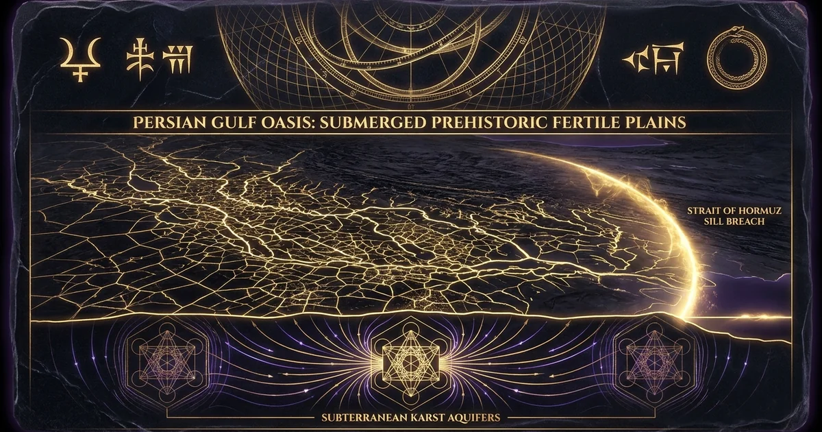
Persian Gulf Oasis: Submerged Prehistoric Fertile Plains
Executive Summary & Theoretical Thesis
Glacio-Eustatic Regression and the Emergence of the Lowland Depocenter
During the Late Pleistocene eustatic lowstand spanning Marine Isotope Stages 4 through 2 (approximately 75,000 to 14,000 calibrated years before present [cal BP]), planetary ice sheet expansion sequestered massive volumes of oceanic water. Global sea levels plummeted to an extreme nadir of approximately -120 to -130 meters relative to present sea level (m rpsl) during the Last Glacial Maximum (LGM, ~21,000–19,000 cal BP). The Persian Gulf—a shallow, low-angle asymmetric foreland basin formed via the ongoing collision of the Arabian Plate with the Eurasian Plate along the Zagros Fold-and-Thrust Belt—possesses an average modern bathymetric depth of merely 35 meters, reaching a maximum axial depth of approximately 90 to 100 meters only within the structural trough near the Strait of Hormuz. Consequently, glacio-eustatic regression drained the modern marine body almost entirely, subaerially exposing an expansive terrestrial plain spanning roughly 100,000 to 120,000 square kilometers.
This subaerially exposed depression, designated in contemporary paleoclimatology as the Persian Gulf Oasis, operated not as an arid wasteland, but as a premier prehistoric human refuge zone. While the surrounding interior of the Arabian shield and the Iranian plateau underwent severe aridification, deflation, and hyper-arid desertification, this tectonic depression served as a topographically protected depocenter. Protected on its northeastern margin by the linear ridges of the Zagros Mountains and sheltered on the southwest by the Arabian platform, the basin accumulated rich alluvial soils and supported dense biophilic networks. The regional structural depression effectively collected the drainage of four major fluvial corridors: the Euphrates, the Tigris, the Karun, and the fossil Wadi Batin fluvial systems.
Rather than terminating at the modern coastline near the Shatt al-Arab delta, these waterways converged into a single master fluvial channel—the incised “Ur-Schatt” paleochannel—which meandered across the length of the exposed basin floor for more than 800 kilometers before discharging into the Gulf of Oman through the incised sill of the Strait of Hormuz. Analogous in its geographic scope and archeological significance to the northern European plains explored in /ancient-prehistory/doggerland-submerged-paleolandscapes, the Persian Gulf Oasis constituted an uninterrupted biophilic terrestrial habitat that sheltered hominin and early human populations for over sixty millennia.
Glacial/Early Holocene Oasis (75,000–8,000 BP)
- Bathymetric Depth: Subaerially exposed floor (-30 m to -90 m rpsl).
- Hydrology: Continental freshwater master river (Ur-Schatt), perennial riparian wetlands, extensive lacustrine bodies.
- Hydrogeology: Active subterranean sub-lacustrine discharge from the Dammam and Rus carbonate artesian aquifers.
- Salinity: Limnic to oligohaline (0.2–2.0 PSU in fluvial networks; seasonal brackish lakes).
- Biophilic Capacity: High carrying capacity; rich gallery forests, broadleaf vegetation, ungulate megafauna, hyper-fertile alluvial soils sustaining a continuous prehistoric human refuge zone.
Post-Transgression Modern System (<6,000 BP)
- Bathymetric Depth: Inundated epicontinental shallow sea (mean depth ~35 m, max ~100 m).
- Hydrology: Marine marginal gulf; primary discharge localized at modern Shatt al-Arab deltaic front.
- Hydrogeology: Submarine karstic springs subdued by hydrostatic head of overlying marine water column; localized hypersaline plumes.
- Salinity: Hyper-saline marine environment (37–43 PSU; upwards of 70 PSU in restricted coastal lagoons).
- Biophilic Capacity: Marine pelagic and benthic biomes; arid surrounding terrestrial littoral with negligible carrying capacity without hyper-intensive irrigation.
Hydrogeological Pluvials vs. Basin Floor Microclimates
The ecological viability of the Persian Gulf Oasis was sustained by a complex microclimatic regime independent of macro-regional precipitation shifts. While regional paleoclimate reconstructions register sweeping arid phases over the Arabian interior during the LGM, the floor of the Persian Gulf basin remained hyper-fertile due to decoupled hydrogeological inputs. The high Zagros Mountains to the north captured substantial winter orographic precipitation, which fed high-gradient melting rivers during spring warming. This mountain discharge continuously recharged the Karun and Tigris drainage basins, yielding sustained baseflow down into the central depression.
Concurrently, the western shelf of the Gulf was underlain by deeply stratified tertiary carbonate units, notably the Upper Cretaceous to Eocene Hasa Group (incorporating the Umm er Radhuma, Rus, and Dammam Formations). These formations form massive regional artesian aquifers charged during early Pleistocene pluvials in the high interior plateaus of central Arabia. Structural fracturing, syndepositional faulting, and salt diapirism from the underlying Infracambrian Hormuz Salt Formation breached the confining aquitards across the exposed shelf. Driven by tremendous hydrostatic head pressures originating hundreds of kilometers inland, these subterranean conduits discharged continuous, voluminous volumes of potable freshwater directly onto the lowstand valley floor.
This sustained karstic discharge gave rise to expansive subterranean freshwater springs in the dried Gulf floor, creating vast sub-lacustrine discharge wetlands, freshwater lakes, and persistent marsh systems. This unique convergence—where high-latitude orographic runoff intersected subterranean artesian discharge at the lowest elevation in the region—decoupled the microclimate of the basin floor from the hyper-aridity of the bordering deserts. As a consequence, the basin operated as an Edenic terrestrial oasis with dense gallery forests, diverse fauna, and unyielding alluvial deposition, providing the physical foundation for the long-term stabilization of Paleolithic and early Neolithic populations.
        Zagros Mountains Orographic Discharge
                         │
                         ▼
        [ Fluvial Drainage: Tigris / Euphrates / Karun ]
                         │
                         ▼
    ┌────────────────────────────────────────────────────────┐
    │       Subaerially Exposed Lowstand Basin Floor         │
    │         (Persian Gulf Oasis Depocenter)                │
    └────────────────────────────────────────────────────────┘
                         ▲
                         │
        [ Artesian Karst Discharge: Dammam / Rus Aquifers ]
                         │
       Arabian Interior Hydraulic Head Pressure
Historical Lineage & Geomorphological Reconstruction
The Rose Hypothesis and Terminal Paleolithic Archaeological Gaps
For nearly a century, archeological investigations across the Arabian Peninsula, the Levant, and the Mesopotamian lowlands were confounded by an anomalous, persistent chronological hiatus: a virtual absence of Terminal Paleolithic and Early Neolithic occupational sites across the central and eastern Arabian landmass spanning the transition from the LGM to the early Holocene. While peripheral highland zones preserved intermittent lithic scatter, the core of the peninsula appeared paradoxically uninhabited precisely when human populations were rapidly transitioning to sedentary and proto-agricultural configurations elsewhere across the Fertile Crescent.
In 2010, archeologist Jeffrey I. Rose synthesized these fragmented archeological anomalies, marine bathymetry, and paleoclimatic data into a coherent paradigm: the Gulf Oasis Theory. Rose posited that archeologists had been searching along the dry, desiccated margins of an ancient biophilic core. The true demographic center of Late Pleistocene Arabia was not the modern exposed peninsula, but the vast, sunken floor of the Persian Gulf. Rather than an unoccupied wasteland, the lowstand basin sustained hundreds of generations of settled human communities.
The abrupt, seemingly instantaneous emergence of fully formed, highly complex sedentary communities around the margins of the Gulf at the beginning of the sixth millennium BCE—most notably manifested in the ubiquitous Ubaid-culture sites appearing suddenly in the southern Mesopotamian alluvium and along the eastern Arabian littoral—represented not an autochthonous leap in technological evolution, but the displaced survivors of an inundated heartland forced onto the regional periphery by catastrophic eustatic sea-level transgression.
“The Persian Gulf Oasis hypothesis identifies the exposed floor of the Arabo-Persian Gulf as a continuous, well-watered environmental refugium throughout the Late Pleistocene… The physical presence of incised paleochannels along the submerged bottomlands, documented in the marine seismic records of Sarnthein (1972) and Kassler (1973), establishes that the master stream of the Ur-Schatt drained directly through the Hormuz sill, maintaining fertile riparian bottomlands for over 60,000 years prior to the Holocene marine transgression.” — Rose, J. I. (2010). New Light on Human Prehistory in the Arabo-Persian Gulf Oasis. Current Anthropology, 51(6), 849–883.
The historical roots of this hypothesis trace back to earlier oceanographic and geological investigations. During the mid-twentieth century, regional seismic-reflection profiling and sediment core extractions executed for petrochemical prospecting revealed that the seafloor was not a featureless sedimentary shelf. High-resolution stratigraphy confirmed the presence of deeply incised fluvial valleys, relict sand dune fields, desiccated sabkha horizons, and drowned marine terraces, which laid the geological groundwork that Rose eventually united with anthropological prehistory.
Bathymetric Sounding and Paleochannel Seismic Stratigraphy
The structural geomorphology of the Persian Gulf Oasis has been empirically mapped via marine seismic reflection profiling, high-resolution multi-beam bathymetry, and side-scan sonar surveys conducted over five decades. Pioneering hydrographic surveys by Michael Sarnthein (1972) and Peter Kassler (1973) first mapped the intricate dendritic networks of paleochannels incised into the basinal limestone and calcarenite substrate. These surveys definitively demonstrated that the modern seafloor is underlain by an extensive, continuous fluvial network that operated subaerially down to depths exceeding -80 meters.
Relict Fluvial Inundation Profile:
West (Arabian Shelf)                       Axial Channel                  East (Iranian Trough)
[Artesian Karst Springs] ───┐                    │                   ┌─── [Zagros Fold Belt]
                            ▼                    ▼                   ▼
═════════════════════════════════════════════[Ur-Schatt]══════════════════════════════════════
                            │              Paleochannel              │
                            └──> Terraced Floodplains & Alluvium <───┘
The master stream of this system, the Ur-Schatt, meandered down the axis of the basin, shifted slightly toward the Iranian margin due to asymmetric foreland tectonic tilt. The channel was incised up to 30 meters deep into the underlying Pleistocene sediment sequences, measuring between 1 and 3 kilometers in width along its central course. Along the western Arabian shelf, high-resolution sparker acoustic profiles reveal extensive paleochannel systems originating from the Wadi Batin—an ancient mega-drainage that once channeled wet pluvial runoff across the entire breadth of the Arabian shield—intersecting the Ur-Schatt south of modern Kuwait.
Stratigraphic analysis of the submerged paleochannels exhibits clear multi-stage incision and aggradation cycles corresponding precisely to high-frequency glacio-eustatic oscillations. Relict gravel bars, cross-bedded fluvial sands, and fine-grained silt deposits within the channel incisions point to stable, long-duration fluvial regimes alternating with seasonal torrential discharge. Deep bathymetric soundings around the Qatar Peninsula and the UAE coastline reveal drowned paleolake depressions and relict shoreline platforms at discrete bathymetric notches (-65 m, -52 m, -30 m), demarcating sustained periods of shoreline stability interspersed with episodes of rapid retreat during global deglaciation.
Marine Transgression Isochrones and Sill Mechanics
The morphology of the Persian Gulf basin is characterized by a critical hydrodynamic threshold: the bathymetric sill at the Strait of Hormuz. Because the floor of the Gulf drops to depths between -70 and -100 meters within the axial valley, the primary barrier controlling oceanic ingress during eustatic transgression was the structural high spanning the sill between the Musandam Peninsula of Oman and the Iranian coast.
As global sea levels rose following the collapse of continental ice sheets during the Terminal Pleistocene, oceanic waters from the Gulf of Oman entered the basin via a morphologically restricted throat. Glacio-eustatic curves and local relative sea level (RSL) models established by Kurt Lambeck (1996) delineate the temporal isochrones of marine transgression:
- Prior to 14,000 cal BP: Sea levels were below -90 m rpsl; the entire interior basin was fully subaerial, discharging freshwater outwards through a narrow, incised river mouth at Hormuz.
- ~12,500 cal BP: Global Meltwater Pulse 1A (MWP-1A) forced oceanic waters over the outer sill lip, transmuting the incised fluvial gorge of Hormuz into a catastrophic marine inlet, establishing the initial proto-marine embayment in the deepest southeastern basin.
- ~11,000 to 9,000 cal BP: Following the deceleration of the /ancient-prehistory/younger-dryas-impact-hypothesis cooling cycle, eustatic sea levels surged past the -50 m mark, driving a broad, shallow marine tongue deep into the central basinal depression.
- ~8,000 to 7,500 cal BP: Meltwater Pulse 1B (MWP-1B) triggered the final, dramatic breach of the central basinal interior. Within a geologically instantaneous window of a few centuries, the entire flat floor of the western and central oasis was inundated, terminating the prehistoric human refuge zone and shifting the regional shoreline hundreds of kilometers to the northwest.
Mathematical Formalism & Physical Mechanics of Inundation
Glacio-Isostatic Adjustment (GIA) Equations for Low-Angle Foreland Sills
Modeling the exact timing and spatial trajectory of the marine transgression requires solving the coupled integral equations of Glacio-Isostatic Adjustment (GIA). Because the Persian Gulf is located in the far-field zone of the Late Pleistocene ice complexes (Laurentide and Fennoscandian), its local relative sea level, $S(\mathbf{x}, t)$, is governed by both eustatic water mass additions and regional visco-elastic deformations of the solid Earth induced by hydro-isostatic loading:
$$S(\mathbf{x}, t) = C(\mathbf{x}, t) \left( \Delta \Phi(\mathbf{x}, t) - \Delta R(\mathbf{x}, t) \right)$$
where $\mathbf{x}$ denotes the spatial coordinates on the Earth’s surface, $t$ is time, $C(\mathbf{x}, t)$ is the ocean function (taking the value of 1 over oceanic domains and 0 over continents), $\Delta \Phi(\mathbf{x}, t)$ is the perturbation in the geoid (gravitational equipotential surface) divided by gravitational acceleration $g$, and $\Delta R(\mathbf{x}, t)$ represents the radial displacement of the solid Earth’s crust:
$$\Delta R(\mathbf{x}, t) = \int_{-\infty}^{t} dt’ \iint_{\Omega} \left[ L_I(\mathbf{x}‘, t’) G_R^I(|\mathbf{x} - \mathbf{x}‘|, t - t’) + L_W(\mathbf{x}‘, t’) G_R^W(|\mathbf{x} - \mathbf{x}‘|, t - t’) \right] d\Omega’$$
Here, $L_I$ and $L_W$ represent the ice and water load distributions, respectively, while $G_R^I$ and $G_R^W$ are the visco-elastic Green’s functions for radial surface displacement under ice and water point loads over a Maxwellian rheological mantle.
In the Persian Gulf, the extreme spatial footprint and rapid introduction of the water mass load ($L_W$) across an exceptionally broad, shallow epicontinental basin induced hydro-isostatic crustal depression along the axial trough. This depression depressed the bedrock floor by several millimeters annually, effectively accelerating the relative sea-level rise and increasing the transgressive velocity over the low-gradient Arabian foreland plain beyond the rate dictated by global ice-melt alone.
Consider a flat sedimentary floor with an average bathymetric gradient $\theta$. The vertical rate of relative sea level rise is denoted as:
$$\dot{z}{rsl} = \frac{dz{rsl}}{dt} = \frac{dz_{\text{eustatic}}}{dt} - \frac{dz_{\text{crust}}}{dt}$$
The horizontal position of the transgressive coastal boundary line, $x(t)$, evolves as a function of vertical water level advancement across the bathymetric surface profile $z = h(x)$. For a low-gradient terrain modeled as a linear slope where $\tan \theta \approx \sin \theta \approx \frac{dh}{dx}$:
$$\frac{dx}{dt} = \frac{dz_{rsl}/dt}{\tan \theta}$$
Empirical seismic mapping across the central Persian Gulf Oasis reveals a mean regional slope of:
$$\theta \approx 0.035^\circ \implies \tan \theta \approx 6.1 \times 10^{-4}$$
During the terminal phase of deglaciation (c. 8,500–7,500 cal BP), regional relative sea-level rise spiked due to Meltwater Pulse 1B, yielding vertical rise rates of:
$$\frac{dz_{rsl}}{dt} \approx 12 \text{ to } 18 \text{ mm/year} = 0.012 \text{ to } 0.018 \text{ m/year}$$
Substituting these values into the horizontal velocity formulation yields:
$$\frac{dx}{dt} = \frac{0.015 \text{ m/year}}{6.1 \times 10^{-4}} \approx 24.59 \text{ m/year}$$
However, in localized, ultra-flat alluvial depocenters and relict lacustrine floodplains where the gradient drops to $\theta \le 0.005^\circ$ ($\tan \theta \le 8.7 \times 10^{-5}$):
$$\frac{dx}{dt} = \frac{0.015}{8.7 \times 10^{-5}} \approx 172.4 \text{ m/year} \approx 1.7 \text{ km/decade}$$
Over human generational spans (40–50 years), the coastal transgression forced lateral retreats of 7 to 10 kilometers, consuming ancestral grazing territories, agricultural plots, and settlement clusters.
Transgression Velocity and Flat-Basin Shoreline Displacement Dynamics
The non-linear rate of shoreline displacement exerted intense adaptive pressure on Late Paleolithic and Early Neolithic populations inhabiting the basin floor. In steep or mountainous coastal zones, a vertical sea level rise of 1.5 meters per century forces an inconsequential landward migration of a few meters. In contrast, the Persian Gulf Oasis floor was an expansive alluvial plain characterized by minimal micro-topographic relief.
As relative sea levels reached the critical elevation of -40 meters rpsl between 8,500 and 8,000 BP, water crossed a morphological threshold. The terrain changed from a distinct, incised channel flanked by bluffs to an unconfined plain where the boundary between fluvial freshwater swamps and encroaching marine bays collapsed. The horizontal velocity vector was not steady; it functioned as a pulsed inundation.
During seasonal high tides and storm surges driven by summer monsoons, high-salinity seawater was forced tens of kilometers inland over the flat topography. This salinized the shallow artesian water tables, killed freshwater date groves and marsh reeds (Phragmites australis), and rendered established habitations unlivable long before permanent marine inundation occurred.
Hydrodynamic Discharge Over the Hormuz Choke-Point
The Strait of Hormuz acted as a hydraulic throttle, transitioning the mode of filling of the Persian Gulf 8000 BP from simple equilibrium oceanic rise to a hydrodynamic breach over a structural sill. As the rising surface of the Gulf of Oman exceeded the elevation of the bedrock sill crest $z_c$, the volumetric discharge $Q$ entering the basinal depocenter was governed by critical open-channel flow over a broad-crested weir:
$$Q = C_d \cdot b \cdot \frac{2}{3} \sqrt{\frac{2}{3} g} \cdot H^{3/2}$$
where $b$ is the effective hydrodynamic channel width of the Hormuz choke-point, $C_d$ is the discharge coefficient accounting for friction along the bathymetric boundary layer, $g$ is gravitational acceleration ($9.81\text{ m/s}^2$), and $H = z_{\text{ocean}} - z_c$ represents the hydraulic head above the sill.
When upstream oceanic levels rapidly surged relative to the lag-delayed water level of the internal basin, the flow achieved critical velocity:
$$v_c = \sqrt{g \cdot h_c}$$
where $h_c$ is the critical depth of water across the throat. This generated severe, scouring marine currents that stripped pre-existing sediments, excavated deep subaqueous scour holes preserved in the modern bathymetric record near the Tunb islands, and sent a sustained marine flood surge into the interior basin. The lowstand plain was rapidly transformed into an energetic, hypersaline, high-energy marine sound.
Empirical Evidence & Observational Hydrology
Sub-lacustrine Artesian Karst Systems and Freshwater Paleohydrology
The primary mechanism supporting the long-term human occupation of the Persian Gulf Oasis was its prolific paleohydrology. Even during the peak of LGM hyper-aridity, the exposed basin hosted expansive, perennial freshwater oases fed by deep subterranean karstic aquifers. The stratigraphic architecture of the eastern Arabian shelf is composed of intensely karstified Paleocene-Eocene limestone successions, primarily the Dammam, Rus, and Umm er Radhuma formations.
These carbonate units dip gently eastward toward the axial trough of the Persian Gulf. During lowstand conditions, the total hydrostatic head difference ($\Delta H$) between the interior Arabian recharging plateaus (e.g., the Tuwaiq Escarpment and As Summan Plateau) and the subaerially exposed floor of the Gulf (-100 m) was magnified by over 100 meters compared to present-day levels:
$$\Delta H_{\text{lowstand}} = H_{\text{inland}} - (-z_{\text{lowstand}}) = H_{\text{inland}} + z_{\text{lowstand}}$$
This massive hydraulic gradient drove sustained, pressurized groundwater flow along deep regional fracture networks. The dissolution of underlying anhydrite and halite beds produced massive karstic collapse structures, sinkholes, and boiling artesian springs—manifestations of which survive today as the marine “submarine freshwater springs” offshore of Bahrain, Saudi Arabia, and the Musandam Peninsula.
During the lowstand, these springs discharged directly subaerially, creating vast networks of limnic ponds, braided streams, and perimeter wetlands that lined the base of the western shelf. These freshwater bodies deposited thick layers of lacustrine marl, tufa, and freshwater shell beds, which have been recovered by marine sediment coring programs.
Hydrostatic Karstic Head Dynamic:
Tuwaiq Escarpment (+800 m)
       │
       ▼ [Groundwater Recharge Zone]
       │
═══════╪══════════════════════════════════════════════════ (Ground Surface)
       │
       │   Confining Aquitards (Anhydrite/Shale)
       └───► [Umm er Radhuma / Dammam Formations]
                   (Karstified Carbonate Aquifer)
                         │
                         │   Artesian Hydraulic Head Drive
                         └─────────────────────────────────► High-Pressure Discharge
                                                                   │
                                                                   ▼
                                                       [Subaerial Basin Floor (-100 m)]
                                                       Perennial Artesian Lakes & Springs
Marine Core Isotope Geochemistry ($\delta^{18}\text{O}$ and Foraminiferal Turnover)
High-resolution chronostratigraphic and geochemical investigations of marine sediment cores extracted from the Persian Gulf floor—such as core MD01-2408 and equivalent transects recovered by oceanographic vessels—provide empirical verification of the environmental regime shift.
Oxygen isotope ($\delta^{18}\text{O}$) profiles derived from benthic and planktonic foraminifera (Ammonia beccarii, Quinqueloculina spp.) demonstrate a sharp, unambiguous transition from low-salinity, freshwater-dominated depositional facies to fully marine, hyper-saline conditions precisely bracketed between 8,500 and 7,300 cal BP:
“Oxygen isotope ratios ($\delta^{18}\text{O}$) measured in calcitic benthic tests demonstrate an abrupt positive anomaly shift from -2.8‰ PDB in basal estuarine/lacustrine sediment layers to +1.5‰ PDB in the overlying marine transgressional horizons. Coincident with this isotopic excursion is a total faunal turnover: oligohaline and freshwater ostracod assemblages (Cyprideis torosa) collapse and are instantly superseded by high-salinity epifaunal foraminiferal assemblages… confirming that open-marine oceanic salinity invaded the subaerial interior depressions between 8,200 and 7,600 cal BP.” — Lambeck, K. (1996); Kennett, D. J., & Kennett, J. P. (2006). AMBIO, 35(5), 67–77.
In basal core strata underlying the transgressive marine sand sheets, sediments consist of organic-rich dark silty clays containing rooted aquatic vegetation fragments, fresh-to-brackish water gastropods, and freshwater diatom assemblages (Melosira, Cyclotella). Radiocarbon dates performed on this organic fraction yield ages ranging from 12,000 to 8,200 cal BP. The sharp, disconformable contact separating these freshwater beds from the overlying bioturbated marine carbonate sands confirms that the transgression was catastrophic, leaving no time for thick transitional paraconformities or gradual brackish estuarine sediment wedges to develop across the flat central plains.
Core MD01-2408 Stratigraphic Sequence:
  Depth (m)   Facies                  Chronology & Microfaunal Index
    0.0 ┬───  Marine Carbonate Sands  Modern Marine (δ18O: +1.5‰; Ammonia beccarii dominant)
        │     High-Salinity Facies
    1.2 ┼───  Transgressive Shell Bed ~7,500 cal BP (High-energy storm/scour horizon)
        │
    1.8 ┼───  Laminated Muds / Marls  ~8,200 cal BP (Lacustrine; Cyprideis torosa ostracods)
        │     Oligohaline Silts       ~11,500 cal BP (δ18O: -2.8‰; Rooted Phragmites reeds)
    3.0 ┴───  Paleosol Substrate      LGM Lowstand Subaerial Floor (>14,000 cal BP)
The Stratigraphic Genesis of Ubaid 0 and Southern Mesopotamian Horizons
One of the most profound archeological correlations of the Gulf Oasis inundation is the abrupt stratigraphical appearance of the earliest agricultural settlements in the lower Mesopotamian alluvium. Prior to the late twentieth century, archeology assigned the primary crystallization of Mesopotamian culture to the Ubaid 1 period (Eridu phase, c. 5400 BCE). However, excavations directed by Joan Oates at Tell el-'Oueili unearthed a stratigraphically deeper, previously unrecognized phase: Ubaid 0 (c. 6500–5800 BCE).
The material culture of Ubaid 0 appears fully realized within the alluvial plain, bearing no primitive precursor forms in the immediate archeological record of southern Iraq:
- It features sophisticated mudbrick architecture utilizing long, molded cigar bricks.
- It demonstrates pre-planned domestic structures centered around grand hypostyle central halls with built-in granaries and intricate drainage profiles.
- It exhibits advanced water-management systems, including canalized gravity-flow irrigation, required to cultivate domesticated cereals in hyper-arid alluvial soils.
- Its fine, kiln-fired ceramic assemblage is ornamented with intricate geometric iconography reflecting highly refined ceramic engineering.
This sudden appearance of high-order social organization, hydraulic technology, and architectural mastery along the margins of the receding marshlands cannot be explained by autochthonous development from regional foraging cultures, which were sparse and technologically disparate.
Instead, the genesis of Ubaid 0 marks the physical arrival of settled, highly organized populations evacuating the retreating shores of the Persian Gulf Oasis. As the terminal transgression consumed the last freshwater havens on the valley floor around 8,000 BP, these populations moved up the incised drainage corridor of the Ur-Schatt, founding new settlements at the emerging deltaic apex of southern Mesopotamia—at sites like Tell el-'Oueili, Eridu, and Ur. The foundational cultural traditions of historical Mesopotamia were thus transplanted from a submerged homeland.
System Architecture: Geomorphic Transgression & Cultural Vectoring
Phase-State Progression: Refugium to Inundated Basin
The transition of the Persian Gulf Oasis from a hyper-fertile Pleistocene environmental refugium to a shallow marine epicontinental sea can be modeled as a discontinuous four-phase sequence:
- Phase I: Lowstand Refugium Climax (75,000–14,000 cal BP): Total subaerial exposure of the basin. The Ur-Schatt master river serves as the hydrological spine; continuous recharge from Zagros snowmelts and deep Arabian artesian aquifers forms a dynamic mosaic of riparian forests, fresh lakes, and fertile savannas. Dense human populations maintain long-term settlement along paleochannel terraces.
- Phase II: Fluvio-Estuarine Retrogradation (14,000–9,000 cal BP): Initial overtopping of the outer Hormuz sill by MWP-1A. Salt water breaches the outer canyon, transforming the lower 200 km of the Ur-Schatt into a deeply incised marine ria and macro-tidal estuary. Populations concentrate along middle and upper fluvial systems.
- Phase III: Catastrophic Basinal Transgression (9,000–7,000 cal BP): MWP-1B forces ocean waters across the central sill down into the wide, low-angle interior depression. Coastline transgression velocities accelerate to between 100 and 1,500 meters per year. artesians are inundated or back-flooded with marine water. The core oasis ecosystem collapses.
- Phase IV: Deltaic Stabilization and Highstand Progradation (7,000 cal BP to Present): Inundation reaches its maximum Holocene highstand (+1 to +2.5 m above present sea level around 6,000–5,000 cal BP). Southern Mesopotamian shoreline pushes inland toward modern Nasiriyah, followed by slow, sediment-driven deltaic-progradation which gradually constructs the modern Shatt al-Arab marsh delta.
Demographic Evacuation Vectors and Ceramic Lineages
The mechanical consumption of the Gulf Oasis plain forced a massive, sustained demographic displacement governed by the orientation of the incised paleochannel corridors. Paleolithic and Neolithic foraging and agricultural groups could not disperse into the hyper-arid interior of the Rub’ al-Khali or the forbidding limestone scarps of the Zagros Mountains. Instead, the retreating populations advanced along regional hydraulic pathways:
               [ Northern Demographic Vector ]
           Upstream the Ur-Schatt Fluvial Trunk
           ───► Tigris/Euphrates Confluence (Lower Mesopotamian Marshlands)
           ───► Foundation of Ubaid 0/1 Horizons (Oueili, Eridu)
                        ▲
                        │
[ Inundated Gulf Oasis Depocenter ]
                        │
                        ▼
               [ Western Demographic Vector ]
           Inland Ascent of the Incised Wadi Batin Corridor
           ───► Eastern Arabian Littoral Oases (Al-Ahsa, Qatif, As-Sabbiyah)
           ───► Arabian Neolithic Coarse Ware & Ubaid-Import Interfaces
The northern evacuation vector directed populations upstream along the Ur-Schatt riverbanks straight into the wet marshes of the southern Mesopotamian plain. These communities brought a sophisticated material culture adapted to riparian wetland environments: reed-bundle boat architecture, mudbrick construction methods, fine line-painted ceramics, and date palm horticulture.
Simultaneously, the western vector channeled populations into the surviving terrestrial oases of the eastern Arabian shelf, such as Al-Ahsa, Qatif, and the Buraimi Oasis, where artesian karst water continued to reach the surface. This western diaspora accounts for the rapid distribution of diagnostic painted Ubaid ceramics across dozens of coastal and island sites throughout eastern Arabia, including Kuwait (As-Sabbiyah), Qatar, Bahrain, and the United Arab Emirates (Dalma Island).
Comparative compositional analyses, such as petrographic thin-sectioning and Instrumental Neutron Activation Analysis (INAA) of ceramics from these sites, show a complex exchange dynamic: local coarse ceramics existed alongside imported fine-ware ceramics manufactured in the newly established northern alluvial centers like Eridu and Ur. This material interface points to enduring kinship networks, ritual connections, and shared cultural lineages linking the displaced populations across the perimeter of their drowned homeland.
Metaphysical Implications & Unified Synthesis
Geomythological Transmutation and the Flood Mythos Archetype
The physical inundation of the Persian Gulf Oasis provides a concrete, empirically verifiable mechanism for one of the most persistent, foundational archetypes in human literature: the Near Eastern universal deluge tradition. Long relegated by modern academia to either literary allegorization or the memory of seasonal river floods within the Tigris-Euphrates valley, the deluge mythos displays features that correlate with the geomorphic submergence of an ancestral habitat.
The interdisciplinary framework of geomythology—pioneered by Dorothy Vitaliano—posits that recurring, deeply rooted oral traditions frequently preserve accounts of catastrophic geological transformations experienced by prehistoric populations. In the case of the Gulf Oasis, the drowning of an inhabited, freshwater landscape spanning over 100,000 square kilometers was not an abstract abstraction, but an existential crisis sustained over multiple generations.
The traumatic loss of a fertile, spring-fed lowland ancestral plain, consumed by dark, hypersaline marine waters advancing across the flat horizon, was encoded into the oral histories of the migrating groups. As these displaced populations consolidated their settlement along the Mesopotamian alluvium and preserved their lineages across millennia, this catastrophic inundation was ritualized, codified, and transformed into the narrative architectures of the Sumerian Eridu Genesis, the Akkadian Atrahasis Epic, Tablet XI of the Epic of Gilgamesh, and the Hebrew deluge narrative of Genesis.
“When skies above were not yet named, nor earth below pronounced by name, Apsu the first, their begetter, and Tiamat, who bore them all, their waters mingled together into a single body…” — Enuma Elish, Tablet I, Lines 1–5
“The sea grew calm, the tempest ceased, the flood was over. I looked at the face of the waters, and silence reigned; and all of mankind had turned to clay… I opened a hatch, and light fell on the side of my face. I bowed low, I sat down and wept, the tears running down my cheeks.” — The Epic of Gilgamesh, Tablet XI, Lines 130–137 (The Deluge Tablet, Utnapishtim’s Account)
The Abzu and Dilmun: Cuneiform Memories of Submerged Karstic Paradises
In the Sumerian cosmological system, the universe was not anchored upon dry rock, but rested upon a primordial, subterranean ocean of pure, sweet, non-saline freshwater known as the Abzu (or Apsu in Akkadian). The Abzu was the cosmic domain of Enki (Ea), the god of subterranean freshwater, wisdom, craft, and architectural knowledge. Enki’s chief temple—the É-abzu (the House of the Subterranean Waters)—was erected at Eridu, the earliest city in southern Mesopotamian tradition, whose sacred architecture is investigated in /sacred-geometry/eridu-ziggurat-geodesy.
Cosmological Paradigm of the Abzu:
      Upper Terrestrial Realm (Dry Alluvial Silt)
═════════════════════════════════════════════════════════
      Confining Bedrock / The Vault of Enki
─────────────────────────────────────────────────────────
      The ABZU (Primordial Deep of Sweet Artesian Waters)
         ▲
         │ Hydrostatic Upwelling via Karstic Springs
         └───────────────────────────────────────────────
The concept of a boundless reservoir of sweet, life-giving water bubbling up directly from subterranean realms beneath the dry earth is an exact conceptualization of the hydrogeological conditions of the Gulf Oasis. The deep Dammam and Rus carbonate aquifers, which forced columns of pressurized fresh drinking water up through sub-lacustrine and subaerial vents, were directly experienced by prehistoric human populations for tens of thousands of years.
When marine waters transvaluated the basin into an epicontinental sea, this sweet-water reality retreated beneath the ocean floor. The physical interface where pure freshwater continued to breach the saline sea—such as the bubbling submarine artesian springs off modern Bahrain—was preserved in Sumerian thought as the sacred realm of Dilmun.
Described in the myth of Enki and Ninhursag as a pristine, pure, and bright land where disease, predatory violence, and aging were unknown, Dilmun is explicitly defined by the miraculous emergence of subterranean sweet waters in a land touched by the rising sun:
“Father Enki answers Ninsikila his daughter: ‘Let holy water spring up from the earth for you… Let your city become the dockyard house of the entire land… Let the sweet waters flow from the earth for you.’” — Enki and Ninhursag, Lines 55–65
Dilmun was not merely a trading hub located on the islands of Bahrain and Failaka; it represented the persistent cultural and geographical memory of the drowned eastern paradise—the submerged, spring-watered oasis floor whose ancestral memory was canonized in sacred myth.
Epistemological Lessons of Submerged Prehistory
The submerged paleolandscapes of the Persian Gulf, Doggerland, and the Sunda Shelf challenge long-standing assumptions in terrestrial archaeology. For more than a century, archaeological research operated under an unintentional terrestrial bias: researchers surveyed dry, accessible continental interiors and constructed cultural evolutionary models founded on the surviving material record of modern terrestrial exposures.
However, late Pleistocene and terminal deglaciation human populations occupied coastal margins, estuarine mouths, and low-lying alluvial basins that offered high carrying capacities. These critical habitats are precisely the zones destroyed, reworked, or submerged by post-glacial eustatic sea-level rise. By acknowledging the Persian Gulf Oasis as a primary engine of late prehistoric demography and cultural innovation, contemporary archeo-historians recover a foundational missing chapter: the emergence of complex, organized human societies was not an anomaly catalyzed in the deserts of the ancient Near East, but an adaptation forced by the marine inundation of the prehistoric fertile plains.
Frequently Asked Questions
Technical and Oceanographic Inquiries
What was the exact chronological and geological timeline of the filling of the Persian Gulf?
The filling of the Persian Gulf occurred in a non-linear, multi-phase sequence across roughly six millennia, driven by global deglaciation:
- Prior to 14,000 BP: Basin entirely subaerial; global eustatic sea level at -120 m rpsl; master Ur-Schatt river draining through the Strait of Hormuz.
- 12,500–11,500 BP: The onset of Meltwater Pulse 1A overtopped the outer sill of Hormuz, flooding the deep eastern axial canyon.
- 9,500–8,500 BP: Rapid vertical sea-level rise inundated the central basin floor down to depths of -50 m.
- 8,200–7,500 BP: The catastrophic terminal phase, accelerated by Meltwater Pulse 1B, pushed shorelines laterally by hundreds of kilometers across the ultra-flat western plains, terminating the freshwater oasis regime.
- 6,000–5,000 BP: Mid-Holocene Highstand reached its peak, with local relative sea level resting 1 to 2.5 meters above modern basinal levels, forming an extensive inland embayment before modern deltaic progradation established the contemporary coastline.
Transgression Chronology Timeline:
BP:  14,000      12,500      10,000       8,200       7,500       5,500      0
     │           │           │           │           │           │          │
RSL: -120 m      -90 m       -50 m       -30 m       -10 m       +2 m       0 m
     [Subaerial] [Breach at] [Axial]     [Catastrophic] [Deltaic] [Highstand] [Modern]
     [Oasis]     [Hormuz]    [Inundation][Terminal]    [Infill]  [Peak]     [Gulf]
                             [Surges]    [Transgression]
How could perennial freshwater springs exist on the floor of a dry marine basin?
Freshwater springs across the exposed basin floor were sustained by artesian hydrogeology. The eastern Arabian platform is composed of porous, highly karstified Tertiary carbonate formations (Umm er Radhuma, Rus, and Dammam Formations) confined between impervious evaporitic and shale aquitards.
These aquifers recharge in the high-elevation continental plateaus of central Arabia, hundreds of kilometers to the west. Because the Persian Gulf Oasis basin was subaerially exposed down to -100 meters, the hydraulic head pressure driving the subterranean water was amplified by more than 10 atmospheres compared to modern hydrostatic basinal pressures. Water migrated through regional fracture systems and salt diapir chimneys, discharging as massive, pressurized artesian springs and forming perennial freshwater lakes and wetlands on the lowstand floor.
Did the inundation take the form of an explosive single-day breach or a gradual multi-century sea-level rise?
The inundation was an episodic, multi-generational process characterized by decades of slow encroachment interspersed with rapid, catastrophic surges. Because the basinal floor had a low gradient (less than 0.05 degrees), even modest vertical rises produced lateral shoreline advancements exceeding 100 meters to 1.5 kilometers per year.
During global meltwater surges like MWP-1B, and during seasonal tidal transitions amplified by monsoon storm tracks, seawater advanced tens of kilometers across the flat terrain within single seasonal cycles. The process was not a instantaneous single-day collapse like the Bosporus breach hypothesis, but an inescapable, highly visible crisis that unfolded over several human generations.
       Vertical Rise Rate (dz/dt) ──┐
                                     ├──► Horizontal Transgression: dx/dt = (dz/dt) / tan(θ)
       Ultra-Low Slope (tan θ)    ──┘
       (θ < 0.05°)
                                     ┌──► Decadal Loss: 1 to 10 Kilometers of Coastline
                                     └──► Multi-Generational Displacement of Habitats
Archaeological Recovery and Marine Remote Sensing
What primary technical obstacles prevent the systematic excavation of Paleolithic settlements beneath the modern Persian Gulf?
Systematic underwater archaeological investigation in the Persian Gulf faces major environmental and geological challenges:
- Coarse Sediment Shell Blankets and Marine Biogenic Carbonates: Post-transgression sedimentation has covered the late Pleistocene paleosols with high-energy bioclastics, hard calcarenite pavements, and active sand waves, obstructing optical and sub-bottom acoustic imaging.
- Extreme Turbidity and Poor Visibility: Strong tidal currents moving through the restricted Hormuz choke-point, combined with shallow waters and dense seasonal algal blooms, reduce underwater visibility to near zero across the central and western shelf.
- Geopolitical and Maritime Logistics: The Persian Gulf is among the most congested shipping corridors on Earth, divided by competing international jurisdictions, dense infrastructure for petrochemical extraction, and extensive underwater pipeline grids, making academic research operations logistically complex and heavily restricted.
Marine Seafloor Obstruction Profile:
═════════════════════════════════════════════════════════ (Water Surface)
      Marine Water Column (High Turbidity, Tidal Scour)
───────────────────────────────────────────────────────── (Seafloor)
      Active Biogenic Carbonate Shell Sands (1–3 m)
─────────────────────────────────────────────────────────
      Indurated Calcarenite Pavement / Marine Transgressive Lag
─────────────────────────────────────────────────────────
      Holocene Marine Mud Matrix (Bioturbated)
───────────────────────────────────────────────────────── (Unconformity)
  ★   SUBMERGED PALEO-SURFACE: Paleosols, Incised Channels, Prehistoric Settlements
How does acoustic resonance and high-resolution sub-bottom profiling distinguish anthropogenic structures from natural calcarenite rock formations?
Marine geoarchaeologists deploy chirped sub-bottom acoustic profiling, high-frequency side-scan sonar, and multi-beam bathymetric backscatter analysis to evaluate the seafloor. As discussed in /sound-cymatics/acoustic-resonance-subterranean-chambers, specific frequencies of acoustic waves propagate through the water column and enter shallow sub-seafloor lithologies, reflecting back to hydrophone arrays based on impedance mismatches ($\Delta Z = \rho \cdot v$) between sedimentary boundaries.
Natural calcarenite features and drowned dune ridges generate diffuse, irregular acoustic backscatter without internal organization. Conversely, anthropogenic structures—such as stone foundations, molded brick pavements, shell middens, or dug wells—generate distinct hyper-reflective, geometrically regular anomalies that present coherent edge boundaries and acoustic shadows. Relict fluvial cuts, channel banks, and lacustrine silts produce smooth, continuous, low-amplitude acoustic reflectors, enabling researchers to distinguish relict terrestrial landforms from the surrounding marine substrate.